Currently out in the Pacific, we currently (as of Wednesday, 8:21pm CDT) have two tropical storms (Frank and Georgette) churning their way off to open waters. Back in the Atlantic basin, it is uncharacteristically calm in the way of tropical development, with no new tropical formation expected in the short term. Typically, we should be seeing an upward trend of tropical storms and hurricanes out in the Atlantic for this time of year, so to experience this relative lull in activity is unusual.

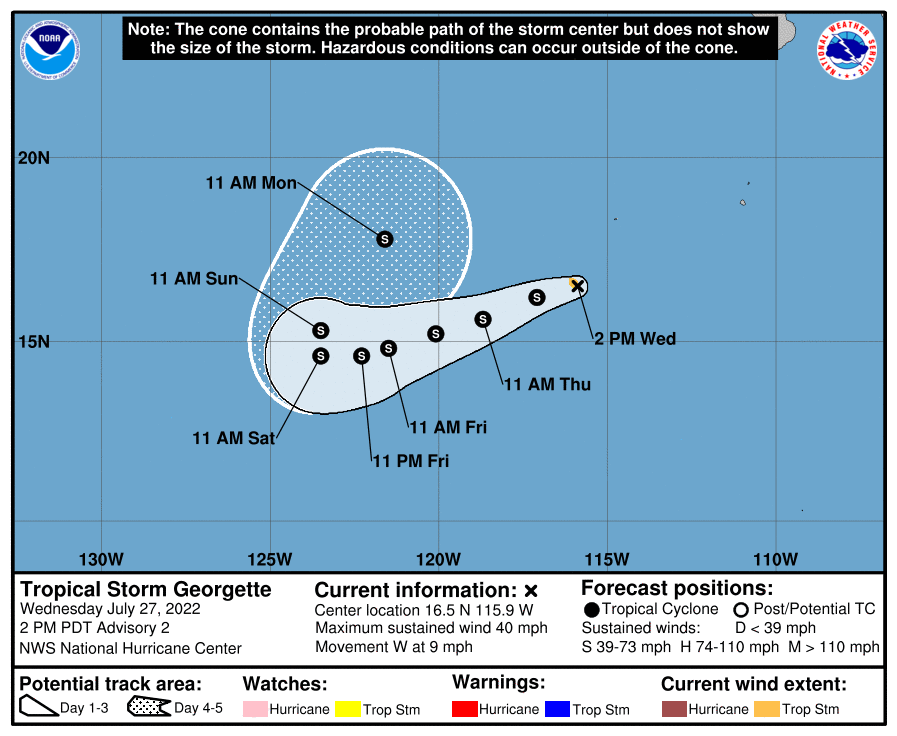
Newly formed Tropical Storm Georgette currently sits just southwest of Socorro Island. At the moment, it is currently meandering west at around 9 mph and is expected to make its way west southwestward into the open waters of the central Pacific Ocean.
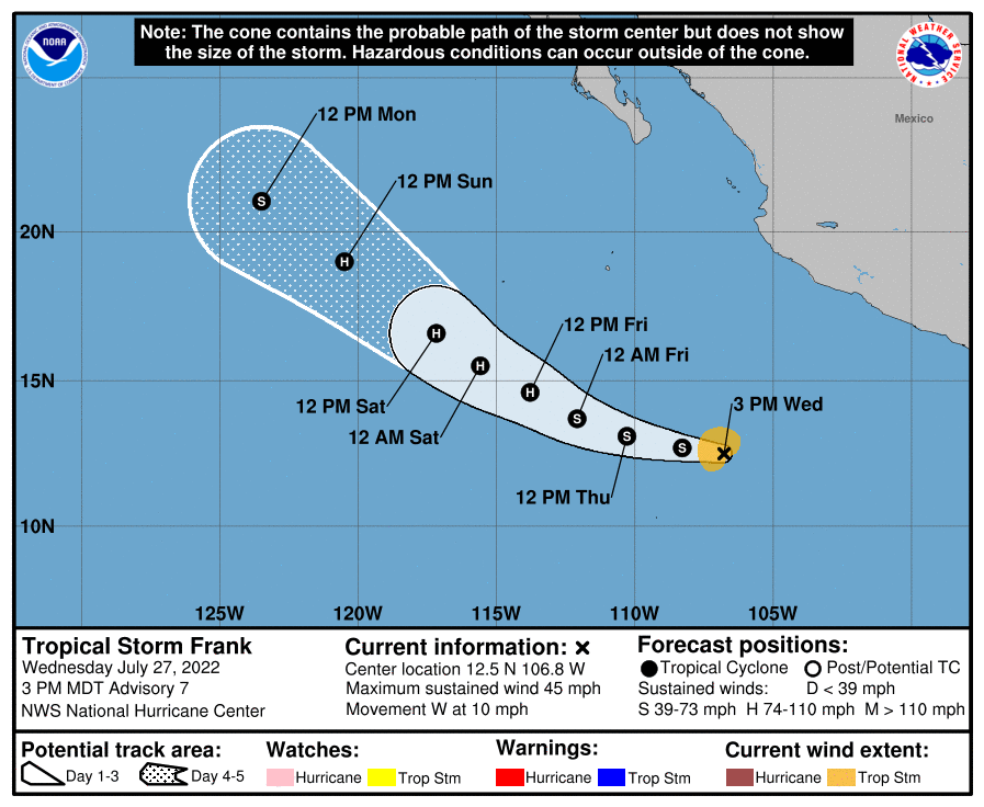
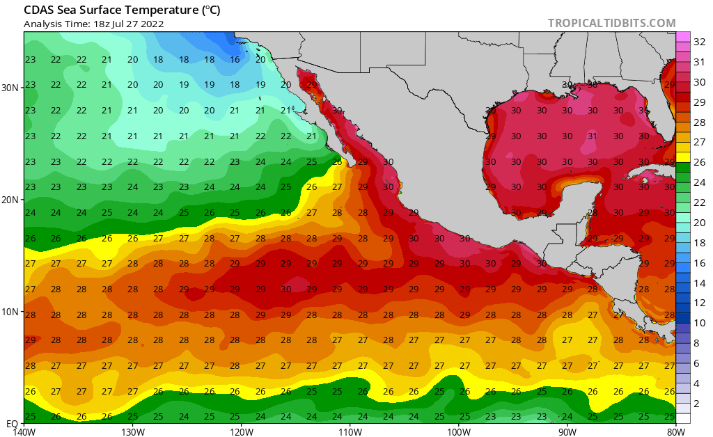
Just behind Georgette to the southeast, Tropical Storm Frank is also making its way west at around 10 mph. Unlike its counterpart head of it, Frank is expected to take a more northwesterly track paralleling Mexico and Baja Mexico, but still remaining over open waters. Frank is also slated to reach hurricane strength by Friday, although it is possible this could happen more quickly, with very warm Eastern Pacific SSTs (sea-surface temperatures) in the order of 25 to 30°C (77°F to 86°F) and relatively weak wind shear aloft.
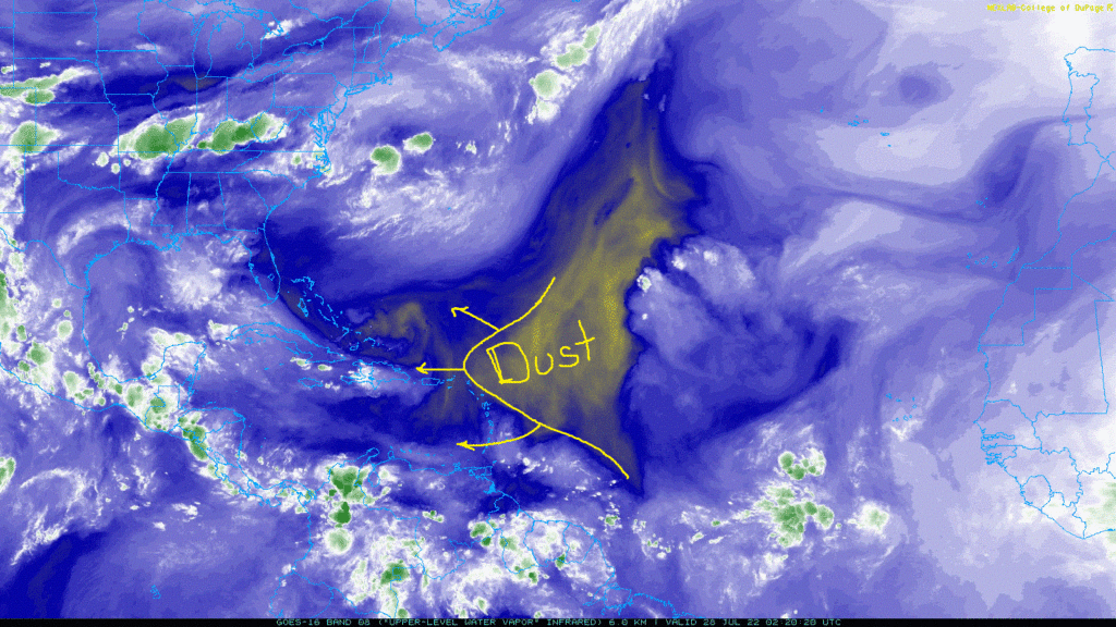
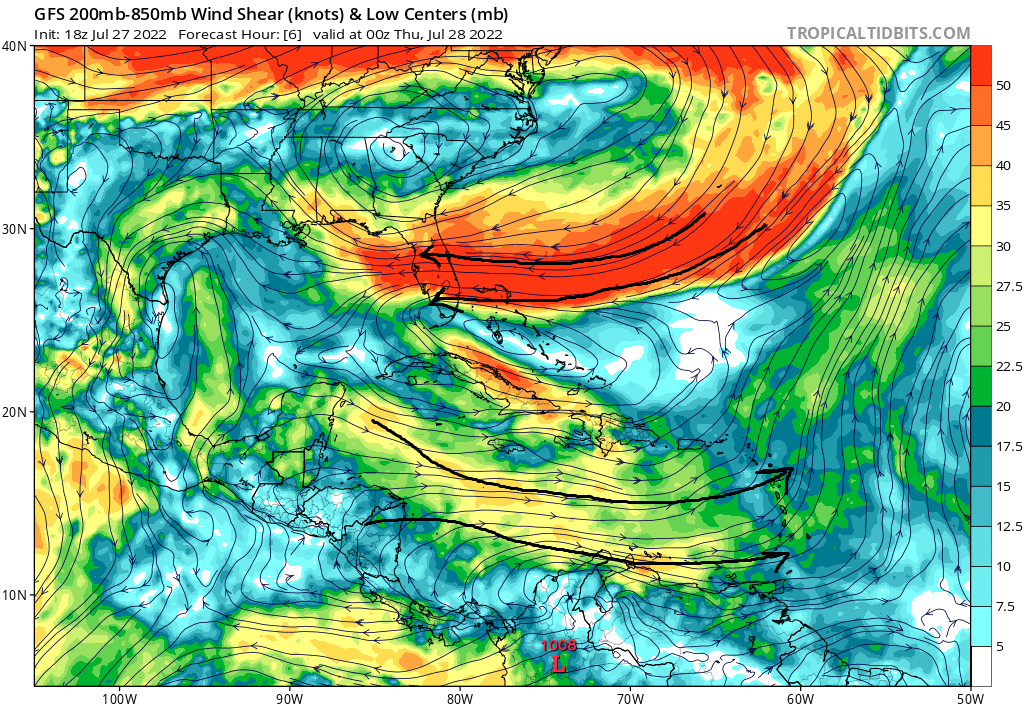
Over in the Atlantic, dry Saharan dust remains over most of the central Atlantic Ocean, helping to inhibit organized development. Even though warm SSTs are abundant for much of the Atlantic and Gulf of Mexico, Saharan dust and relatively strong wind shear aloft, will help keep this region quiet for the foreseeable future.
