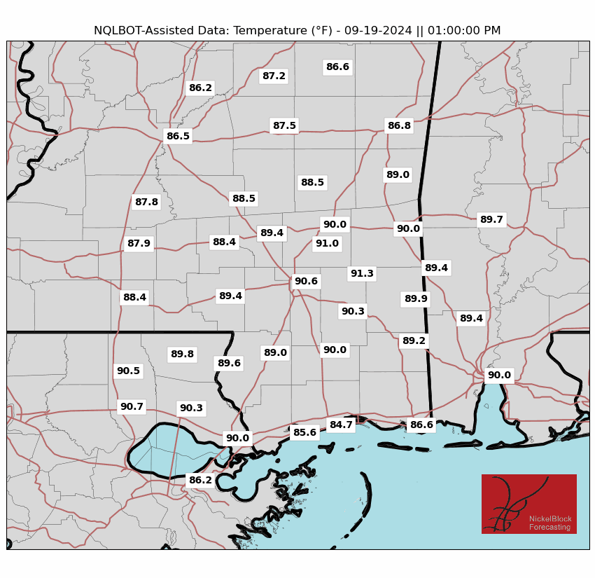
For today and tonight, we may see a few showers and storms across the area. A slow-moving rex block pattern is keeping showers in place over parts of central and south Mississippi and over into Alabama. While there’s a lot of moisture in the air, flash flooding isn’t expected, as the low-pressure system is weakening. With clouds and rain in the area, temperatures will stay cooler than normal today.

For Tuesday through early next week, scattered showers and thunderstorms are expected south of I-20 in the afternoon and evening, fueled by tropical moisture. Fog may become an issue Tuesday night into Wednesday morning, with the possibility of a Dense Fog Advisory if conditions worsen.
As we head into Wednesday things should start to dry out a bit — temperatures will hover back around 90. And then as we move through the back half of the week we may see a few afternoon storms pop up.
All the while, we will need to keep tabs on what is happening in the Tropics. The Central American Gyre may “Wake up” a bit as we move through the next 10 days.
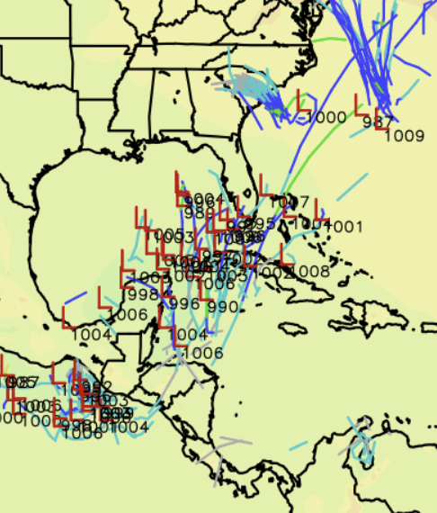
This means the chance we see some sort of tropical ‘something’ develop is higher than normal – but certainly not a guarantee.
REGIONAL DAY TO DAY FORECAST
Today: Partly sunny. A chance of showers and thunderstorms this morning, then showers and thunderstorms likely this afternoon. Highs in the mid 80s. East winds around 5 mph. Chance of rain 70 percent.
Tonight: Mostly cloudy with a chance of showers and thunderstorms in the evening, then partly cloudy after midnight. Lows in the upper 60s. East winds around 5 mph. Chance of rain 40 percent.
Tuesday: Mostly sunny. A slight chance of showers and thunderstorms in the morning, then a chance of showers and thunderstorms in the afternoon. Highs in the mid 80s. East winds around 5 mph. Chance of rain 50 percent.
Tuesday Night: Partly cloudy. Lows in the upper 60s. Southeast winds around 5 mph in the evening, becoming light and variable.
Wednesday: Mostly sunny. A slight chance of showers and thunderstorms in the afternoon. Highs in the upper 80s. Northwest winds around 5 mph. Chance of rain 20 percent.
Wednesday Night: Mostly clear. Lows in the upper 60s.
Thursday: Sunny. Highs in the upper 80s.
Thursday Night: Clear. Lows in the mid 60s.
Friday: Sunny. Highs around 90.
Friday Night: Clear. Lows in the upper 60s.
Saturday: Sunny. Highs in the upper 80s.
Saturday Night: Mostly clear. Lows in the upper 60s.
Sunday: Sunny. A slight chance of showers and thunderstorms in the afternoon. Highs in the mid 80s. Chance of rain 20 percent.


That’s the ones I worry about most … the ones that only give you a couple of days prep time.