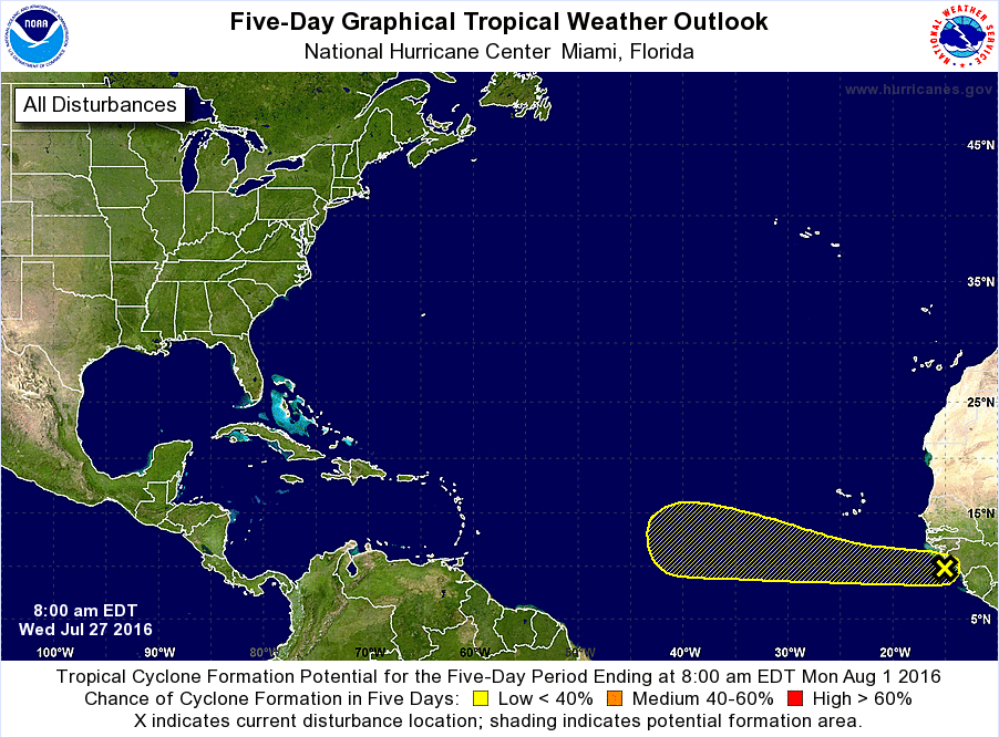
Latest from the National Hurricane Center:
TROPICAL WEATHER OUTLOOK
NWS NATIONAL HURRICANE CENTER MIAMI FL
800 AM EDT WED JUL 27 2016For the North Atlantic…Caribbean Sea and the Gulf of Mexico:
1. A tropical wave located along the coast of western Africa is
producing a large area of cloudiness and disorganized shower
activity. Environmental conditions are expected to be conducive
for some development of this disturbance during the next several
days while it moves generally westward at 15 to 20 mph.
* Formation chance through 48 hours…low…10 percent
* Formation chance through 5 days…low…20 percentForecaster Stewart

Quick Breakdown
The developing wave will have a few hurdles to jump over before it is a threat to the Gulf Coast of East Coast.
The Saharan dust is still doing a great job at squelching any developing storms for the past month. We’ve been talking about it easing up as we head into August but the latest model trends are starting to show the dust continuing to be a factor as we head through mid August.
The mid-levels of the atmosphere above the tropical Atlantic is quite dry. Any developing storm would really need to get it’s act together to ford through the dry air.
Steering flow between the two areas of high pressure over the United States should push anything that makes it this far, away from the US, anyway.
So there is no need to panic or to listen to social media posts claiming that landfall is imminent for the US. As it is not.
That said… Crazier things have happened. That is why we always urge folks to be prepared, because it only takes one storm.

