The fog this morning may be pretty dense in some spots, so please make sure you give yourself some extra time out the door this morning. As we move through the day, the clouds will stick around. You may see a few pokes of sun, but it will remain mostly cloudy today.
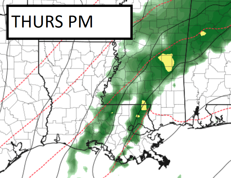
The clouds will stick around for the next few days, too, with the next good shot for rain arriving on Thursday.

So far, it looks like the potential for severe weather is pretty low. While we can’t rule it out at this point, I am not overly concerned about it. The biggest threat, given the numbers in trhe data, would be some wind gusts up to 60mph in the stronger storms and the potential for a brief tornado.
Then that clears out and we shake out of this pattern and start to talk about a return to sunshine.
REGIONAL DAY TO DAY FORECAST
Today
Fog this morning with near zero visibility at times. Then mostly cloudy by this afternoon. Highs around 70. West winds around 5 mph, becoming north around 5 mph this afternoon.
Tonight
Cloudy. Cooler with lows in the upper 40s. North winds 5 to 10 mph.
Wednesday
Cloudy. Highs in the lower 60s. North winds around 5 mph.
Wednesday Night
Cloudy. Lows in the lower 50s. East winds around 5 mph.
Thursday
Mostly cloudy with storms possible. Highs around 70. Southeast winds 10 to 15 mph, becoming west in the afternoon. Chance of rain 70 percent.
Thursday Night
Showers likely. Lows in the lower 40s. Chance of rain 70 percent.
Friday
Partly sunny. Highs in the mid 50s.
Friday Night
Mostly clear. Lows in the mid 30s.
Saturday
Sunny. Highs in the lower 60s.
Saturday Night
Mostly cloudy. Lows in the lower 40s.
Sunday
Partly sunny. Highs in the lower 60s.
Sunday Night
Mostly clear. Lows in the lower 40s.
Monday
Sunny. Highs in the upper 60s.

