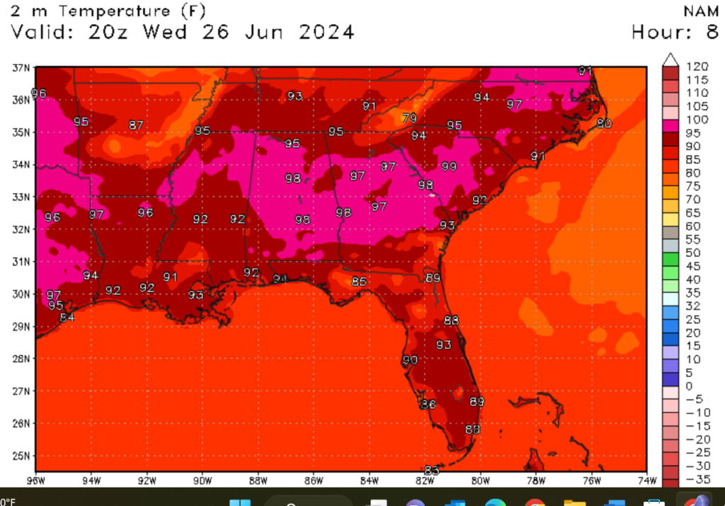
I hope you have been able to stay cool this week, as we have more heat to deal with today. A heat advisory is in effect for our region until 7 p.m. this evening. Temperatures are expected to climb into the upper 90s, with heat index values expected to reach well over 100 degrees Fahrenheit. Looking at our rain changes, the region should expect scattered showers and thunderstorms; a few of these storms could be severe, with damaging winds and primary hail being the primary concerns. This weather trend will continue in the next few days, but slightly cooler temperatures are expected thanks to a cold front expected to move through
Heat advisory in effect
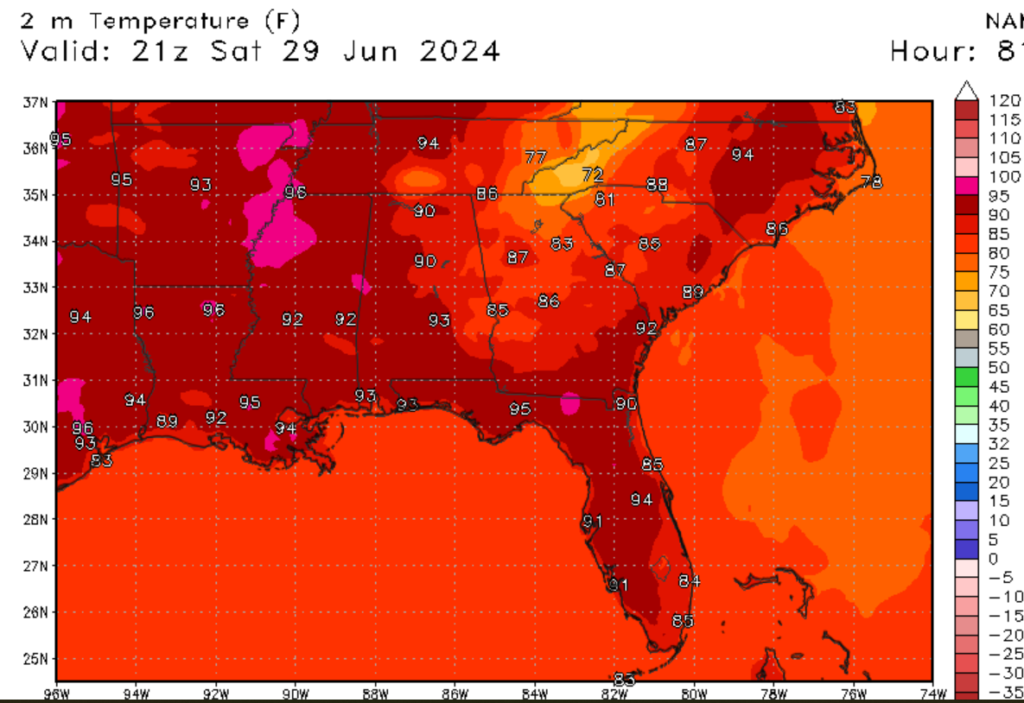
A heat advisory is in effect for the region until 7 PM CDT. This advisory has been issued because of potentially dangerous heat in the area today. Temperatures for today are expected to be in the mid-to-upper 90s for areas inland, such as Hattiesburg, MS. Temperatures along and near the coast, such as New Orleans, LA, are expected to be in the low 90s. Looking at heat indexes for today, most of the region can expect heat index values of well over 100 degrees Fahrenheit. I would not be surprised if a few 110-degree readings are to be observed today.
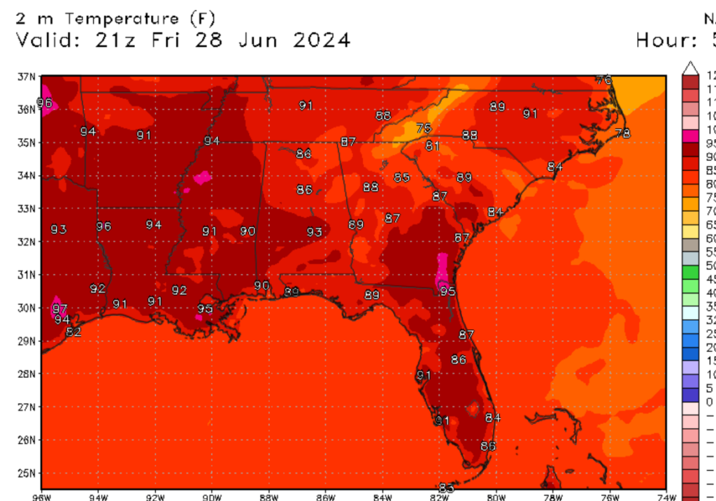
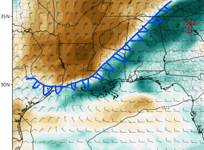
This heat is expected to back off slightly in the next couple of days, thanks to a cold front that’s expected to move south to our region. Temperatures are expected to cool slightly to the low 90s, with heat index values expected to hover around 100 degrees Fahrenheit. Although temperatures are expected to be slightly cooler, heat-related illnesses can still be expected through the rest of this week. For those who work outside, please make sure to take frequent breaks, drink plenty of water, and watch for heat-related illnesses.
Showers and thunderstorms are expected today
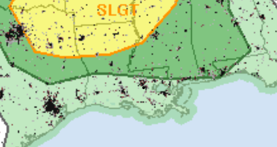
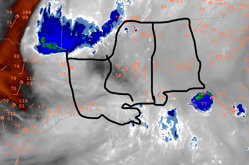
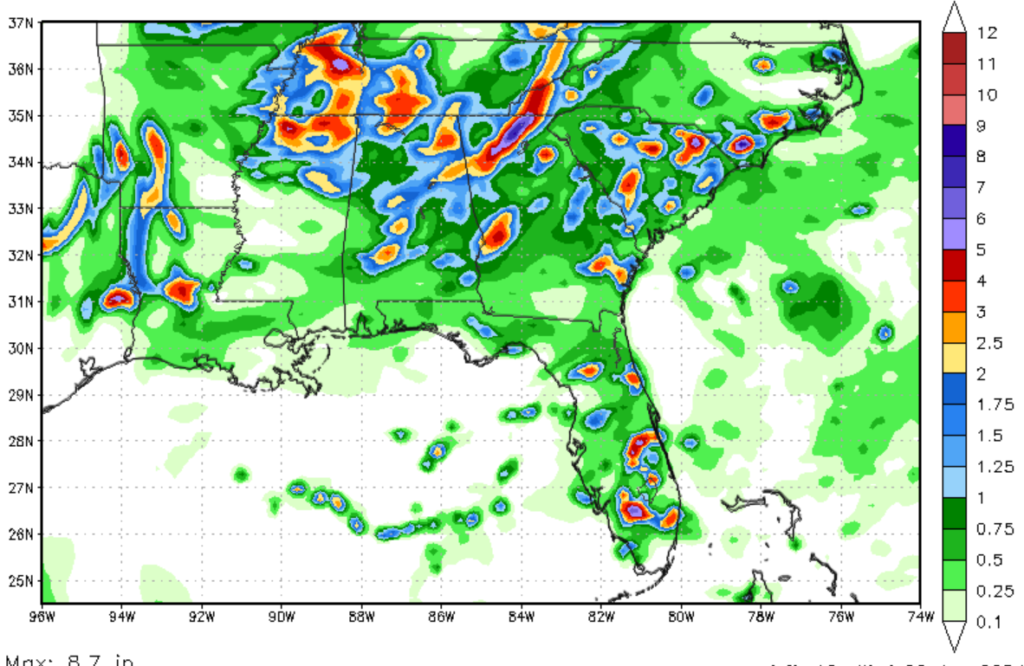
Looking at our rain chances for today, most of the region should expect scattered showers and thunderstorms. Areas to the north should expect a higher chance of rainfall. Locations to the north, such as Hattiesburg and Jackson, MS, should expect a couple of severe thunderstorms to roll through. These severe storms could produce high winds and large hail, as CAPE values are high in the region. Heavy rain and lightning are expected with these storms and could produce localized flooding. Storms should start firing up around 3 PM CDT and should peak around 6 PM CDT. The storm should move out of the region by 10 PM CDT.
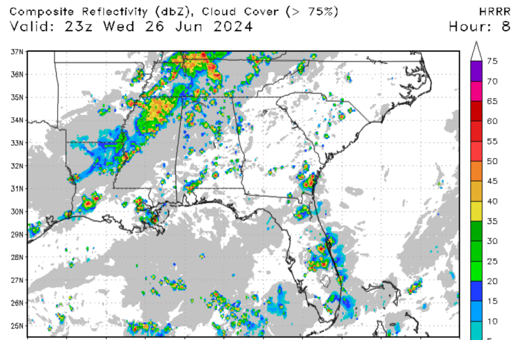
Looking to the rest of this week in terms of rainfall, the trend of afternoon showers and thunderstorms should continue. A cold front associated with a center of low is expected to continue bringing moisture into the region, allowing for convective thunderstorms to develop. Thunderstorm chances are expected to be high tomorrow as the cold front moves through the region. Severe weather is not expected for the next couple of days.
Looking out to the future


Looking into next week, the trend of hot and humid weather is expected to continue for the foreseeable future. This is thanks to a ridge of high pressure that is expected to set up in the middle of the nation. This will push the jet stream far to the north and allow for hot, humid air to set up in the region. Temperatures are expected to be above average, while precipitation amounts are expected to be below average for the time being. This is concerning, as drought conditions could develop in the near future. All we can do is hope for a pattern change as we move into July, the hottest month of the year.


