Happy last day of July, I hope that this was a great month for you. As you are quite aware, we have had quite a cool and wet last couple of weeks, but now a pattern change has taken hold, bringing us drier conditions and above-normal temperatures. A large ridge of high pressure has taken hold of the Central U.S., bringing with it scorching temperatures. Heat advisories and excessive heat warnings have been issued for our region. I expect that the above-average temperatures will last through the rest of this week, with a slight cooldown expected by the weekend. Looking at the tropics, we are keeping a very close eye on a possibly developing system that may cause impacts to the United States.
Heat expected for the next couple of days
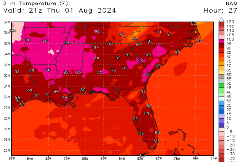
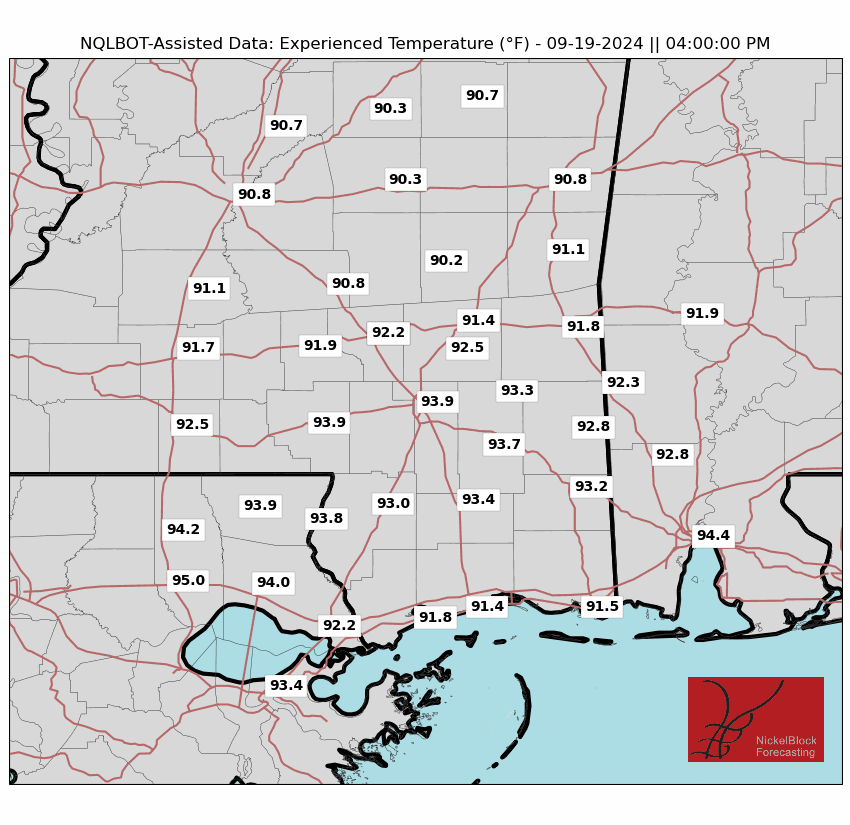
Because of the high-pressure system affecting our region, we can expect above-average temperatures and below-average precipitation. Air temperatures are expected to reach the low to mid-90s for the region through at least the weekend, hence why the heat advisories are in effect. As you can see in the images above, it’s going to be very hot tomorrow, with our inland communities seeing the highest temperature and heat indexes.

Looking to the next few days, I don’t expect this ridge of high pressure to move out of the region. This means that the above-average temperatures that we are seeing today and tomorrow should continue through at least the weekend. As we approach the weekend, I do expect some weakening of the center of high pressure, which will allow for slightly cooler temperatures and a great increase in rainfall chances. Because of the multiple days of heat, humidity, and lack of winds, the feel like temperatures could top 110 degrees Fahrenheit. Due to these high heat indexes, please make sure to be careful when venturing outside, especially during the middle of the day. If you need to be outside, make sure to keep hydrated and watch for heat-related illnesses.
A possible change
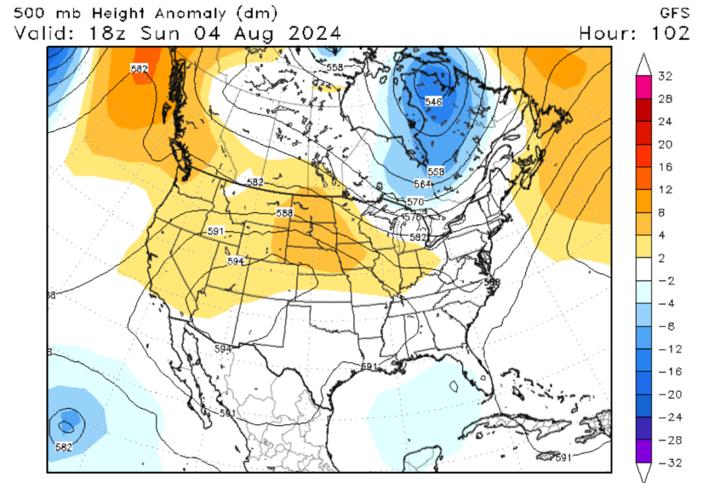

As we move into the first weekend of August, a slight pattern change is expected to affect our region. As seen in the image to the left, a mid-level trough is expected to form in Newfoundland, Canada, which could increase our rainfall potential. Even so, our region is still expected to be under relatively high pressure as seen in the image to the left. This means that our temperatures are still going to be warm, but increased moisture content from the trough will alow for our rainfall chances to increase. As seen in the image to the right, the heaviest rainfall is expected to be along the coast, while areas inland will stay mostly dry. Since these storms need heat, moisture, and energy to form, the best place for convective development is in the Gulf, hence why this region is expected to see more rainfall this weekend.
A look in the tropics

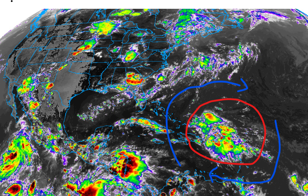
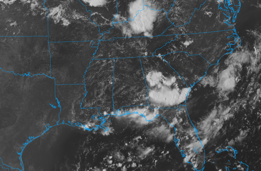
Looking at the Tropical Atlantic, we have a possible system brewing in the Lesser Analies in the Caribbean. As of now, this broad area of showers and thunderstorms is moving northwest and starting to show some possibilities of development. This will become more likely as the system moves closer to the Bahamas. A combination of low wind shear, high moisture content, a ridge of high pressure to the north, and warm water temperatures will promote rapid development. As this system continues to move to the United States, we will continue to closely monitor this system.


