Imagine sitting down at a poker table and watching the dealer remove the King and Nine of Hearts, the Ten and Three of Clubs, the Six and Jack of Spades, and the Four and Nine of Diamonds from the deck.
And then still trying to get a meaningful hand—like Three of a Kind, a Full House, or a Straight Flush. It can still be done, it just becomes remarkably harder.
That’s what you’re doing when you reduce weather balloon launches. You’re removing cards from the deck.
MORE REDUCTIONS
We continue to see reductions in the amount of data going into weather models and the raw observations available for local National Weather Service (NWS) offices to use. Earlier this week, the NWS issued a press release alerting the public that weather balloon launches were ending at two more offices due to staffing shortages and funding cuts. The latest affected offices include Rapid City, SD, and Omaha/Valley, NE.

Other offices have already had to reduce their launches to just one per day.
Looking at a map of balloon launch sites, it’s easy to assume that having plenty of other sites nearby should make up for the gaps. But it doesn’t. Just like removing cards from the deck still hurts your chances at a good hand, removing data points diminishes our ability to forecast weather accurately.
“The more data we can feed into our weather models, the more accurate our forecasts, but I can’t speculate on the extent of future impacts,” NOAA spokesperson Susan Buchanan told NBC26 in Green Bay on Friday.
Green Bay is one of the offices now launching just one balloon per day. They join others like Aberdeen, SD; Grand Junction, CO; Gaylord, MI; North Platte, NE; and Riverton, WY in cutting back.
“Having that detailed information [is] critical in trying to figure out when tornadoes were going to form, how quickly they might form,” Chief Meteorologist Bill Randby at KETV in Omaha said on air. “If you had staff to do it this morning, but now you don’t have staff to do it this evening says that this decision was made by somebody that doesn’t understand weather.”
Because weather is spatial and dynamic, things happen across space and time. It’s not a linear relationship—it’s not as simple as “fewer balloons = slightly worse forecast.” It’s more like a web than a line. What’s happening in one part of the atmosphere—say, pressure or wind in Kansas—can influence what happens hundreds of miles away in Mississippi, or even days later in Michigan. These are Euclidean relationships, based on distance and geometry, not just cause and effect.
“We might anticipate on average there’s going to be a decrease [in forecast certainty] because we have fewer observations going into our forecast models,” Jonathan Martin, University of Wisconsin-Madison Atmospheric and Oceanic Sciences Professor told NBC26.
And forecast certainty matters—especially when we’re talking about the magnitude and timing of severe weather in the United States. And particularly when the cuts affect balloon sites in the Midwest and Southeast, two regions prone to extreme events.
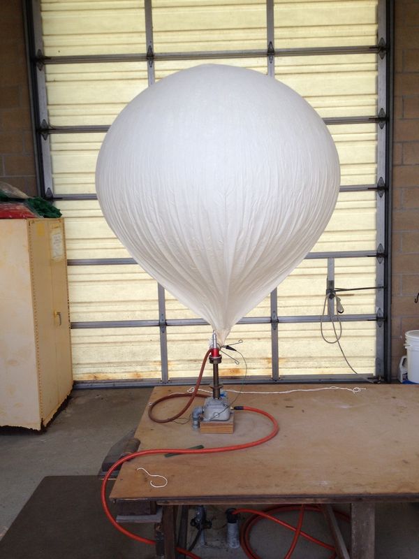
“It’s part of a global process,” Cowboy State Daily meteorologist Don Day said in a recent article. “Around 6am and 6pm, these balloons go up in locations around the world. They carry an instrument package measuring temperature, pressure, wind, and humidity from the surface to the stratosphere. This gives us a vertical profile of what the atmosphere is doing with real measurements.”
OTHER OPTIONS
In recent years, satellites have become better at reading atmospheric temperature and moisture content, and we can now use them to estimate wind speeds as well.
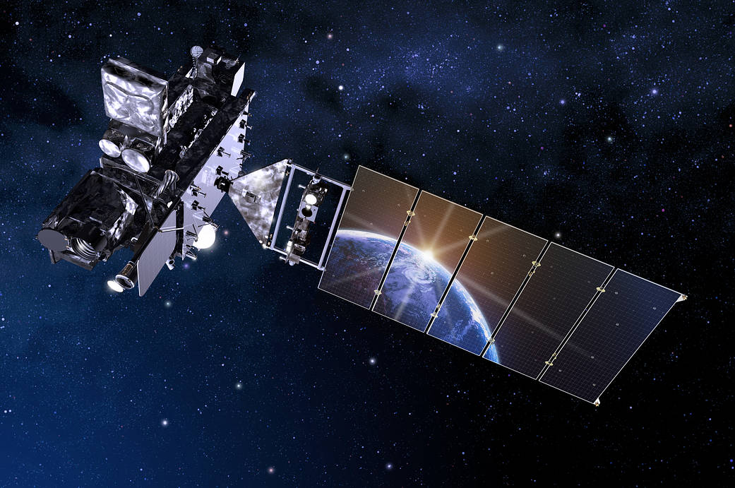
Microwave sounders are satellite instruments that measure Earth’s radiance at microwave frequencies, helping scientists estimate temperatures through thick layers of the atmosphere. They’re great because they offer global coverage with frequent updates, but they come with the downside of low vertical resolution, meaning they can’t capture detailed temperature changes at every different altitude like a weather balloon.
Infrared sounders work similarly but use infrared frequencies and special algorithms to retrieve temperature data. They also provide global coverage and more detail vertically, but they’re easily affected by clouds and aerosols, which can throw off their readings. Again, balloons can sail right through hte clouds with no problem.
GPS Radio Occultation is a technique that uses GPS receivers on satellites (Yeah, regular ole GPS) to measure how GPS signals bend as they pass through Earth’s atmosphere. This bending, called refraction, helps scientists create detailed vertical profiles of temperature and moisture. But getting the data can be more difficult than simply launching a weather balloon.
Further complicating all of that is that each of those methods use mathematics to convert what the satellites are “Seeing” to a value that is measurable and meaningful to meteorologists. And it isn’t a direct sampling of the atmosphere.
Even further complicating things is that satellites are expensive to build and maintain. Relying on them may end up costing more money in the end.
If you wanted to use newer technology that is terrestrial-based, there are ways, but they are also more expensive than a balloon.
I’ve reached out to a company, Meteomatics, that offers weather drones. These are drones you can fly around and use to collect meteorological data. I’m still waiting to hear back with an “official” response, but I’ve chatted with their folks over the years and I have a pretty good idea about what they can do.
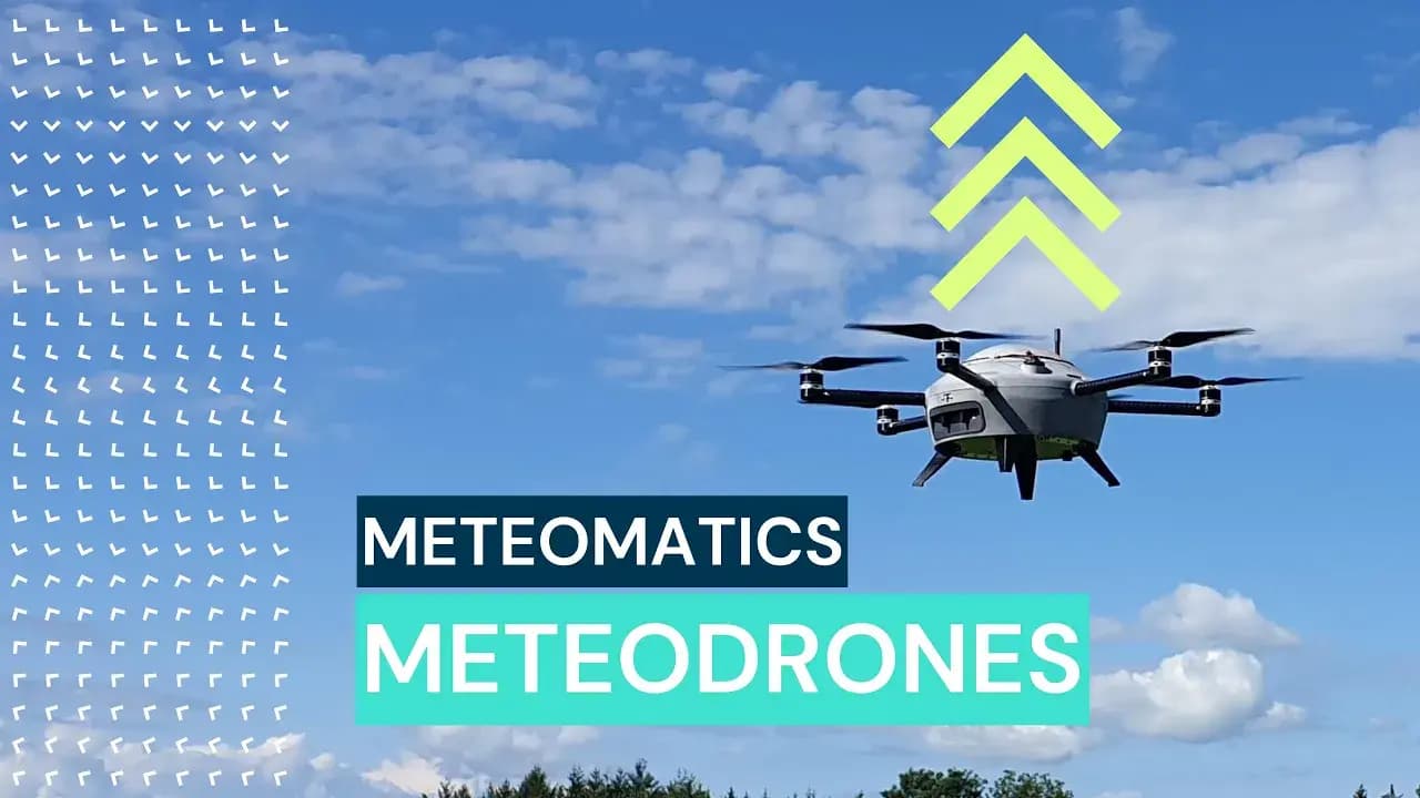
The premise from Meteomatics is that radiosondes face several limitations that restrict their scalability, especially when compared to modern alternatives like their “Meteodrones”.
Radiosondes have a short operational lifespan—typically just a few hours—and are usually launched only twice a day, limiting data collection. On top of that, they are usually a “one time use” deal because while they can be re-used, they aren’t often found. In contrast, Meteodrones can fly every 30 minutes – if needed – and conduct multiple flights over extended periods.
This could be really helpful leading into high impact weather, when we could feed the intermediate models (the ones that come out every hour or every three or six hours, with new raw observations. While we don’t have the capacity to do such things yet, it could be devised, I’m certain. And it would be helpful!
But weather drones have a higher (much higher!) upfront cost.
They are reusable, so that helps. Drones could be more cost-effective in the long run depending on use case. But, none are currently in use by any NWS office. And, if the government is trying to “reduce cost,” I doubt that purchasing these drones would fall under that umbrella.
THE BOTTOM LINE
Weather balloon cuts may seem minor, but they’re removing crucial data from our forecasting toolkit—like taking cards out of the deck and still trying to play a strong hand. These balloons provide direct, high-quality observations of the atmosphere that feed into weather models and help forecasters make accurate, timely decisions – especially during severe weather.
Reducing the number of balloons and limiting the data indirectly increases the risk that something could happen that we couldn’t predict accurately.
While newer technologies like satellites and GPS-based systems offer alternatives, they come with trade-offs in resolution, reliability, or accessibility. Weather drones show promise, too, but they’re expensive and not widely adopted yet. For now, the reduction in balloon launches, especially in data-critical regions like the Midwest and Southeast, means forecasts could become less certain, just when we need them most.


