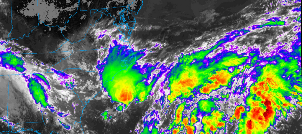
So Francine’s Tropical Storm/Depression status has been stripped, however as an extratropical system it’s still hanging out in our neck of the woods. While it won’t bring us any high winds or flash flooding, it’ll still bring in some rain over the weekend. Let’s take a look.
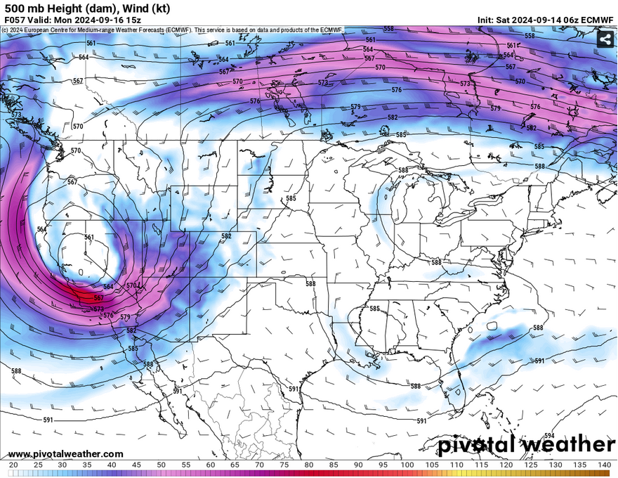
Looking at the upper levels, what’s left of Francine is a fairly stout shortwave trough that’s hanging over the central part of the Deep South. Not only this, a large ridge over the Great Lakes region will form and weaken over the next few days as the low begins to move towards the Gulf of Mexico. If you’ll look towards South Carolina, a developing wave over the Atlantic will also be a factor for many on the Atlantic coastline. While it doesn’t look like anything major, it’s an interesting development for this time of year.
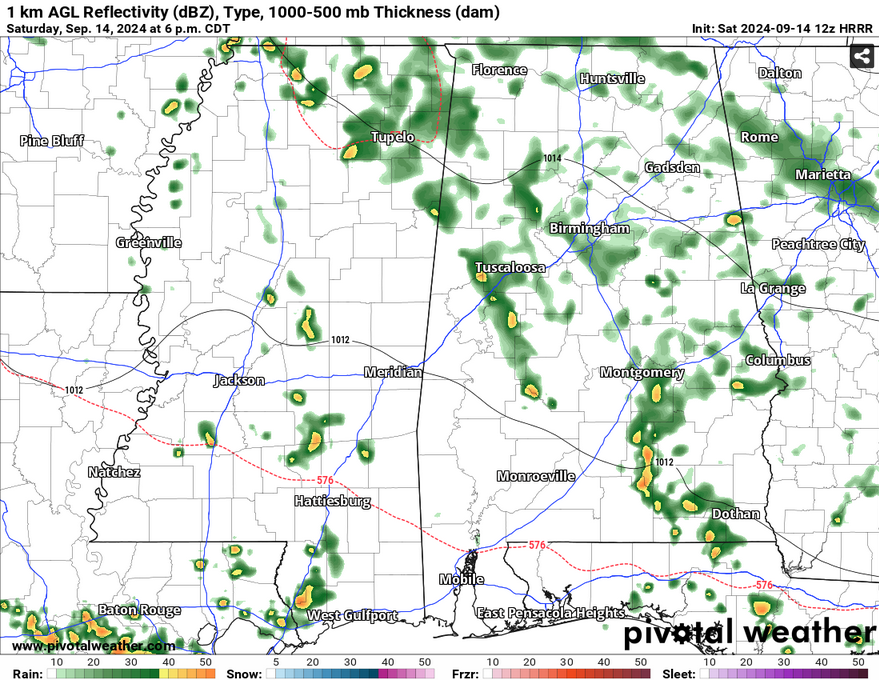
What the low means for us is that there is an area of circulation at the surface that will spark up some convection during the afternoon and evening hours. Today, there will be a small MCS that will bring some rain and thunder across parts of the Pinebelt and into parts of central Mississippi. Some of the rain will remain overnight in central MS and will keep going into the morning. Temperatures will be from the mid to upper 80s during the day and the upper 60s at night.
So for Gameday tonight? I would keep the poncho with you just in in case.
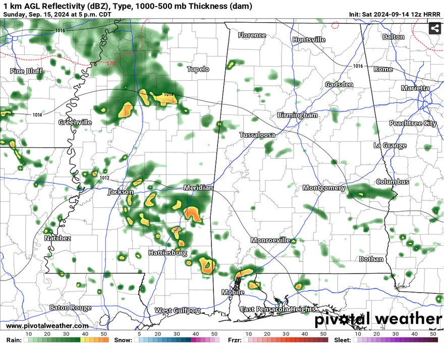
On Sunday, the rain chances will continue with more scattered storms across the southern and central portion of Mississippi. While there won’t be a lot of rain, it’ll be beneficial for many of us and to keep the fire weather suppressed for a little bit longer. With the low moving further south, this will keep temperatures towards the low 80s during the day before reaching the upper 60s again overnight.
By Monday, the low will be near the Gulf coast, however it’s not quite done with the moisture flow. Areas around the MS/AL state line will see the most of the rain during the day while we’ll still see a few showers and thunderstorms. Temperatures will climb into the low to mid 80s during the day and winds will be from the northeast due to the circulation. We may see up to half an inch as the storms move out.
Have a good weekend and keep the umbrella on you!
Select Data Set:

Regional Day-to-Day Forecast
Today – A 30 percent chance of showers in the afternoon. Partly sunny, with a high near 87. West wind 5 to 10 mph.
Tonight – A 20 percent chance of showers before sunset. Patchy fog after 11pm. Otherwise, partly cloudy, with a low around 68. North northwest wind around 5 mph becoming calm in the evening.
Sunday – A 50 percent chance of showers and thunderstorms in the afternoon. Partly sunny, with a high in the low to mid 80s. Calm wind becoming north around 5 mph in the afternoon. New rainfall amounts of less than a tenth of an inch, except higher amounts possible in thunderstorms.
Sunday Night – A chance of showers and thunderstorms before sunset. Mostly cloudy, with a low in the upper 60s. Calm wind. Chance of precipitation is 30%.
Monday – A chance of showers and thunderstorms starting in the mid-morning. Partly sunny, with a high in the low 80s. Calm wind becoming east northeast around 5 mph in the morning. Chance of precipitation is 70%. New rainfall amounts between a quarter and half of an inch possible.
Monday Night – Mostly cloudy, with a low in the upper 60s. East northeast wind around 5 mph becoming calm in the evening.
Tuesday – A 40 percent chance of showers and thunderstorms in the afternoon. Mostly sunny, with a high in the low 80s. Northeast wind around 5 mph.
Tuesday Night – Mostly clear, with a low in the upper 60s. East northeast wind around 5 mph becoming calm.
Wednesday – A 20 percent chance of showers and thunderstorms in the afternoon. Sunny, with a high in the upper 80s. Calm wind becoming northeast around 5 mph in the morning.
Wednesday Night – Patchy fog after 1am. Otherwise, clear, with a low in the mid 60s.
Thursday – Sunny, with a high in the upper 80s.
Thursday Night – Clear, with a low in the mid 60s.
Friday – Sunny, with a high in the upper 80s.


