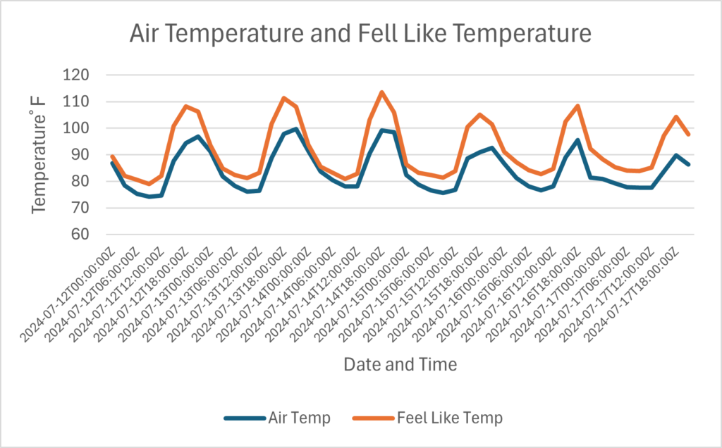
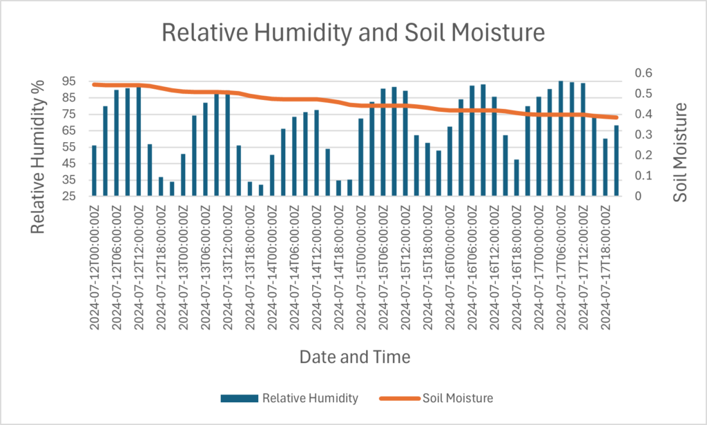
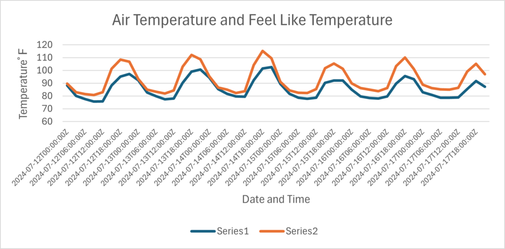
Happy Friday. I hope that you had a great week. Looking at our weather forecast for today, above-average temperatures are expected to start building in our region. This is thanks to an area of high pressure sitting in the Atlantic Ocean. Although some cloud cover is expected today, the heat is still expected to be high. When the sun is out, humidity levels are expected to be high today, pushing the fell-like temperatures or heat index to well over 100 degrees Fehernhight. Looking at our rainfall chances for today, most of the region should see dry conditions, but a few pop-up storms are possible near the coast and areas south of Interstate 20.
Heat is expected to build through the weekend


Looking at our temperatures today, the trend of hot and humid weather is expected to continue for our region through this weekend. Today, I am forecasting that most areas in the region should see high temperatures of at least 90 degrees Fahrenheit. The only areas that will be cooler will be areas along the coast, as the waters of the Gulf of Mexico will keep these areas slightly cooler. Although coastal areas should see marginally cooler temperatures, I am expecting heat index values to be around or greater than 100 degrees Fahrenheit this afternoon. The heat that is starting today is likely to stick around this weekend as an area of high pressure off the coast of the Atlantic is expected to pump in hot, humid air for the tropics. Please make sure to take care of yourself this weekend and watch for heat-related illnesses.
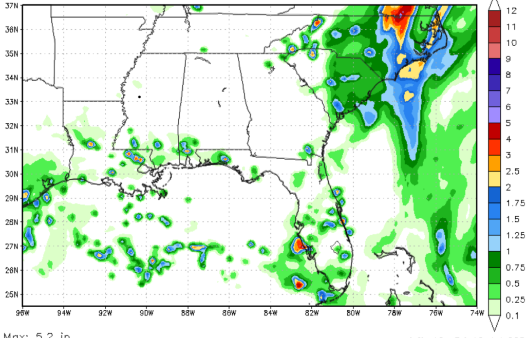

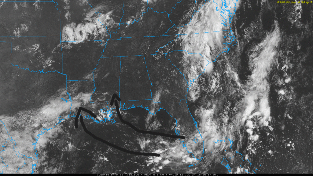
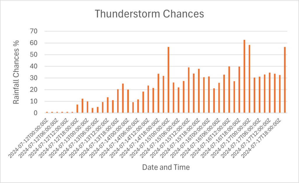
Looking at our rainfall chances, most of the models show little to no rainfall. I think that our rainfall chances for the next couple of days will be higher. As I write this at 10:54 a.m. CDT, radar shows rain moving from the Gulf into the New Orleans Metro Area. As the day progresses, I predict that most of the rain will stay near the coastline and fail to make it inland. Areas along and north of Interstate 20 should not expect rainfall but rather just some mid-level clouds. Areas along the coast should expect scattered showers and thunderstorms, with the potential of brief heavy rain from some of these scattered cells. Due to the oppressive heat and humidity, these showers will provide little relief and only make the area more humid. The low levels winds in the atmosphere are blowing from the south, allowing for convective showers and thunderstorms to develop, which is why I am expecting shower activity to affect areas near the coast primarily. Some of these storms could produce heavy rainfall in a short period of time, potentially leading to localized flash flooding.
A look into the future


Looking into the next 10 days, I expect a weak trough to move into our region by next week. This will allow for slightly cooler air temperatures to set up in our area. When I say cooler temperatures, I expect highs to be around 90 degrees Fahrenheit, which is more typical of this time of year. The bigger news, however, is our rainfall chances. Because of the trough expected next week, our rainfall chances are expected to increase. Most of the rainfall expected next week will be in the form of convective scattered showers and thunderstorms, typical of this time of year.
A quick look at the tropics


Looking at the tropics, there is little activity to report. After Beryl moved through the Atlantic, most of the tropical Atlantic is dominated by a ridge of high pressure. The only area of concern is a small area of low pressure off the coast of the Carolinas. This is just an area of disorganized showers and is expected to only produce rainfall along the coast of the Mid-Atlantic region. Looking into the Pacific, a small, unorganized area of showers and thunderstorms is likely to move off the coast of Mexico. Environmental conditions don’t look favorable for tropical development as the system moves to the west.


