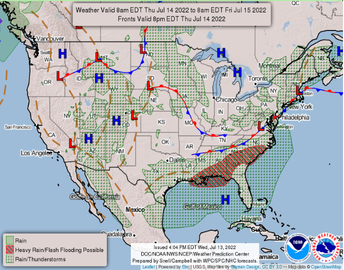
Hello everybody, for today CONUS weather forecast that there will be heavy rain throughout the southeast, the high-pressure ridge remains in the west, and dry line thunderstorms in the four corners. In the central plains, northwest and west coast will remain sunny and dry for today. In the northeast and east coast will have scattered showers and thunderstorms in the area.

Heavy Rainfall in the Southeast

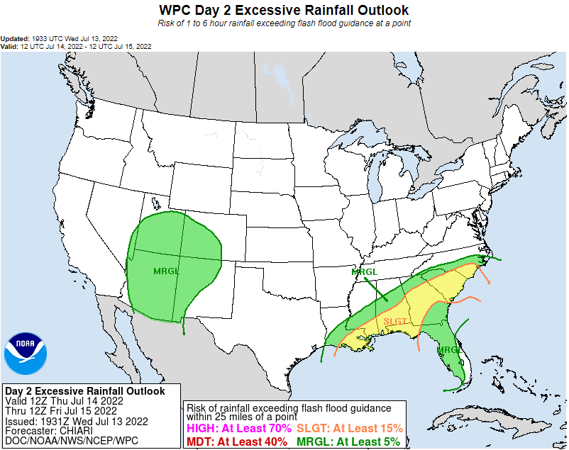
As the cold front boundary moving down south will be developing thunderstorms and showers in the Southeast. There will be a slight risk for the Southeast and a Marginal risk in the Four corner states. There is an estimate measure of rainfall will be happening in the Southeast that will be up to 2 to 4 inches of rainfall.
Dry line storms at Four Corners

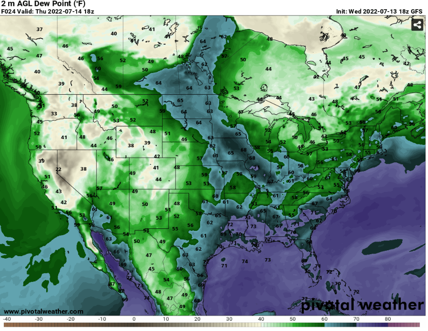
Under the high-pressure system in the west, there will be storms developing in the four corner states because there will be dry line boundary interacting with the humid air from Gulf of California. The dew point is going up to upper 40s to low 50s. This will be enough humid air to develop some showers and scattered thunderstorms.
Heat dome and Fire weather

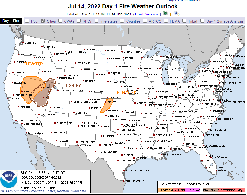
As the High-pressure ridge will be at the Western part of United States for the next few days. It will provide above warmer temperatures for the west. There will be an elevated fire risk for northwest Nevada and Kansas. From the Fire weather outlook discussion that a fire might start from a dry thunderstorm in those areas. There will be some thunderstorms will be developing in the four corner states. With any nearby thunderstorms in these very dry elevated fire risk might start a fire with a stray lighting from these thunderstorms.

