Happy July, everyone! What a crazy way to start off the month with Category 5 Hurricane Beryl out in the Caribbean Sea. As far as our local forecast, heat will continue to be the main story this week as high pressure builds in overhead. The best chance for some rain will be late this week and into the weekend, but expect a lot of dry time out there.
Another Hot & Humid Week
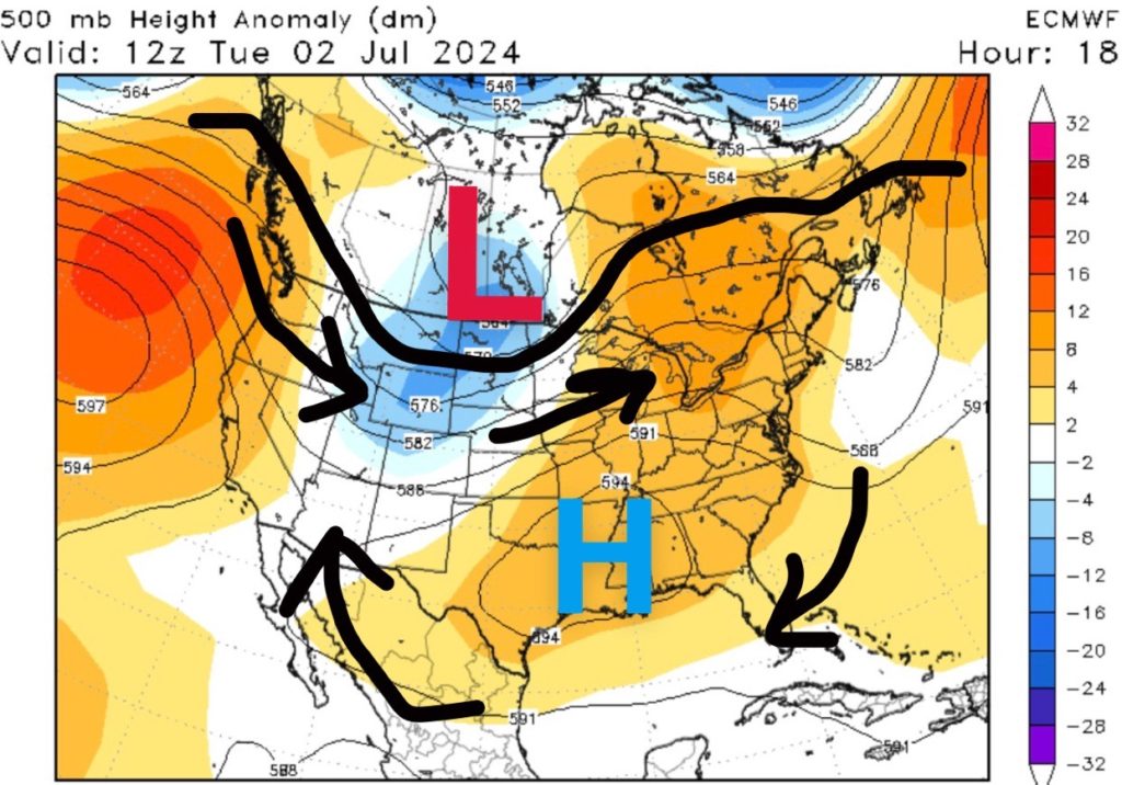
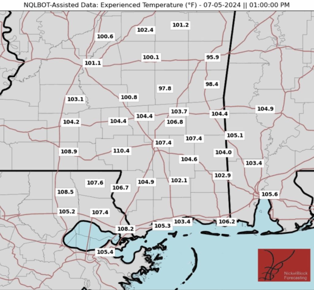
Currently, a strong area of high pressure is over East Texas, resulting in more hot weather across the Gulf Coast. An Excessive Heat Warning has been expanded along the Mississippi River up to Vicksburg, MS with additional Heat Advisories for parts of Louisiana and Mississippi.
For tonight, a surface low off to our east will reinforce dry air moving into the region, leading to more comfortable low temperatures in the mid to upper 60s for many of us.
Dangerous heat will persist, with temperatures reaching the mid to upper 90s daily. Heat index values will likely exceed 100°F across much of the area, especially Wednesday through Friday when they could reach 105-110°F. Heat Advisories may be necessary during this time. Be sure to drink plenty of water and limit your time outside.
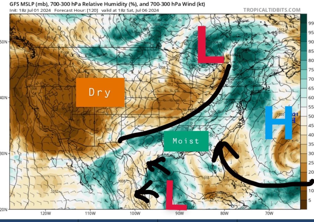
During the rest of the week, high pressure will continue to build over the region with a surface high forming off to our east. This surface high will attempt to advent more moisture northward, increasing chances for afternoon showers and thunderstorms through the rest of the week. Rainfall for most places will be under an inch and the best chance to see rain will be along the Gulf Coast.
A frontal boundary is forecasted to move into the region over the weekend, “potentially” providing some relief from the heat. We’ll see though…
Category 5 Hurricane Beryl
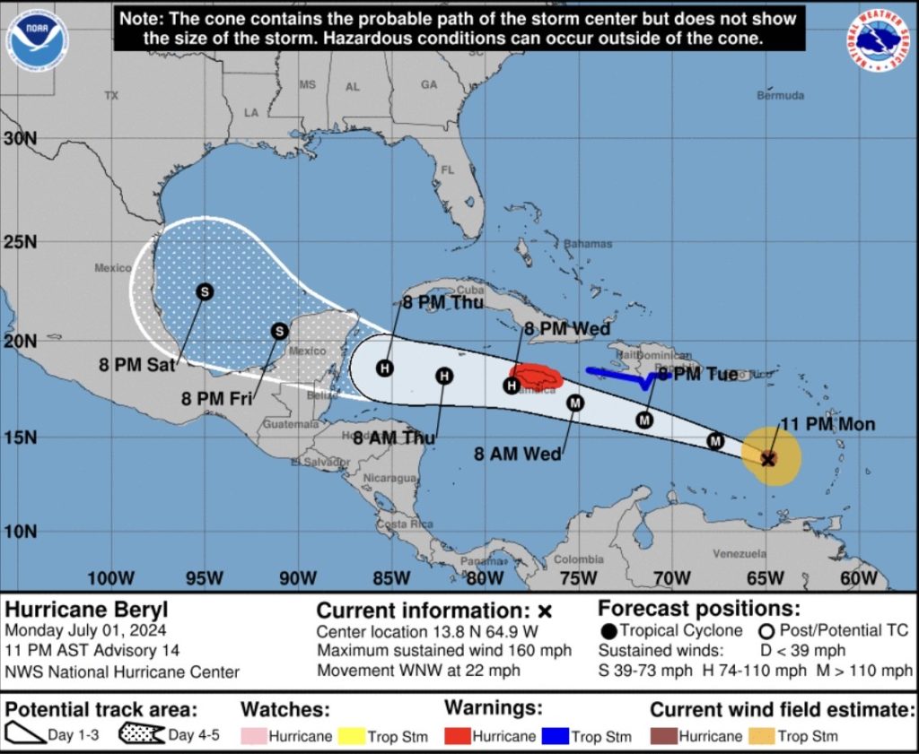
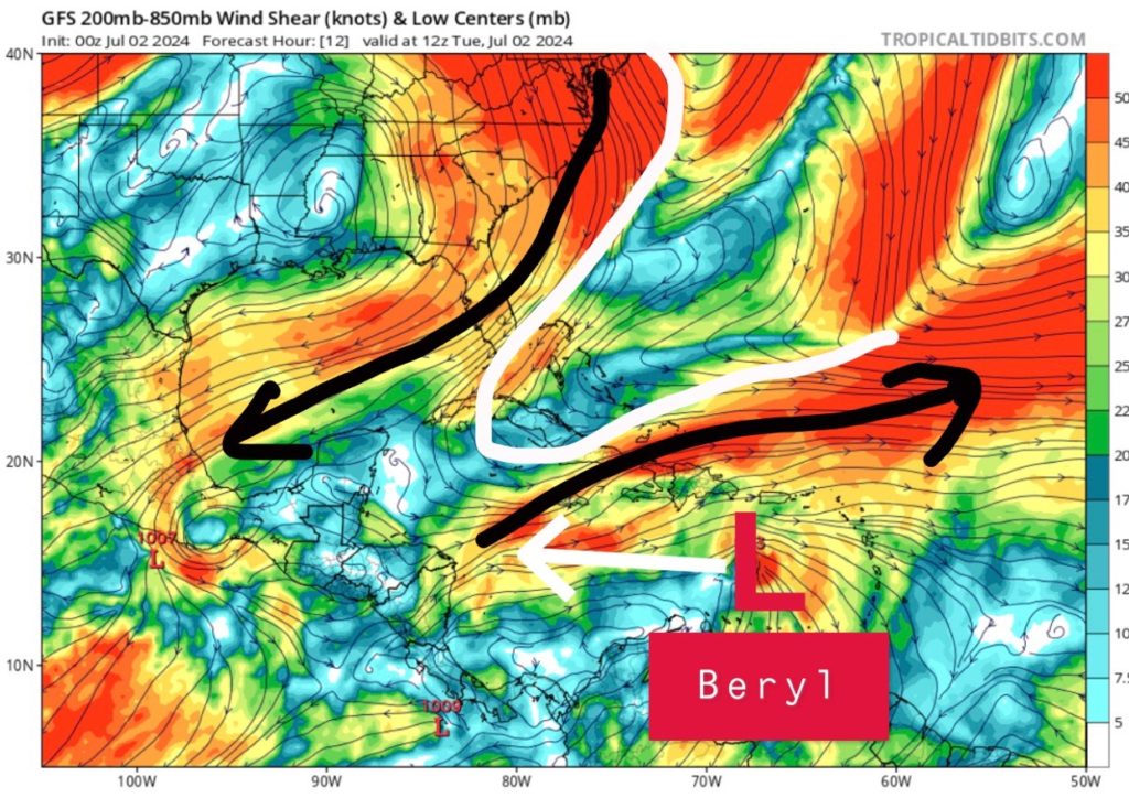
We officially have Category 5 Hurricane Beryl as recon data from the hurricane hunters found winds of 160mph with a pressure near 938mb. This is the earliest category 5 hurricane on record!
The good news is that Hurricane Beryl will gradually weaken as it moves off to the west-northwest across the Caribbean. Wind shear will be moderate in the central Caribbean due to a trough across the Bahamas, disrupting the organization of the storm.
Jamaica is under a hurricane warning with the worst impacts occurring on Wednesday. From there, landfall will take place near the Yucatan Thursday night into Friday. Depending on how much land interaction Beryl faces will determine its strength heading into the Gulf of Mexico this weekend.
Still lots of disagreement with U.S. impacts, but areas such as Texas should continue to watch this system closely. Landfall is more likely across Mexico, but a weaker high pressure center to the north may allow a northern jog.


