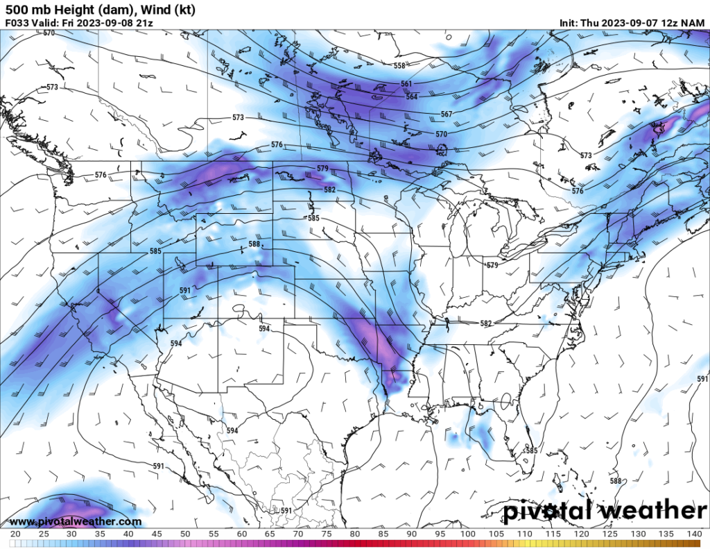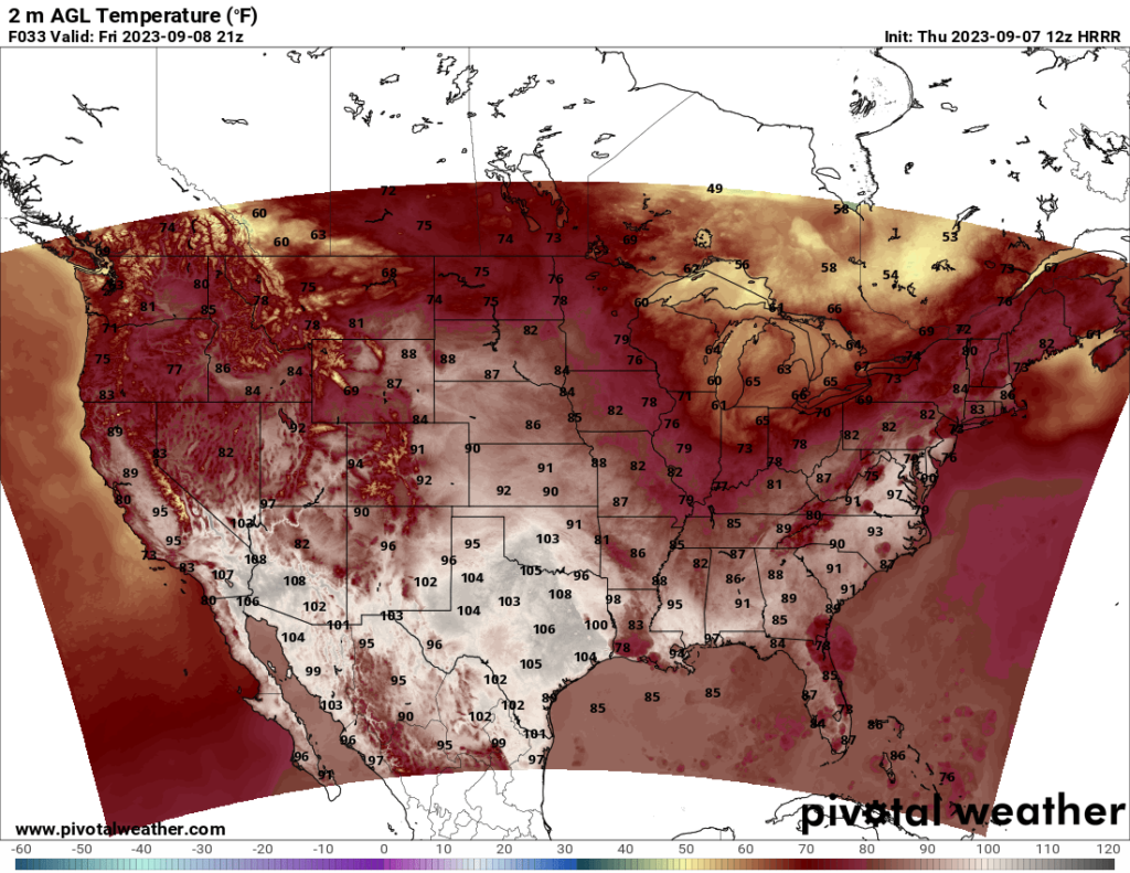
Autumn is in the air for some. For others, not so much. A trough centered over Michigan and the Rust Belt states should bring cooler air over much of the eastern Midwest states and the Southeast, bringing high temperatures down to the 70s and even the 60s in parts of the Midwest and into the mid 80s in the Southeast. The cooler air should spread eastward and reach the East Coast by Saturday or Sunday. Meanwhile, the heat is expected to persist in Texas and parts of the Southwest this weekend as a ridge hovers over the region. High temperatures could reach between 105 and 110 in some areas. For those of you in this area who are tired of the heat, you’ll have to wait a little longer.


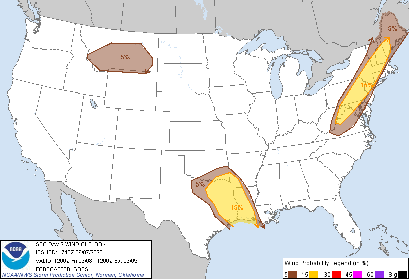
On Friday, the Storm Prediction Center has two areas in a Slight risk, with the main threat being damaging winds. Eastern Texas, western Louisiana, southwest Arkansas, and far southeast Oklahoma are currently in a Slight risk for damaging winds, and much of the Northeast also faces a damaging wind threat. The SPC also has a marginal wind threat in Montana.
In the Texas/Louisiana risk area, storms are expected to move southward across Arkansas and possibly eastern Oklahoma in the morning and early afternoon and progress into Louisiana and east Texas. Currently, the greatest risk is for wind, although a marginal hail risk exists too. Tornado risk appears low, owing to an unfavorable wind shear profile for tornado development.
Meanwhile, in the Northeast, storms are expected to form in the afternoon ahead of a slow-moving cold front. CAPE values are forecast to be over 3000 J/kg in some areas, which is impressive for the Northeast. Shear values will likely be the limiting factor, but based on my observation of the models so far, I think sufficient shear exists for severe weather. Just like in the Louisiana and Texas severe threat, damaging winds appear to be the primary threat, along with a marginal hail risk. However, unlike the other risk area, I cannot rule out a threat for an isolated tornado, either. The wind profile appears better for tornadoes here than in the other risk area, and I would not be too surprised if the SPC includes a marginal tornado risk in tomorrow’s update. I still think tornado risk is overall fairly low in the general area, and any tornado event would likely be isolated. However, I cannot rule out the possibility.

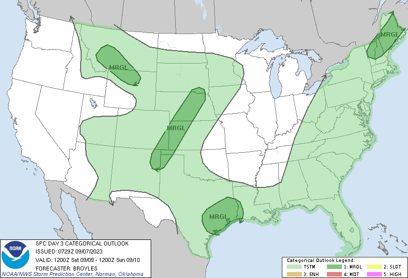
On Saturday, there are four Marginal Risk areas the SPC currently has outlined. At this time, there is still a bit of uncertainty, but based on the current SPC discussion, the main threats associated with the Northeast and Gulf Coast Texas risk areas are isolated damaging winds, while in the Plains and Montana/Wyoming risk areas, hail and wind are both potential threats. I do not want to speculate too much at this time due to the uncertainty, but anyone in these risk areas might want to keep an eye on the forecast as it updates tomorrow and Saturday.

