As we head into the weekend and look at the 500 mb heights chart, we can notice two main features. First, a ridge forms over the western Great Plains and eastern Rockies. At the same time, troughing occurs over the Northeast CONUS, with strong 500 mb winds. Additionally, there is a notable trough over the Pacific Northwest.
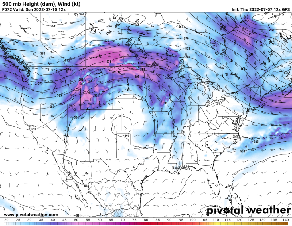
These features are expected to persist for a couple days before the ridge moves eastward and the trough moves over the Atlantic. By midweek, though, a similar setup occurs again, with a new ridge forming over the Rockies and a new trough forming over the Northeast.
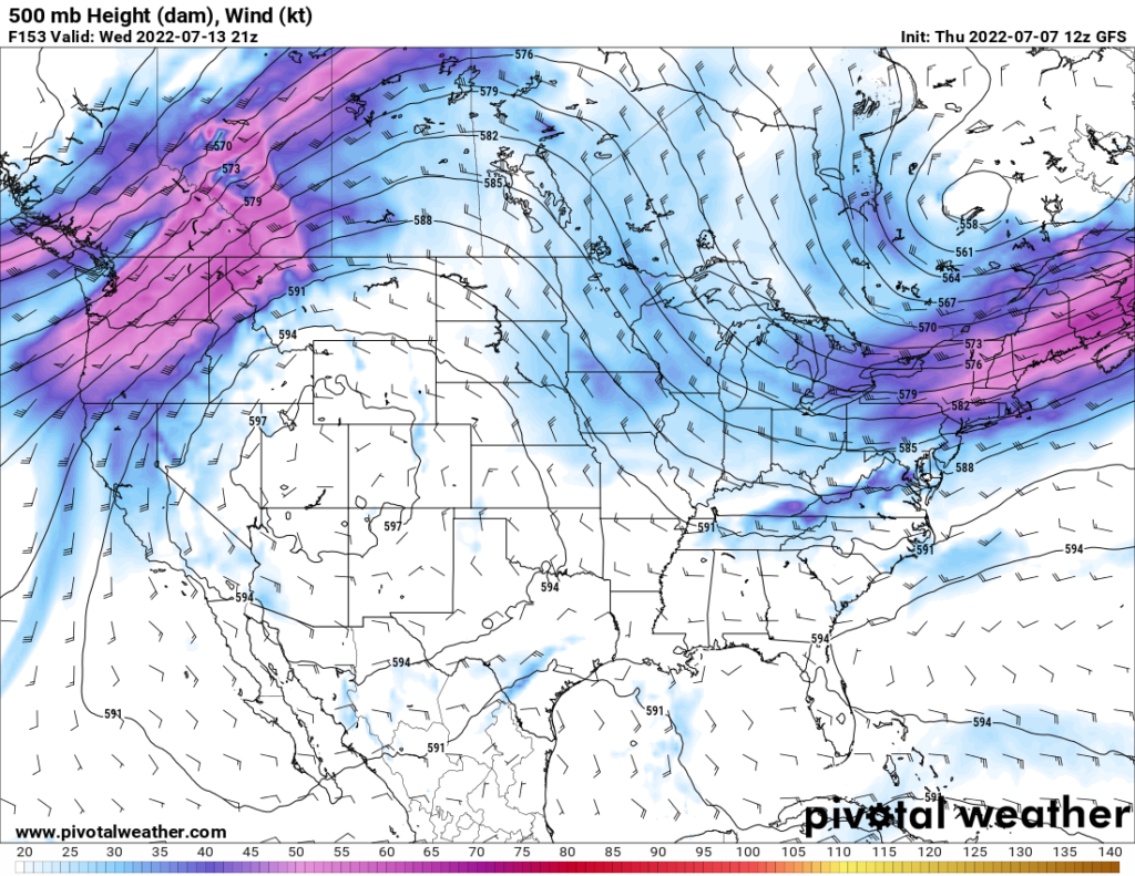
What does this all mean for the CONUS? Well, for starters, the ridging over the Plains and Rockies will result in hot temperatures throughout the region.
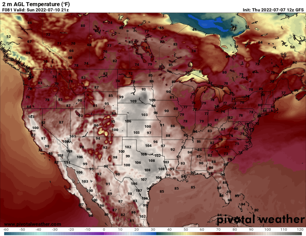
Ridging is associated with warmer temperatures, and considering the ridge is located over the Plains, which does not get as much moderation in their temperatures from the ocean, temperatures are expected to skyrocket. Temperatures above 100 could be expected over the weekend as far north as South Dakota. Hot, dry winds from Texas and the Southwest US will move toward the north, advecting hot temperatures into the Great Plains. The Plains and Rockies can also expect high temperatures Wednesday and Thursday as the new ridge over the Rockies forms.
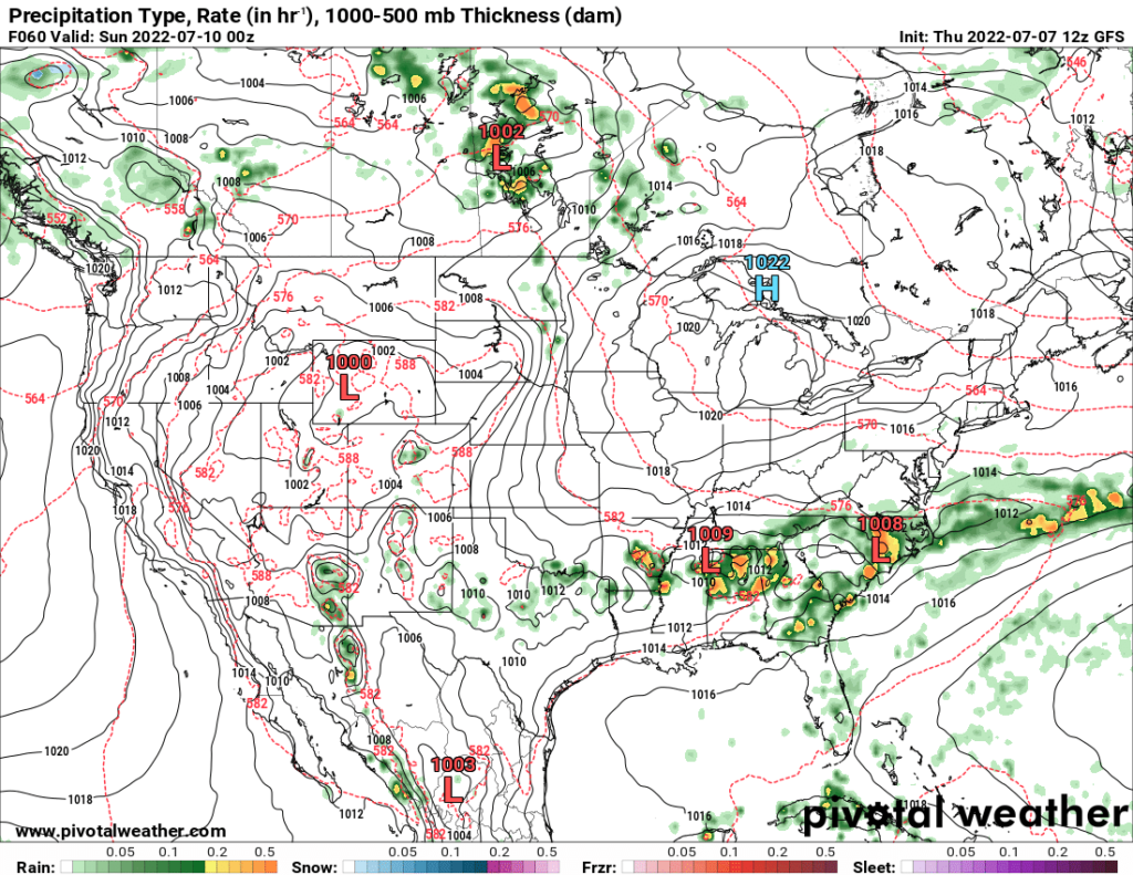
Meanwhile, in the Southeast, a small cold front is expected to move through the area Saturday afternoon through early Sunday morning. This cold front will result in a line of thunderstorms that will move south. There is also a small risk of severe storms on Friday and Saturday.
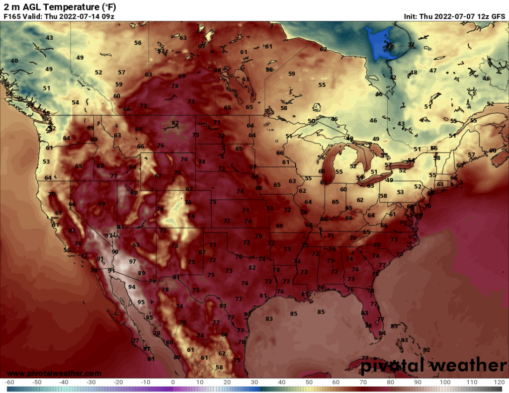
While the Great Plains bake in the heat, the Northeast will see more mild temperatures due to the troughing. Low temperatures in upstate New York and Vermont could dip as low as the lower 50s. The daytime highs should be pleasant, though.

