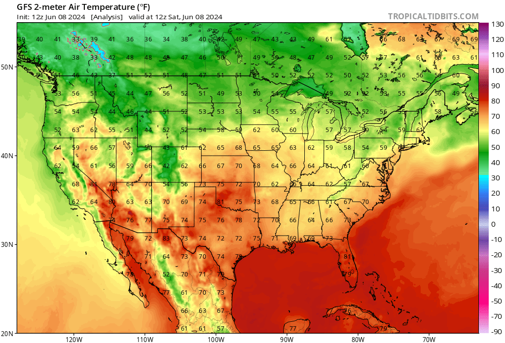
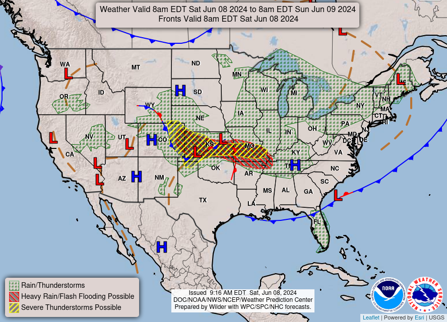
Happy Saturday, everyone; I hope you had a great first week of June. Today’s national forecast has quite a lot of information to cover, so I will start by giving a quick synoptic overview. Then, I will go into detail about each significant weather phenomenon affecting the nation. Looking at the two maps below, the heatwave that has been baking the southwest is spreading east thanks to the ridge of high pressure to the north. Areas of the central plains can expect to see severe weather this afternoon, with high winds and large hail being the primary threats. Further to the southeast, heavy rain associated with the severe weather to the west poses a flooding threat to southern Missouri. This is shaping up to be a very active weather day in the U.S., so let’s get into it.
The Heat Moves East
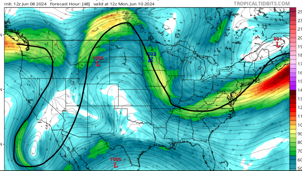
Those in the southwest U.S. Have been feeling the first significant heatwave this summer. Luckaly for those in that region, the head will subside somewhat for today. The bad news is that the dome of high pressure, which has caused the heat wave, is moving east and setting up an omega block. This is when a ridge of high pressure is cut off by two low-pressure systems. The Black line in the image to the right shows an omega block at 250 mb. Because of this setup, hot and humid air is setting up for the southern plains. Afternoon highs today are expected to be around 100 degrees in parts of Texas and Oklahoma. Areas to the west, which have been baking for the last couple of days, should see slight relief today; however, temperatures are still expected to be over 100 degrees for parts of Nevada and Arizona. Make sure that you drink lots of water and stay inside during the middle of the day.
Severe Weather in the Central Plains
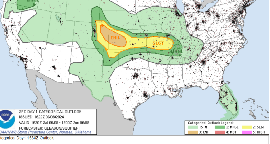
Changing subjects here, today, we have an enhanced risk or level 3 for severe weather in the central high plains. There is also a level 2 or slight risk for severe weather from Eastern Colorado to Southwestern Illinois. This severe weather is being caused by the upsloping of the Rockey Mountains, which will cause storms to fire off the mountains by mid-day. Moisture at the surface, an unstable environment, and daytime heating will fuel these storms by the late afternoon. Storms will quickly become severe east of the Denver Metro Area and could drop large hail and produce damaging winds. A brief spinup tornado or two can’t be ruled out from these storms. Further east, heavy rain is forecasted with these storms, which will be talked about in the next section of this report.
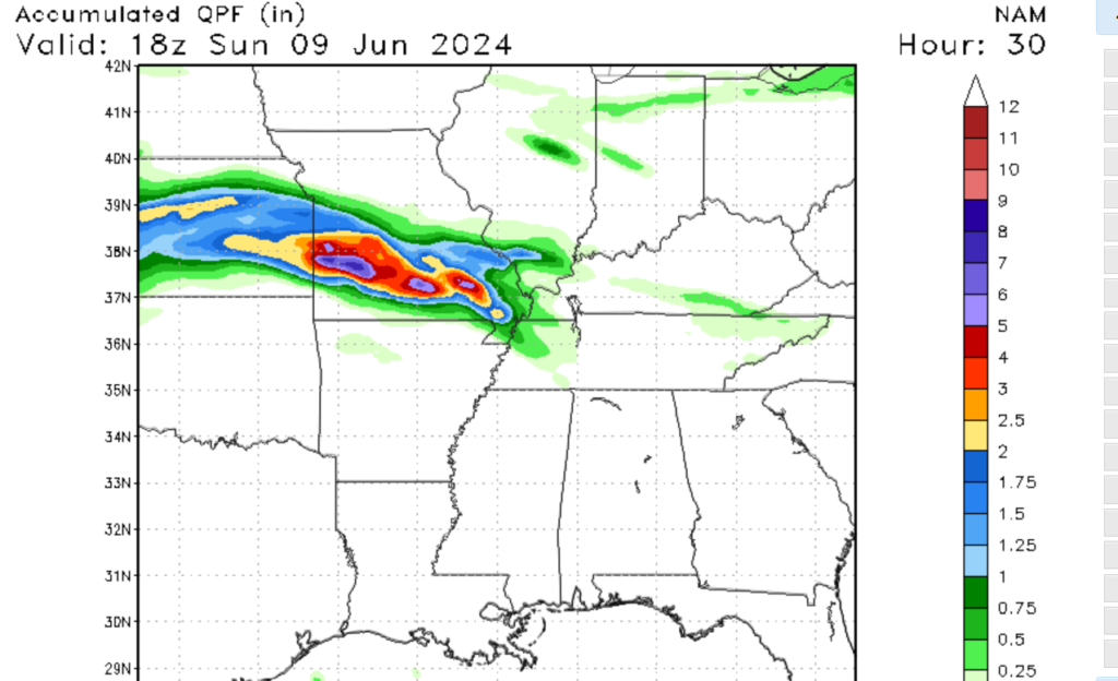
Flooding Concerns in the Mid-South
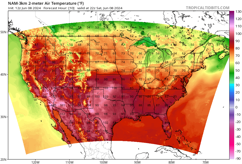
Switching gears again, we have flooding concerns in the mid-south, primarily Southern Missouri south of Interstate 70. The severe weather that the central plains are expecting today will continue to move east-southeast and collide with a cold front. This will keep the already potent storms strong and cause primarily heavy rain in parts of Southern Missouri, but hail and strong winds can’t be ruled out. These storms are expected to arrive in the region by 6 PM CDT and last through the overnight hours. I expect that most of Southern Missouri will see 2 to 4 inches of rain with localized amounts closer to 5 inches. The image below shows expected rainfall amounts for the region.
Overall, quite a few different weather events are currently affecting the United States. The southern plains and southwest can expect above-average temperatures. Further north, the central plains can expect severe weather, and flooding is a concern in southern Missouri. This is why it is essential to stay weather-ready, significantly if your region is currently being affected by extreme weather.


