This evening, a weakening cold front will clear out most of the showers in our area, giving way to drier and cooler conditions. Overnight temperatures are expected to drop to the low to mid-60s. Hurricane Helene, well to our south, is still slated to stay east of the area.

The latest from the National Hurricane Center continues to show the storm heading north-northeast toward the Big Bend region of Florida.
Back locally, tomorrow, the closed low will strengthen near the Mississippi/Arkansas/Tennessee border, acting as a barrier a bit of a dance partner to Hurricane Helene. In fact, the reason for the specific path of Helene is due to the guiding by this cutoff low.
An exaggerated illustration shown below highlights that as the low sags south, it will deflect to the southwest at first (first image) and then back to the east second (second image). While Helene will originally deflect to the northeast and then back to the west.
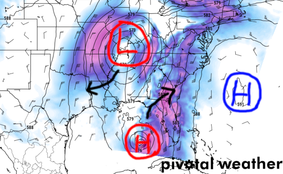
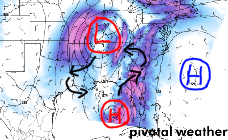
The arrows on the above images are, again, a bit of an exaggeration of movement to illustrate the point. But you can see how that compares to the actual track of Helene from the NHC.
That leaves our area in between a “rock and a hard palce” so to speak. Where we will be a bit breezy due to pressure gradient wind, but not in a great place to pick up much meaningful rain. That said, we will get to skip out on the “hurricane” part, so I don’t know that anyone is going to complain.
Looking ahead to Saturday through Wednesday, the mid/upper low will continue to influence our weather, resulting in increased cloud coverage, especially in the northern areas. By Monday, a shortwave ridge will start to build, leading to clearer skies as the work week progresses.
A more significant weather change may occur mid-week next week as a cold front pushes southward, bringing cooler and drier air. For now, expect precipitation-free days with seasonal temperatures throughout the next few days
REGIONAL DAY TO DAY FORECAST
Tonight: Partly cloudy. A chance of showers and thunderstorms, mainly in the evening. Lows in the upper 60s. Northeast winds 10 to 15 mph. Chance of rain 40 percent.
Thursday: Partly sunny. A slight chance of showers in the morning, then a chance of showers with a slight chance of thunderstorms in the afternoon. Highs in the lower 80s. North winds 10 to 15 mph with gusts up to 30 mph. Chance of rain 30 percent.
Thursday Night: Partly cloudy with a slight chance of showers and thunderstorms in the evening, then mostly clear after midnight. Lows in the lower 60s. Northwest winds around 15 mph with gusts up to 30 mph. Chance of rain 20 percent.
Friday: Sunny. Highs in the lower 80s. West winds 10 to 15 mph with gusts up to 25 mph.
Friday Night: Mostly clear. Lows in the mid 60s.
Saturday: Sunny. Highs in the mid 80s.
Saturday Night: Mostly clear. Lows in the mid 60s.
Sunday: Sunny. Highs in the upper 80s.
Sunday Night: Mostly clear. Lows in the mid 60s.
Monday: Sunny. Highs in the upper 80s.
Monday Night: Partly cloudy in the evening, then becoming mostly clear. Lows in the mid 60s.
Tuesday: Sunny. Highs in the upper 80s.


