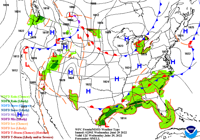
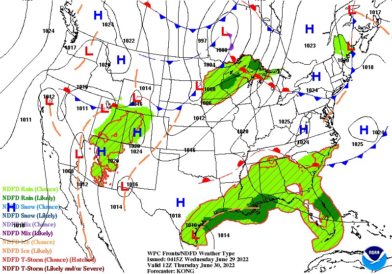
The ridge of high pressure that is all too familiar with us by now continues to stay off to the west, allowing for more seasonal temperatures across the southeast, as well as chances of scattered showers. Eventually, this ridge will meander back eastward and hover over the southeastern US, bringing warmer than average temperatures to the region. Along with this, we are watching the potential for organized tropical development in the Gulf of Mexico off the coast of Texas.
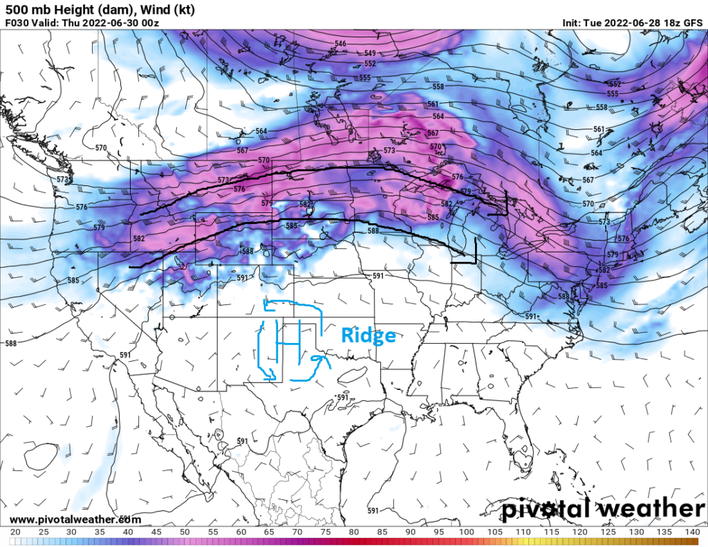
For the remainder of the week, scattered showers and thunderstorms continue to be possible across the southeastern states and gulf coast, due to in part of the center of high pressure situated off to the west as well as a stationary front draped across much of the region. Eventually as the front transitions into a warm front and lifts northward, existing outflow boundaries from the previous days’ storms will be the main trigger for convection.
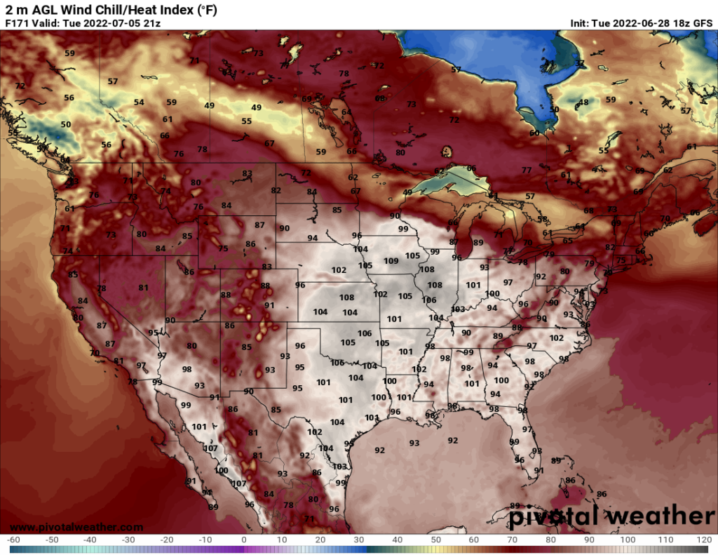
Once the ridge of high pressure traverses eastward again by late this week into next week, the heat will begin to rise once again above seasonal averages. Several areas in the southeast may reach the mid to upper 90s by next week, with some potentially reaching into the 100s. This heat, along with high dew points due to ample gulf moisture, will raise the heat index to near or above triple digits, making for uncomfortable outdoor conditions for anyone doing strenuous activities.
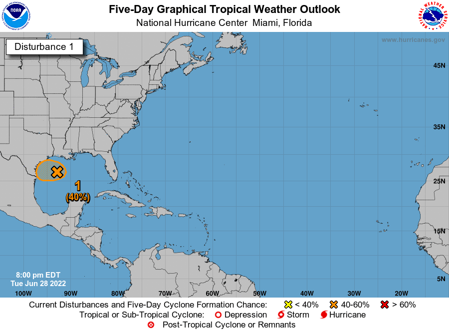
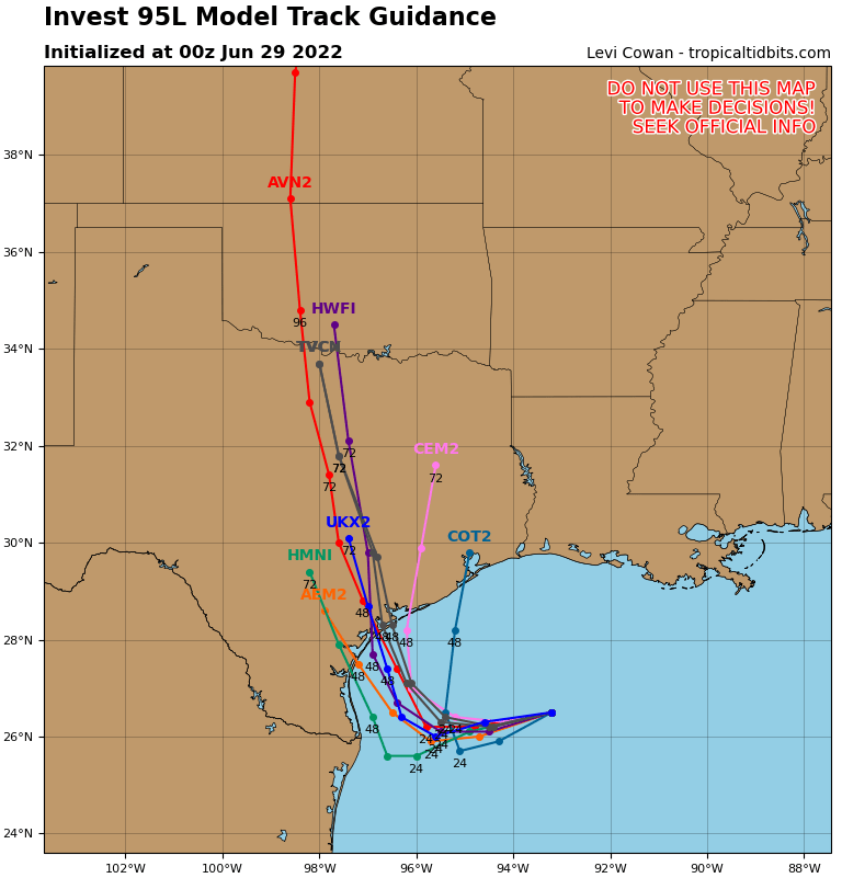
Another thing that will need to be monitored is the potential for tropical development off the coast of Texas and Louisiana. Currently (as of 12:01am CDT), the National Hurricane Center has given Invest 95L a 40-percent chance of developing into a tropical storm. Latest model guidance suggests the area of concern will make landfall between Houston and Corpus Christi and then proceed to make a right turn and head north through central Texas. Impacts and intensity of this potential storm will have to be monitored in the coming days.
Local 3 Day Forecasts (Courtesy: NWS)
| Dallas, TX | ||
| Wednesday | Thursday | Friday |
| High: 94°F | High: 97°F | High: 94°F |
| Low: 75°F | Low: 76°F | Low: 75°F |
| Precip: None | Precip: None | Precip: None |
| Houston, TX | ||
| Wednesday | Thursday | Friday |
| High: 94°F | High: 87°F | High: 88°F |
| Low: 77°F | Low: 77°F | Low: 78°F |
| Precip: 50% | Precip: 60% | Precip: 60% |
| New Orleans, LA | ||
| Wednesday | Thursday | Friday |
| High: 88°F | High: 88°F | High: 88°F |
| Low: 79°F | Low: 79°F | Low: 79°F |
| Precip: 80% | Precip: 80% | Precip: 80% |
| Little Rock, AR | ||
| Wednesday | Thursday | Friday |
| High: 89°F | High: 92°F | High: 92°F |
| Low: 69°F | Low: 72°F | Low: 73°F |
| Precip: None | Precip: 20% | Precip: 40% |
| Memphis, TN | ||
| Wednesday | Thursday | Friday |
| High: 91°F | High: 91°F | High: 90°F |
| Low: 72°F | Low: 73°F | Low: 73°F |
| Precip: None | Precip: 30% | Precip: 40% |
| Birmingham, AL | ||
| Wednesday | Thursday | Friday |
| High: 88°F | High: 88°F | High: 88°F |
| Low: 71°F | Low: 71°F | Low: 71°F |
| Precip: 60% | Precip: 50% | Precip: 60% |
| Atlanta, GA | ||
| Wednesday | Thursday | Friday |
| High: 86°F | High: 85°F | High: 83°F |
| Low: 70°F | Low: 71°F | Low: 70°F |
| Precip: 60% | Precip: 40% | Precip: 70% |
