In case you missed the news yesterday, we got our seasonal hurricane outlook from NOAA and the National Hurricane Center.

NOAA also introduced a handful of new tools they’ll be using this year to monitor, track, predict and communicate risk for each storm. So hopefully, even if it is this active, we will all be better prepared because of the new stuff the NHC has to use.
Around here, it is more of the same.
We will continue to see the threat for severe weather to our north during the next few days with opportunities for a few isolated, renegade storms to drop south toward us later into the evening and overnight. The biggest risk for any severe weather is going to be closest to I-20, but really anyone is fair game to see a lone storm between now and early Saturday morning.
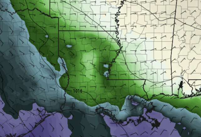
Otherwise things are looking pretty warm. Actual temperatures will top out around 90 and when you factor in the sun, the humidity and the wind, the ‘experienced temperature’ will hover around 100F.


It looks like model guidnace wants to paint the next shot for rain for us as Monday morning now. Not sure I buy it quite yet, but the idea being that a cluster of storms will cascade toward the Gulf and slide through Monday morning before dawn. It would still leave the area dry for any plans Monday afternoon.
Then a cold front arrives – in name only – on Tuesday and into Wednesday to help knock dewpoints back and lower the humidity. We will also be slightly cooler, but not enough to get excited about.

After that, a bit of an odd pattern gets established int the model guidance which leaves our area warm (but not too hot) and drier (both precip and humidity) for the rest of next week and into next weekend. Not sure I fully buy this one, either, but I’ll continue to monitor trends.
REGIONAL DAY TO DAY FORECAST
Today: Mostly sunny. Highs around 90. South winds 5 to 10 mph.
Tonight: Mostly clear in the evening, then becoming mostly cloudy. Lows in the lower 70s. South winds 5 to 10 mph.
Saturday: Mostly sunny. Highs in the lower 90s. Southwest winds 5 to 10 mph.
Saturday Night: Mostly clear in the evening, then becoming partly cloudy. Lows in the lower 70s. South winds 5 to 10 mph.
Sunday: Mostly sunny. Highs in the lower 90s. South winds 5 to 10 mph.
Sunday Night: Partly cloudy. Storms possible after midnight. Lows in the lower 70s. Chance for rain around 20 percent.
Memorial Day: Pre-dawn storms possible. Mostly sunny. Highs in the lower 90s. Chance for rain around 20 percent.
Monday Night: Mostly clear in the evening, then becoming partly cloudy. Lows in the lower 70s.
Tuesday: Mostly sunny. A slight chance of showers and thunderstorms in the morning, then a chance of showers and thunderstorms in the afternoon. Highs in the lower 90s. Chance of rain 30 percent.
Tuesday Night: Mostly clear. Lows in the upper 60s.
Wednesday: Sunny. Highs in the lower 90s.
Wednesday Night: Partly cloudy. Lows in the upper 60s.
Thursday: Sunny. Highs in the lower 90s.

