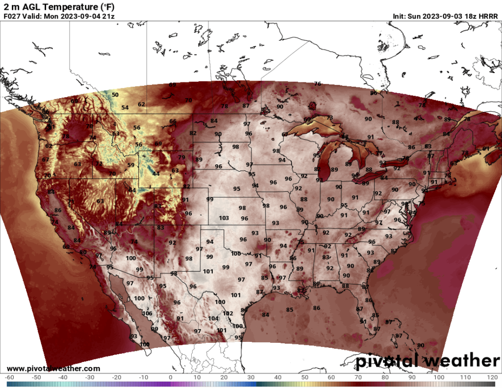
Labor Day Monday looks like it will be hot for much of the country. The central and eastern CONUS should see high temperatures in the 90s in many places, and a few areas in the southern Plains may reach 100. The good news, however, is that it will not be as hot as it was over the last month for much of the country, with the heat indexes only reaching into the 100s in a few places, mostly in Louisiana and east Texas.
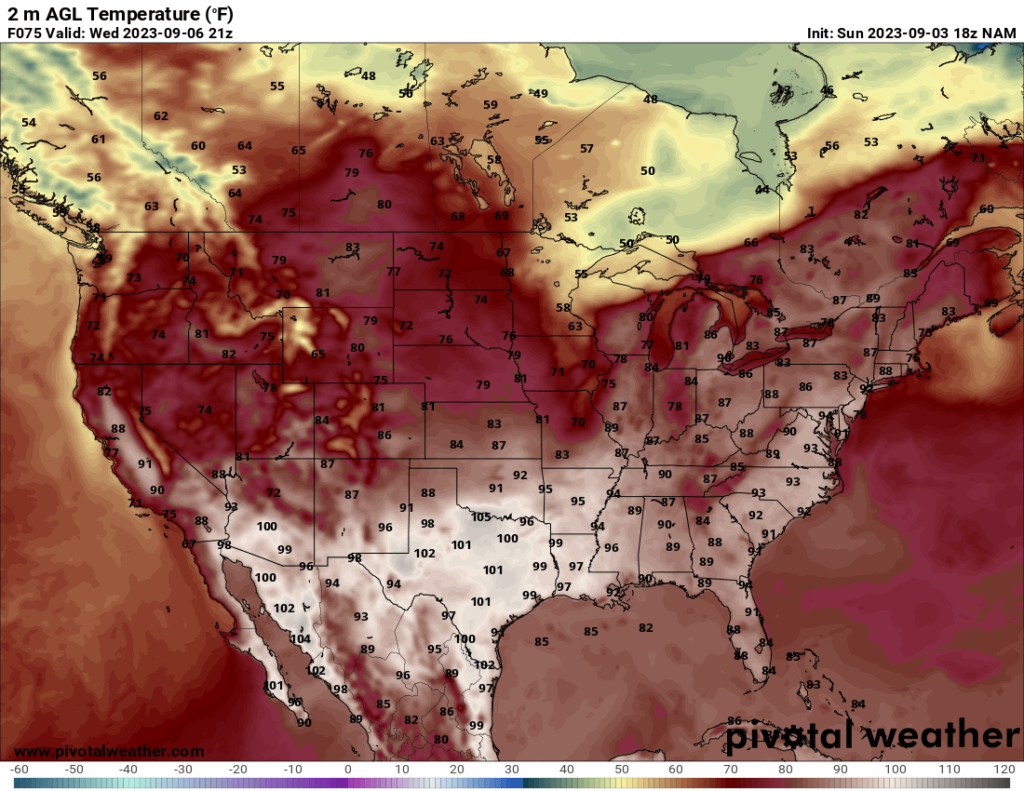
After Labor Day, we may see a cooldown in parts of the northern US. A cold front is forecast to progress across the northern Plains, which will lower the temperatures there by midweek and give the area a taste of fall temperatures. The current GFS model expects the front to stall over the central Plains midweek while continuing south across the Great Lakes by Thursday, lowering temperatures there as well. Precipitation is forecast ahead of this front, with rain and thunderstorms likely in the Great Lakes region on Wednesday, progressing southward to the Northeast by Thursday or Friday. It is too soon to say whether a severe threat will be present with any of these storms, so those in the area should check the Storm Prediction Center and their local forecast for updates as the week progresses.
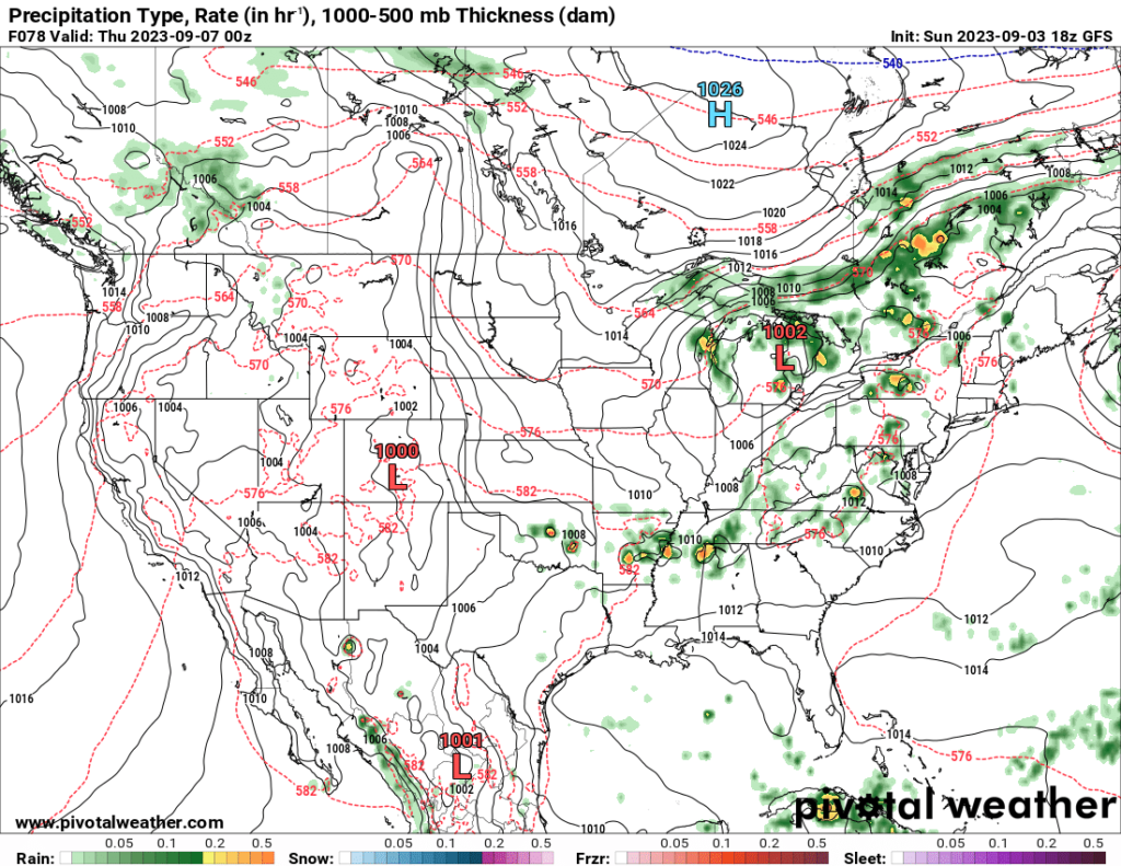
Speaking of severe threats, there are a few areas of possible severe weather to look at over the next couple days. The most notable risk right now is over the northern Plains. As you can see from the maps below, the SPC currently has a 15% hail and wind risk over parts of the northern Plains (which is equivalent to a Slight Risk by SPC standards). Instability in the area appears to be on the lower side, maybe reaching the low 1000s J/kg in the highest risk area, but relatively strong shear will allow for severe potential. Additionally, a shortwave trough passing through the area will provide a lifting mechanism, also increasing severe potential (in the third image below, the shortwave trough is centered over Montana and Wyoming; lifting occurs on the east side of this). Storms are expected to form in Wyoming and Montana in the afternoon and progress eastward over the Dakotas by evening and after sunset.
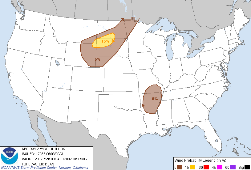
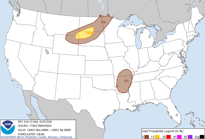
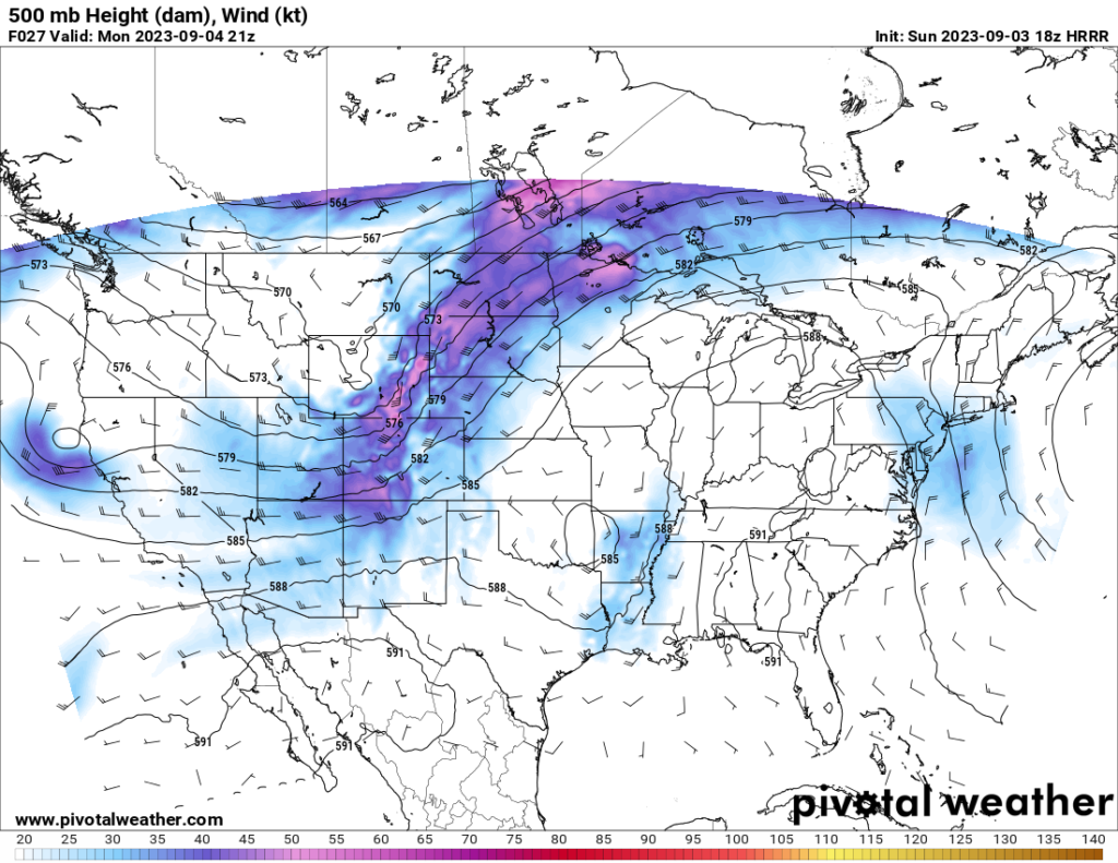
Elsewhere, Arkansas and southern Missouri may see a Marginal Risk for wind and hail. An upper level low pressure system centered over the Oklahoma/Arkansas border will provide lift to the east of the low, and the cooler temperatures in the upper levels associated with the low will provide a greater lapse rate (rate of temperature decrease with increasing altitude), which provides more instability. Shear is on the lower side, but it should be just enough that, combined with modest CAPE and moisture, a chance for isolated strong wind and hail events will be present.
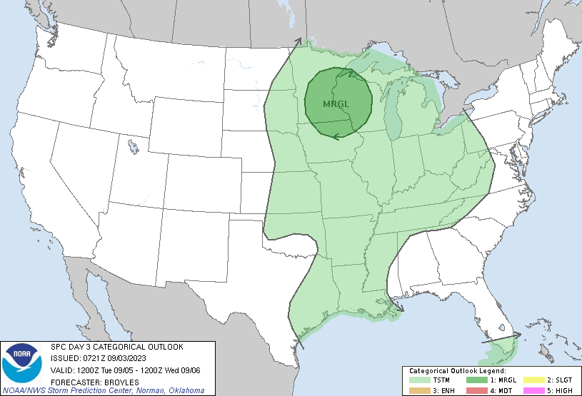
On Tuesday, the SPC currently has a Marginal Risk over parts of Minnesota, Wisconsin, and Iowa. The NAMNEST model currently shows a somewhat favorable severe environment for the area on Tuesday, with CAPE above 2000 J/kg and even 3000 J/kg in some areas and shear hovering around 30 kts in a few spots. Additionally, the NAMNEST shows dew points in the mid 60s to the lower 70s, which is sufficient for severe storms. The model output shows a line of storms forming late in the afternoon across Iowa and Missouri and stretching into Minnesota and Wisconsin around sunset. The greatest chance for supercells currently seems to be over eastern Minnesota and western Wisconsin, although I would not be surprised if the SPC extends the risk area southward to cover much of Iowa. I also think the SPC will upgrade this risk to a Slight in a future update. Due to the forecast of linear storms, straight line winds and hail will likely be the biggest threats, although I cannot rule out a risk for an isolated tornado within an embedded supercell, either. I would definitely advise those in this part of the Midwest to check their forecast for updates tomorrow and Tuesday as the models become more clear.

