For what has been the same theme for some time now, the Atlantic basin still has not offered much in the way of tropical storms or hurricanes up to this point. The Pacific basin, on the other hand, has been very active throughout the opening months of hurricane season. At the moment, Hurricane Frank and Tropical Storm Georgette still continue to headline matters in the tropics in the near term.
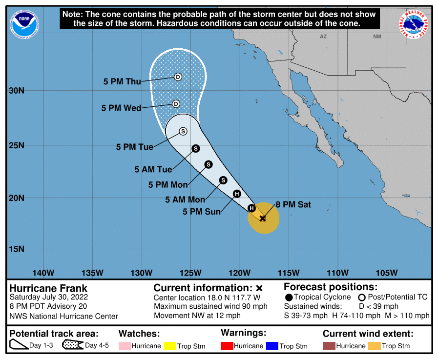
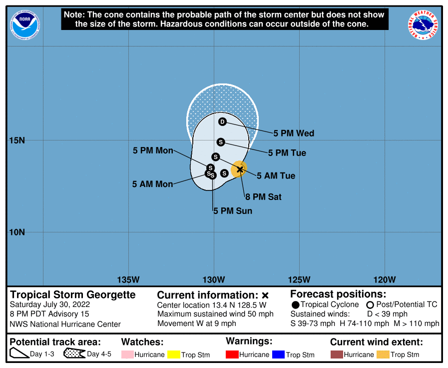
Hurricane Frank is located off the southwest coast of Baja California in Mexico and is moving northwest at 12 mph. Current guidance has the hurricane maintaining a northwesterly track for the next 5 days, and also does have it gradually weakening as it encounters colder SSTs. The remnants of Frank may possibly come close to the coast of California by the end of the week, but the potential for any rainfall associated with it is unknown at this time. To Frank’s west, Tropical Storm Georgette continues to slowly weaken over open waters. It is currently moving west-southwest at 9 mph and will maintain its current heading over the next couple days before turning northward and falling apart due to colder SSTs.

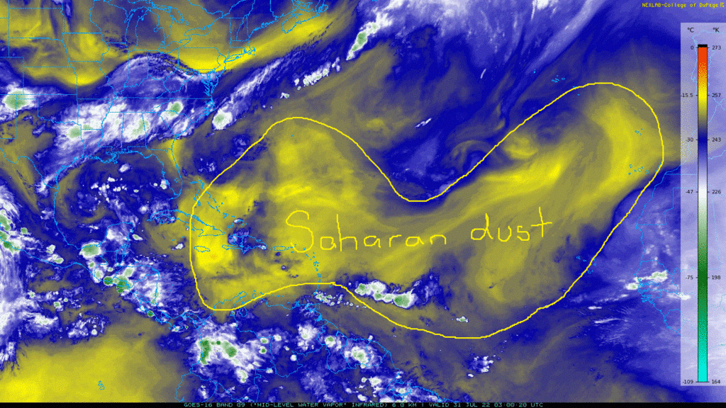
Over in the Atlantic, things continue to remain quiet throughout the region. SSTs are still very warm throughout the Gulf of Mexico, Caribbean Sea, central and western Atlantic Ocean, however, large swaths of Saharan dust aloft as well as moderately high wind shear have put a stop to any organized development.


