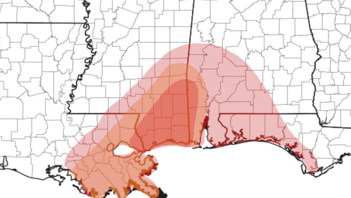
Alright guys, I ran the Karrie Meter map numbers and I wanted to share an update about The tornado risk through about midnight tonight for the area.
Fir things’ first, though, let’s get the latest from the Storm Prediction Center.
Forecast from the SPC
…SUMMARY…
Hurricane Zeta may spawn a few tornadoes this afternoon through tonight from extreme southeast Louisiana/Mississippi into southern Alabama and the western Florida Panhandle.
…Southeast LA this afternoon to AL/GA through tonight…
Hurricane Zeta is expected to make landfall late this afternoon along the LA coast to the south of New Orleans (please see latest NHC advisories for details). The weakening remnants of Zeta will then accelerate northeastward through tonight across AL/GA, to the east of a deep midlevel low over the southern Plains. An influx of tropical moisture and associated buoyancy will continue through the day along the north central and northeast Gulf coast as Zeta progresses north-northeastward.
Some more cellular convection has been observed this morning over the northern Gulf. An increase in low-midlevel flow and vertical shear will occur as Zeta approaches the coast as the mid 70s boundary-layer dewpoints spread inland with muted daytime heating, which will increase the threat for supercells/tornadoes in the outer northeastern and eastern convective bands. The more favorable phasing of buoyancy/vertical shear will occur this afternoon/evening from extreme southeast LA into southern AL/western FL Panhandle. Poor lapse rates near the warm core center of Zeta and diurnal stabilization should gradually limit the threat farther inland overnight, though strong wind profiles and marginal CAPE rooted near the surface may still support an isolated tornado overnight into GA, to the southeast of the center.
Karrie Meter Numbers
Taking a look at the Karrie Meter from the NAM3km pic.twitter.com/jT2lhNiUiq
— Nick Lilja (@NickLilja) October 28, 2020
Depending on which model you look at and the placement of the center of the storm, the Karrie MEter kicks back different numbers for different areas. This is pretty normal. As the Karrie MEter is dependent on different numbers, at different levels, at different altitudes in the atmosphere… understandably, if you move the center of a hurricane by as little as 10 miles, you can change the impacts to a large area.
So here is a “broad-brush” of the average across most of the model data from the Karrie Meter data:

Notice that places like Poplarville, Lumberton, New Augusta, Richton, Waynesboro, State Line, Leakesville, Beaumont, McLeain, Lucedale, and Wiggins are showing the highest risk from the Karrie Meter. Points nearby, and points between included, too.
Places like Hattiesburg, LAurel, Ellisville, and Quitman are in the slightly lower threat area.
Places like Columbia, Collins, Bay Springs are in the lowest threat area givent he available data from the Karrie Meter.
This data is only through midnight. And this threat will shift northward through the overnight hours.
The SPC and the Karie Meter are different, which one do should I trust, Nick?
The SPC. Trust them first. They are very smart people who have a very good handle on severe weather.
I share the Karrie Meter data and threats because the Karrie Meter has shown to ahve some reasonable predictive value for south Mississippi in the past. It has – historically – done as well (or better) than the SPC for our area.
The reason I still think you should trust the SPC is that the Karrie Meter has only been used for a handful of tropical systems. There aren’t enough examples to pull from to know if it does a good job or not. So far, it has worked well. But the sample size is too small to “trust” it more than the folks at the SPC.
This will be another good test for the Karrie Meter, though, to see how it performs.
Straight-line wind threat
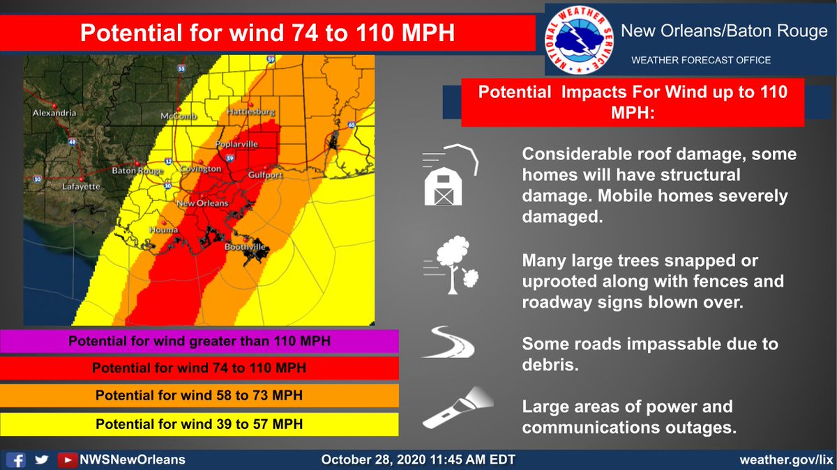
The NWS is starting to become more concerned about strong straight-line wind gusts moving farther inland than originally anticipated, too.

That graphic from the NWS in NEw Orleans shows a chance for greater than hurricane-force wind extending inland through the Highway 26 corridor and into southern Forrest and Perry counties.


