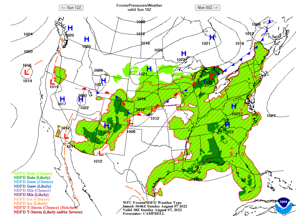
Hello everyone, there will be a stationary cold front will be coming through the plains and the Midwest to develop thunderstorms. Also, it possible for the cold front to bring storms at the four Corner states (Utah, Colorado, Arizona, New Mexico). In the Northwest and Northeast, it will suffer for above average temperatures to start a heat wave.

CONUS Temperature Pattern in 72 Hours
With the temperature anomaly will show a pattern of which states will receive cooler weather or having hotter temperatures than normal. In the next few days, the Northeast and Northwest will be hottest part of the country as some of the states will be above 5F to 12F degrees than their average temperatures. It is possible to see the outline of the cold front in the northern plains that will bring slightly cooler temperatures to the South in the next few days.
Midwest storms
In the morning, there will be widespread and heavy rainfall will be happening in the Midwest. The first round of storms will start to dissipate to lighter rain in the Ohio Valley in the afternoon or evening. The second round of storms will start to develop in Iowa and will grow stronger throughout the Midwest in the late afternoon and evening.
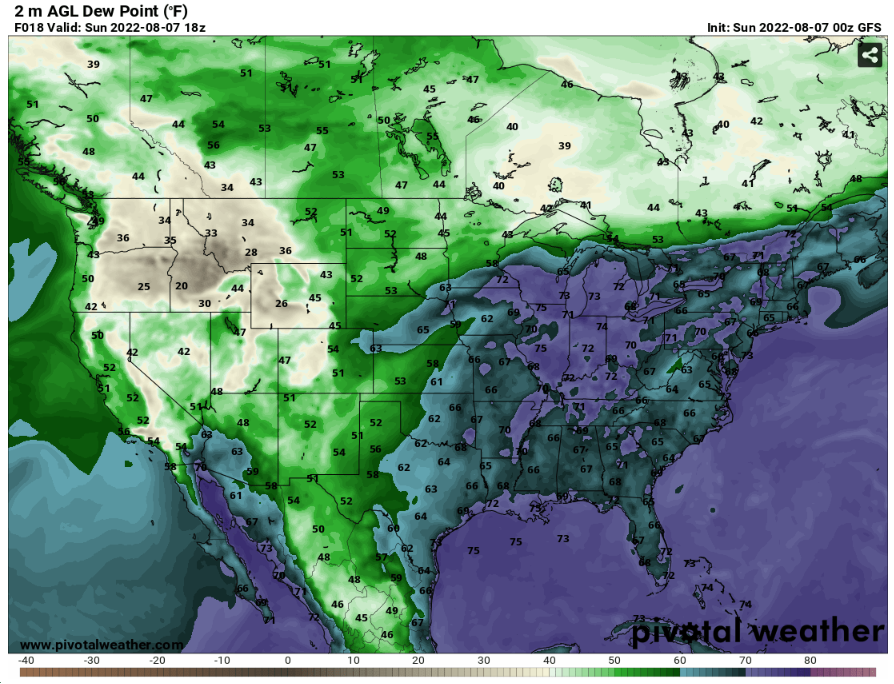
The highest dew points values in United States will be happening in the Midwest. This will be another factor on supporting the thunderstorms with the cold front coming through the Midwest.

United States Rainfall
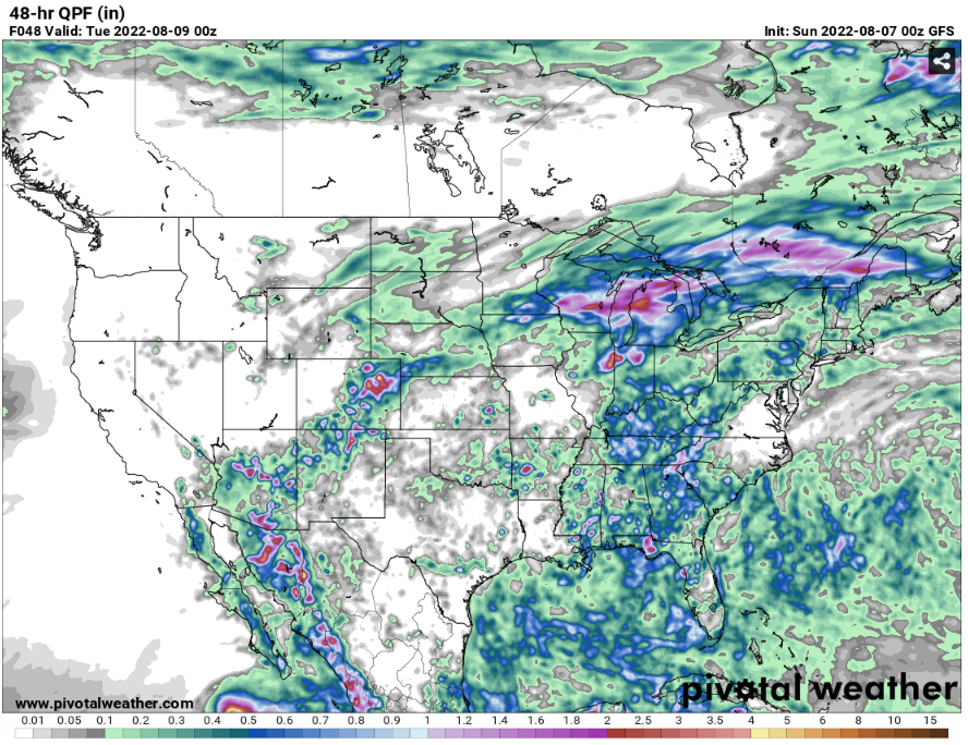
It seems like the heaviest rain fall will be happening in the Midwest because of multiple rounds of storms coming through there. The estimated rainfall in next 48 hours in the Midwest will be around .5 to 3 inches of rain. For the Northeast states will have some rain relief with their above average temperatures in the next few days. Meanwhile there will be a lack of rain in the Northwest that make their heat wave worse.


