The Karrie Meter isn’t often run in the Summer. In fact, up until last Friday, I’d never used it for the summer because whenever I ran the numbers for the spot forecasts, it never seemed to matter.
But, before this year, I’d never had access to the Karrie Meter Map.
Last Week
A quick step back in time. Last week, I ran the Karrie Meter just for fun and it kicked back some interesting numbers.
I’ve long known that the Karrie Meter doesn’t work in the summer because it is very CAPE-dependent.
So for fun, today, I ran it to see what it kicked back for the next 3 afternoons.
Not terrible. But also not terribly helpful. pic.twitter.com/Ck2xCE3RkY
— Nick Lilja (@NickLilja) May 22, 2020
In the tweet I dismissed the Karrie Meter because, as I note, I’ve known that it is pretty dependent on instability. So in the Summer when instability is naturally higher, the meter should have less value.
Except, it actually did have value.
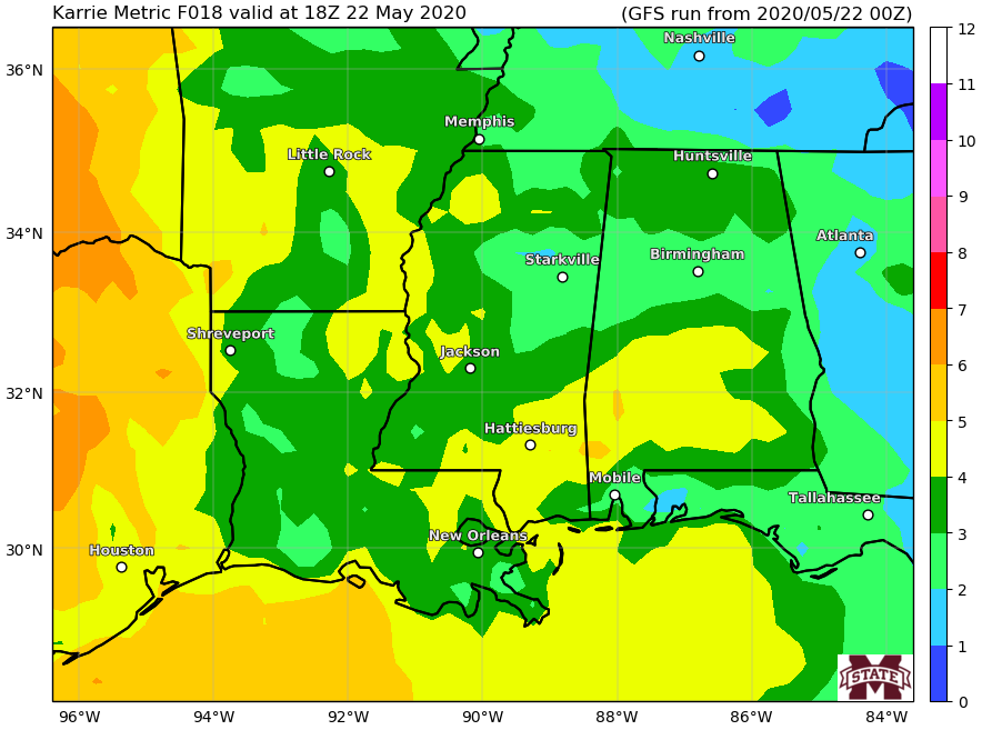
Here is the map for last Friday:

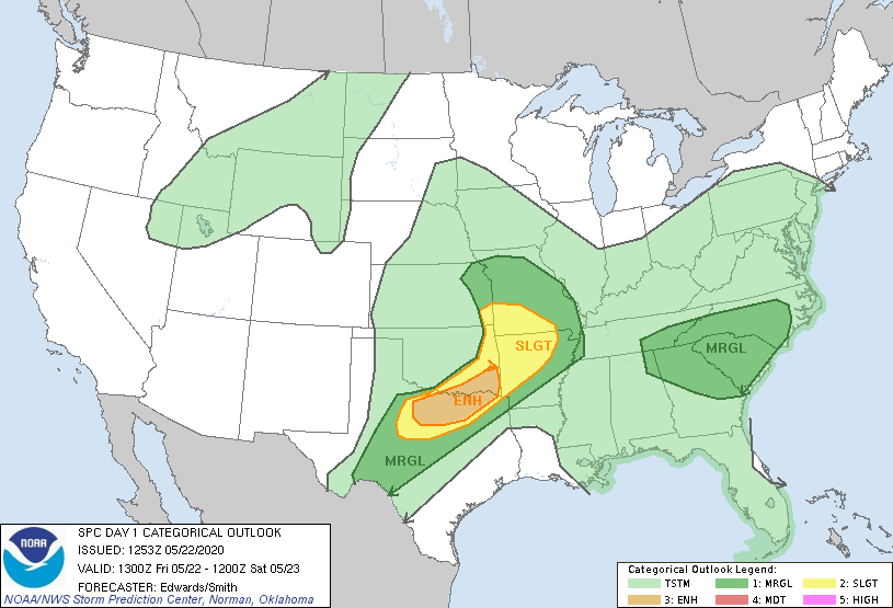
And here was the SPC outlook for severe weather:

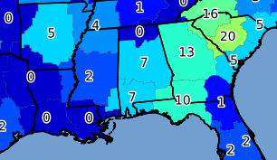
Here is a look at the number of severe thunderstorm warnings by NWS office area:

Tomorrow’s Forecast
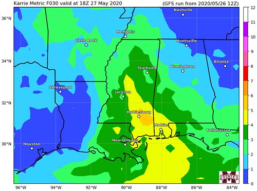
Looking ahead to tomorrow, the Karrie Meter is showing a potential for severe weather.

Main Threats
Right now it looks like heavy rain, gusty wind, frequent lightning, and small hail will be the main concerns. Wind gusts may briefly exceed 60mph. The tornado threat is very low. Like, really really low.
Timeline
It looks like storms will develop as early as 11am and linger around as late as 9pm.
We will see how this goes
The Karrie Meter was not designed for summer / late spring convection and storms. So, with complete transparency here, I’m not sure how well it will do with the forecast. It did well last week, but this is still in the “beta testing” phase, so to speak.

