Happy Saturday. I hope that you had a great week. Looking at the weather for the weekend, most of the region will stay warm and dry. Temperatures should reach the low to mid-90s for us tomorrow under primarily sunny skies. Things should stay dry through this weekend as high pressure continues to dominate the region for the next several days. As we move through next week, high pressure looks to primarily dominate the weather pattern, bringing primarily dry conditions and above-average temperatures. Things might be quiet for our region, but a potential system is forming in the Atlantic that could cause impacts to the region.
Warm weather ahead

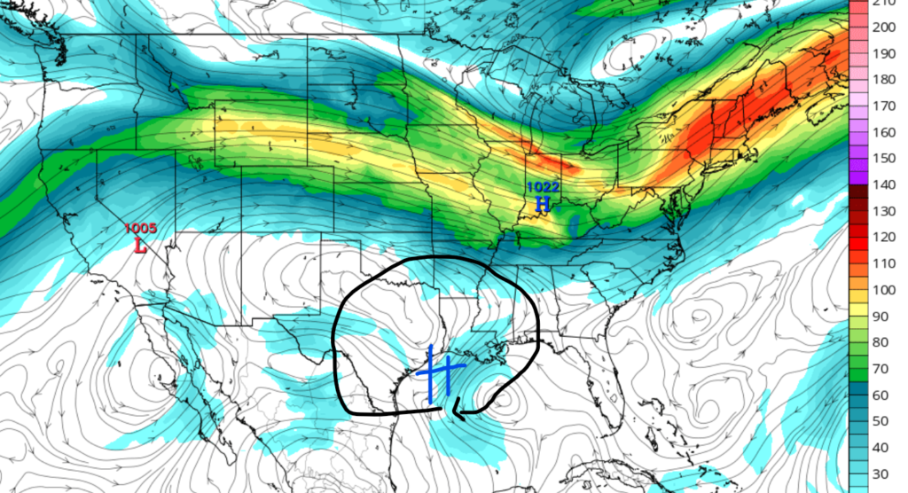
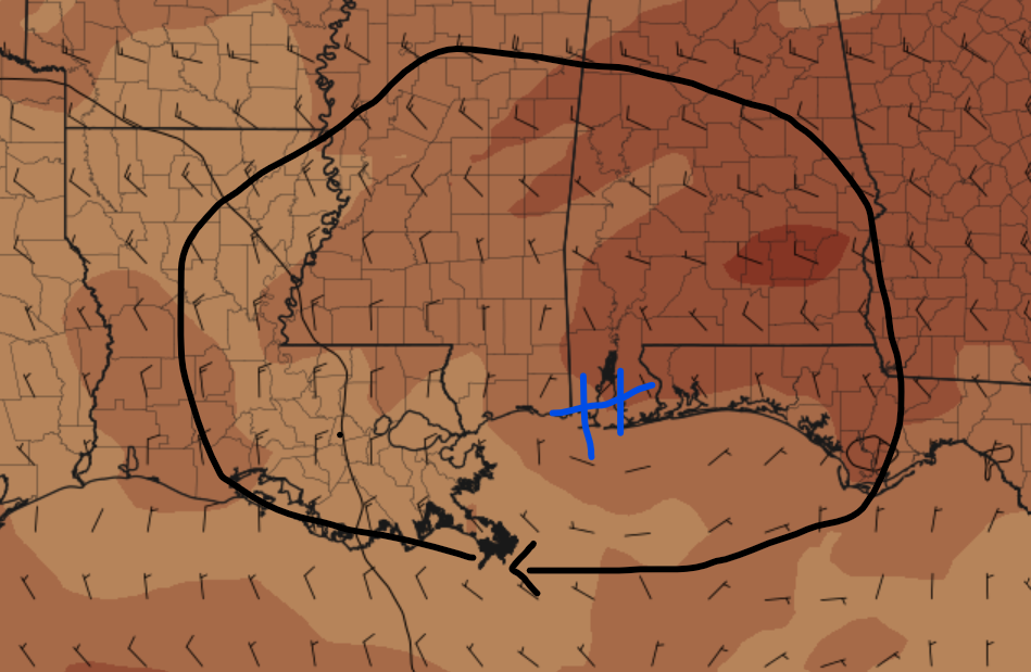
Things are expected to continue being hot, thanks to a stubborn ridge of high pressure located to our north. Although a cold front moved through the region last week, high pressure has reentered, allowing our temperatures to stay above average. High temperatures are expected to climb into the mid-90s by tomorrow afternoon. Tomorrow night’s lows are expected to drop only into the high 70s for areas inland, with low 80s expected for coastal regions
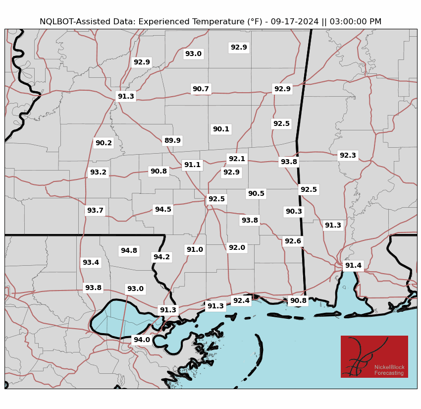
Not only will tomorrow bring hot air temperatures, but heat index values are expected to soar. The feel-like temperatures are expected to climb well over 100 degrees Fahrenheit for the whole region tonight. Luckily, in my time forecasting for this region, I have personally seen heat index values higher than this. This is thanks to a relatively dry lower atmosphere associated with the ridge of high pressure. Regardless of the heat index tomorrow, always take proper heat-related precautions if working or spending time outside on Sunday.
No rain in site

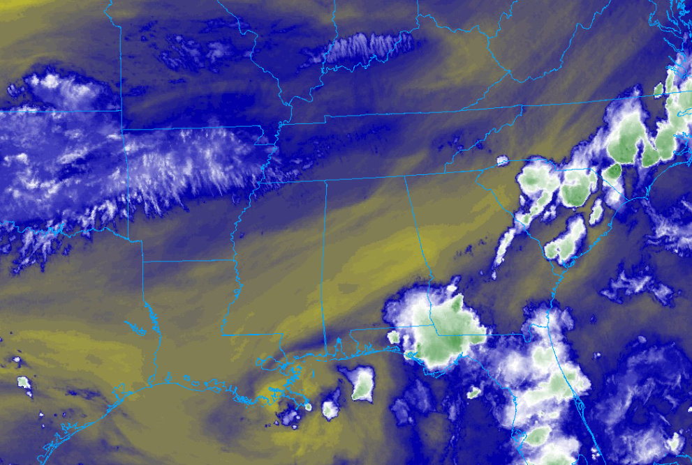
As a consequence of the ridge of high pressure that is set up in our region, little to no rainfall is expected for tomorrow. I don’t even expect cloudcover to develop tomorrow afternoon, which shows how dry it is. If you are a rain lover, I am sorry to say that I don’t expect any rainfall for the next several days, as this high-pressure system sits over the region.
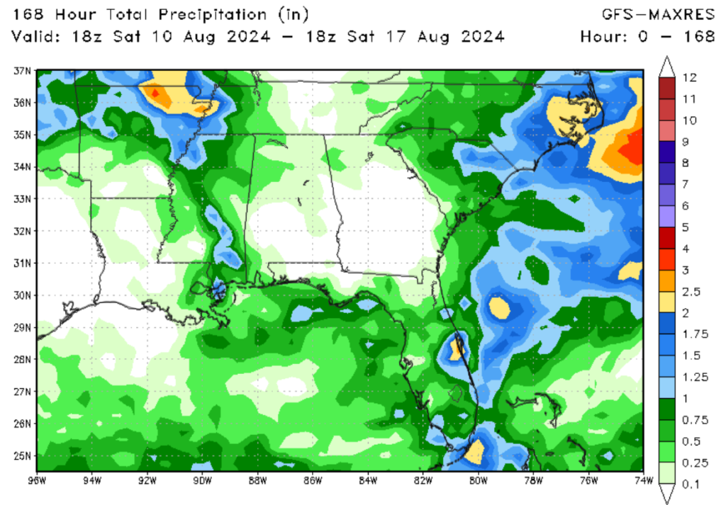
As we move through this next week, I do expect a bump in our rainfall chances as high pressure starts to weaken. Rainfall chances should start as early as Monday as more humid air moves into the region. These showers and thunderstorms are expected to be isolated in nature, so expect primarily dry conditions for the next several days.
A look ahead


Looking at our 6-10-day temperature and precipitation anomaly, most of the models show a similar trend: above-average temperatures and below-average precipitation. Although a mid-level trough is expected to move through the Eastern United States, I don’t see it digging far enough south to affect our weather that much, with the only exception being a slight increase in our rainfall chances. The good news of this setup is it helps keep tropical systems away from our region.
A quick look at the tropics

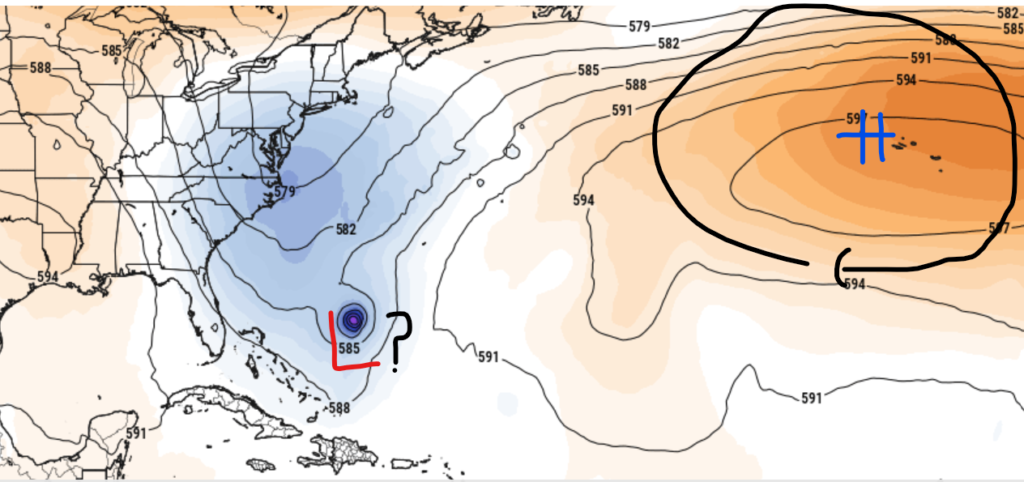
Looking at the tropics, we have a possible system brewing in the Tropical Atlantic. This system is coming off the heels of Debby, which caused major flooding for parts of the Southeast. Currently, a large area of showers and thunderstorms are quickly organizing near the Lesser Analies. Conductive environmental conditions appear to be in place as this system continues to organize over the next several days. I would not be surprized if we have a named tropical system by the middle of next week. I am expecting that this system will move in a west-northwest direction through the next several days. Please remember to keep a close eye on tropical weather outlooks posted on the site.


