I hope everyone’s weekend has started off great, despite the heat and humidity from storms. The same conditions are expected for tomorrow with the potential for a more organized system of storms along with high temperatures. We also have some news surrounding the tropics. Let’s get into it!
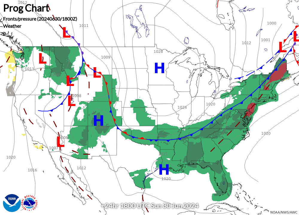
Looking at the front coming into the area along with plenty of moisture from the gulf, conditions are favorable for some more storms Sunday afternoon. This front is expected to move through the area and towards the coast through tomorrow and Monday.
North/northwesterly winds indicate this front moving into the area and will help storms develop. These winds will also bring a slight breeze moving at 5 mph along with partly cloudy skies, helping to cool us off a little bit before the rain ramps up the humidity.
SCATTERED STORMS EXPECTED OVER THE NEXT FEW DAYS
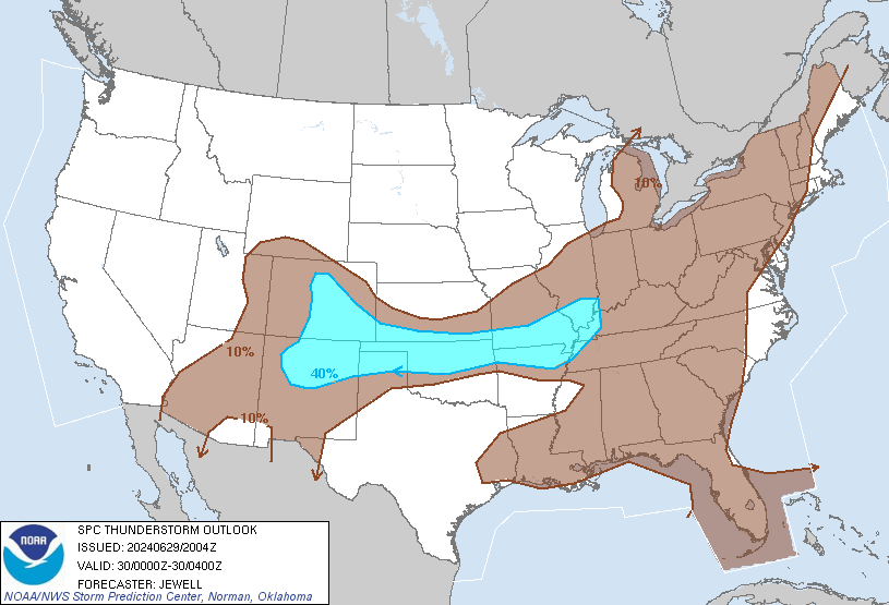
Thanks to the frontal system, plentiful moisture amounts, and daytime heating, our area is expected to get some more rain Sunday. The SPC’s thunderstorm outlook has our region in a 10% chance for thunderstorms. The heavier storms that form are expected to stay north of I-20, while areas to the south and along the coast may see more scattered storms as the afternoon progresses.
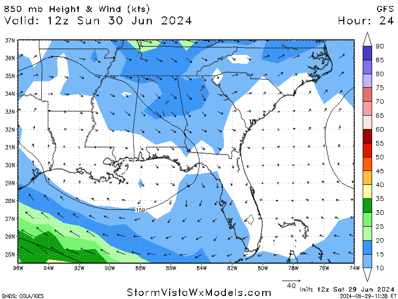
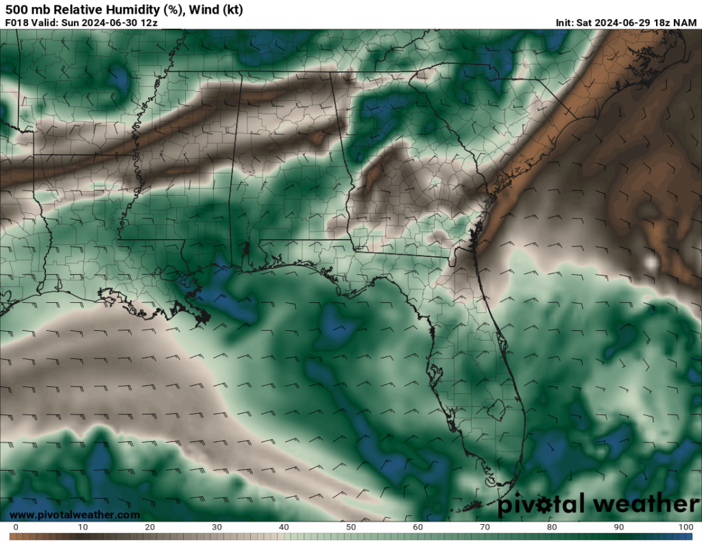
Existing moisture from the gulf and daytime heating will also play a role in these storms not only for tomorrow, but throughout the week. These two factors will help storm development, so pop-up showers are likely while these conditions continue.
EXCESSIVE HEAT WARNINGS IN PLACE
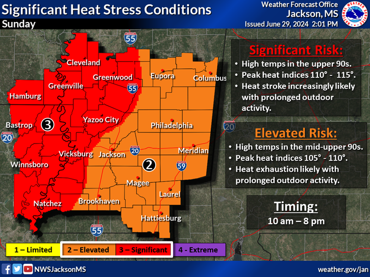

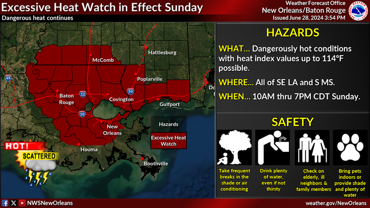
Heat advisories and excessive heat warnings cover our area for Sunday and will continue as conditions exist. The warnings are in our LA counties and along the Gulf Coast in MS, while areas to the north are stuck with heat advisories. No matter what hazard has been issued for your area, it is important to be aware of the heat and prepare properly by staying hydrated and taking breaks from working outside.
Highs for the area are expected to reach the low/mid 90s, while heat indices will be in the mid 100s. This trend will remain to start the week off with highs averaging in the mid 90s. High-pressure building in our area will help to keep these high temperatures consistent through the week, so continue to prepare for the heat during the day.
BRIEF TROPICAL UPDATE
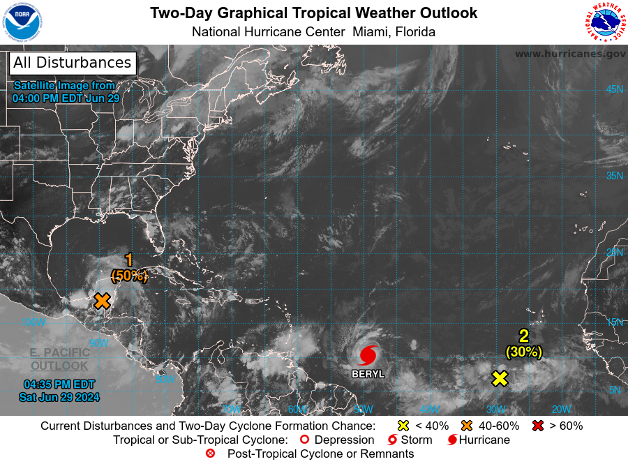
We officially have our second named storm of the season. Tropical Storm Beryl is turning heads as it is forecasted to become a major hurricane over the weekend. Models are in agreement that it could strengthen to Category 4 status late Sunday night or early Monday morning. We also have two other systems that are worth keeping our attention on over the next couple of days. For a more detailed forecast on these three systems and what they are expected to do, take a look at Seth’s Tropical Forecast for today!


