I hope everyone is having a great week so far! The intense heat is forecasted to move out as a cold front will move south into the area on Thursday, bringing a chance for storms with temperatures falling back down into the mid and upper 80s. This front will likely stall, allowing for more rain and slightly cooler temperatures this weekend.
UPCOMING RAIN CHANCES
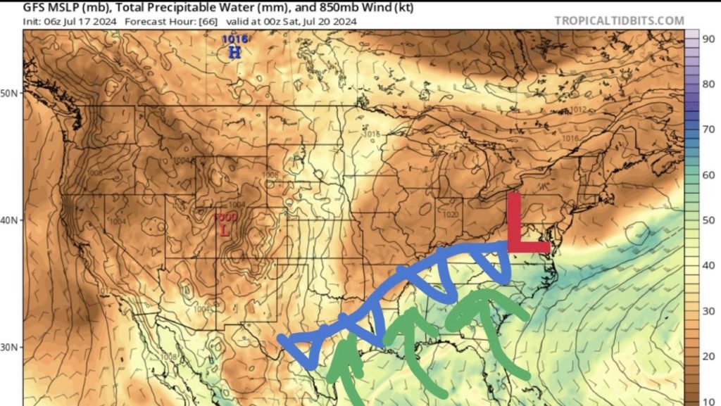
The pattern of extreme heat is coming to an end! The upper-level riding pattern we’ve been used to will break down as a broad trough dips southwards, dragging a cold front into our region on Thursday. Rain chances will be highest during the morning and evening hours as the front begins to stall.
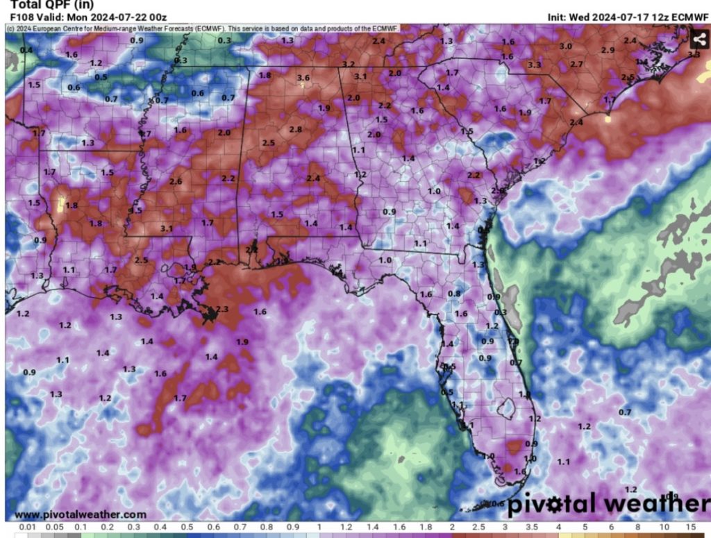
The forward speed of the front will begin to slow down as it enters our area, allowing for more time to advect moisture northward out of the Gulf of Mexico and increase rainfall totals for the rest of the week and into this weekend. On and off showers are thunderstorms will be possible from Thursday to Sunday, so even though it won’t be raining the entire time, confidence is high that the entire region will experience rain this weekend. Models are consistently showing 1-2″ of rain for our area through Sunday evening with a few places that could exceed that total.
With the greatest available moisture near the coast, areas near the Pine Belt region should monitor the potential for flash flooding. If you live in this area, familiarize yourself with better road options in case you have to avoid flooded roads this weekend.
Furthermore, lots of cloud cover is forecasted out ahead of this front due to the increase in moisture. With limited daytime heating, high temperatures will only get into the mid and upper 80s for most of the region.
MORE RAIN NEXT WEEK
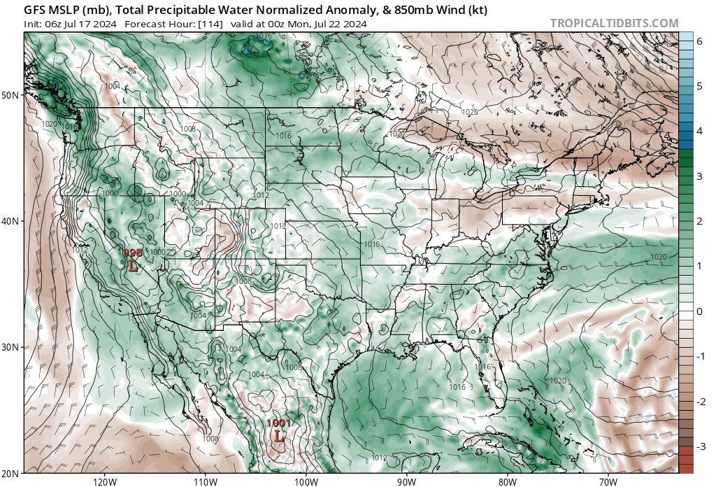
By the start of the new work week, the frontal boundary will continue to stall across the region, but it’ll be weaker by this time. What will help keep rain chances higher is an area of high pressure off to our east. Being on the west side of the aforementioned high, clockwise flow around it will allow moisture to advect northward. This is simply called return flow. Rain chances will be highest through Wednesday, then models begin to disagree on the pattern after that.
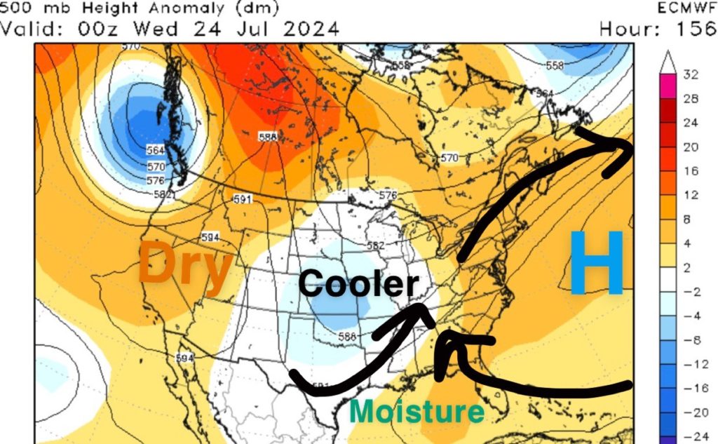
The first half of next week will feature similar temperatures due to more cloud cover and less of a ridging pattern. However, by Wednesday, low-level ridging will build in from the southeast, so temperatures are forecasted to warm back into the 90s with heat indices near 105F.
QUICK TROPICAL UPDATE
In the Atlantic Basin, things should continue to stay relatively quiet over the next week, so use this time to reach out if you have any questions regarding the tropics! I’ll have a cool graphic out tomorrow showing that the season is getting ready to ramp up next month.
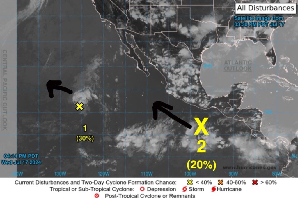
In the Pacific, we have two areas of interest highlighted by the National Hurricane Center (NHC).
The first area (1) has been slowly moving off to the west over the past few days. It has struggled to organize and develop with stronger upper-level shear nearby. While a tropical depression could still form over the next day or two, the window for further development is shortening due to stronger wind shear and cooler sea surface temperatures (<80F).
The second system (2) is a fairly new area of showers and thunderstorms in the eastern Pacific. There is the potential for a tropical depression or storm to form this weekend south of the coast of southern Mexico. Further development is possible early next week while it moves off to the west-northwest. The next name on the list is Bud.


