This feels like one of those weekends you’re going to have to plan out as on-and-off showers and thunderstorms will be likely Friday through Sunday. The cold front that has moved through today is forecasted to stall which is why we’ll be stuck in this wet pattern for the next few days. It will be nice having high temperatures in the mid to upper 80s, so be sure to go outside when there’s a break in the rain!
A RAINY WEEKEND:
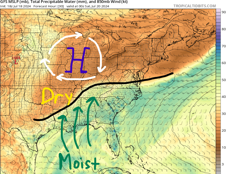
Many areas experienced rain today with our cold front slowing moving south towards the Gulf Coast. These rain showers should be taken seriously as New Orleans, LA dealt with flooding this afternoon. The forward speed of the front will continue to slow down as it pushes through our area, allowing for more time to advect moisture northward out of the Gulf of Mexico and increase rainfall totals for this weekend.
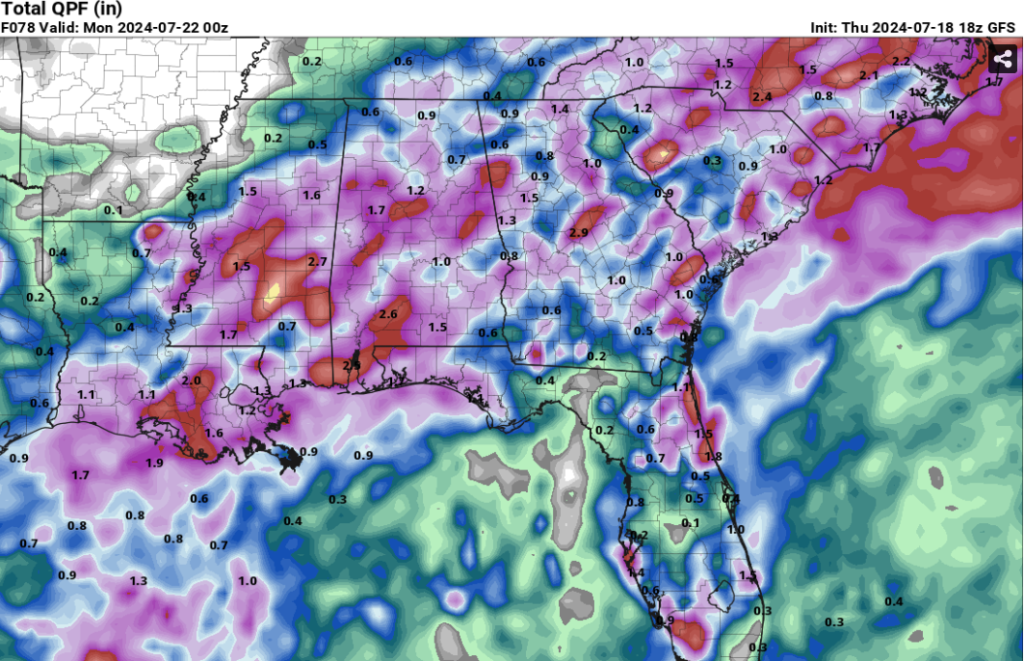
On and off showers are thunderstorms will be possible from Friday to Sunday, so even though it won’t be raining the entire time, confidence is high that the entire region will experience rain this weekend. Models consistently show 1-2″ of rain for most of our area through Sunday evening with a few places exceeding that total.
With the greatest available moisture near the coast, areas near the Pine Belt region should monitor the potential for flash flooding. Cities such as McComb, MS, Hammond, LA, Hattiesburg, MS, and Mobile, AL could exceed 2″ of rain. If you live near these areas, familiarize yourself with better road options in case you have to avoid flooded roads this weekend.
Furthermore, lots of cloud cover is forecasted ahead (south) of this front due to the increase in moisture. With limited daytime heating, high temperatures will only get into the mid and upper 80s for most of the region.
MORE RAIN TO START NEXT WEEK
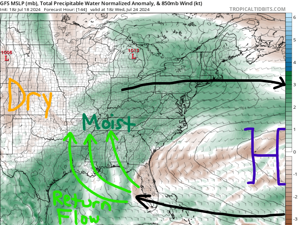
After multiple chances of rain this weekend, the start of next week looks to continue the rainy trend. The frontal boundary will continue to stall across the region, but it’ll be weaker by this time. What will help keep rain chances higher is an area of high pressure off to our east. Being on the west side of the aforementioned high, clockwise flow around it will allow moisture to advect northward. This is simply called return flow. Rain chances will be highest through Wednesday before models disagree more with synoptic scale features.
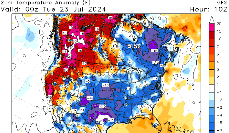
The first half of next week will feature similar temperatures due to more cloud cover and less of a ridging pattern. However, by Wednesday, low-level ridging will build in from the southeast, so temperatures are forecasted to warm back into the 90s with heat indices near 105F.
TROPICAL UPDATE
In the Atlantic Basin, we are quiet with no new areas highlighted by the National Hurricane Center (NHC). Please use this time to reach out to us if you have any questions, so you can be prepared for the rest of hurricane season.
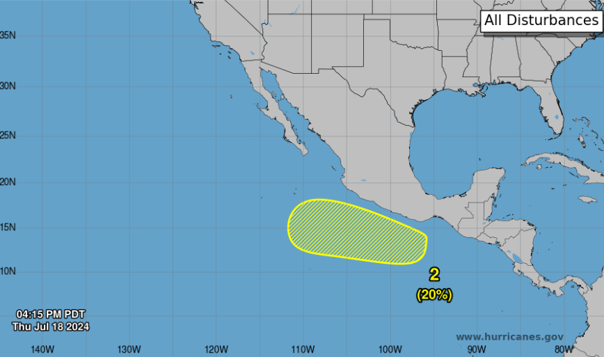
In the Pacific, we have one area of interest highlighted by the NHC.
A broad area of showers and thunderstorms is currently in the eastern Pacific. There is the potential for a tropical depression or storm to form next week south of the coast of southern Mexico. This area of interest (AOI) will be over open waters for the next seven days as it moves off to the west-northwest. The next name on the list is Bud.
I mentioned yesterday that I have a cool tropical graphic for the Atlantic Basin, but I will save that for tomorrow in my full tropical update!


