Good evening! I hope everyone had a great day, besides the excruciating heat of course. Some areas closer to the coast may get a tiny bit of relief with a chance for some storms tomorrow afternoon, but heat indices will still be higher than desired. However, a break in the ridge we are experiencing may come this weekend, bring the possibility for a front to slide into our area. Let’s talk about it!
FOR WEDNESDAY:

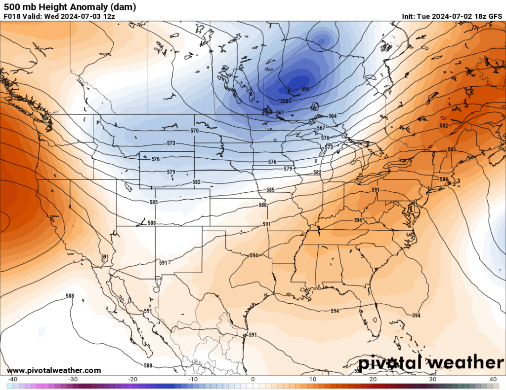
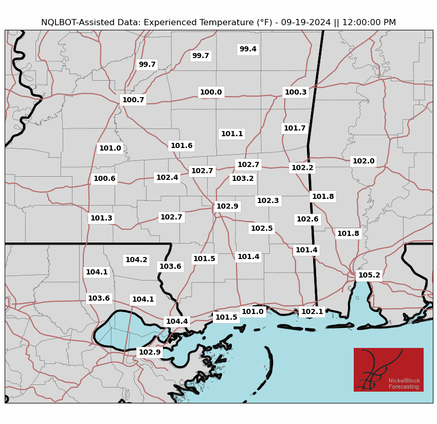
I know everyone is tired of hearing about it, but the high pressure ridge we are experiencing is still causing these high temps. Highs will be in the lower 90s with heat indices ranging from 100-110 throughout our area. This is thanks to the increased moisture we are seeing, which is causing the humidity we know and love (definitely joking). Heat advisories will most likley be issued for the majority of our area, with a couple excessive heat warnings thrown in the mix. Regardless, it will be hot yet again.
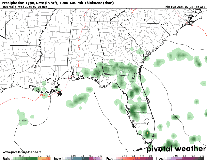
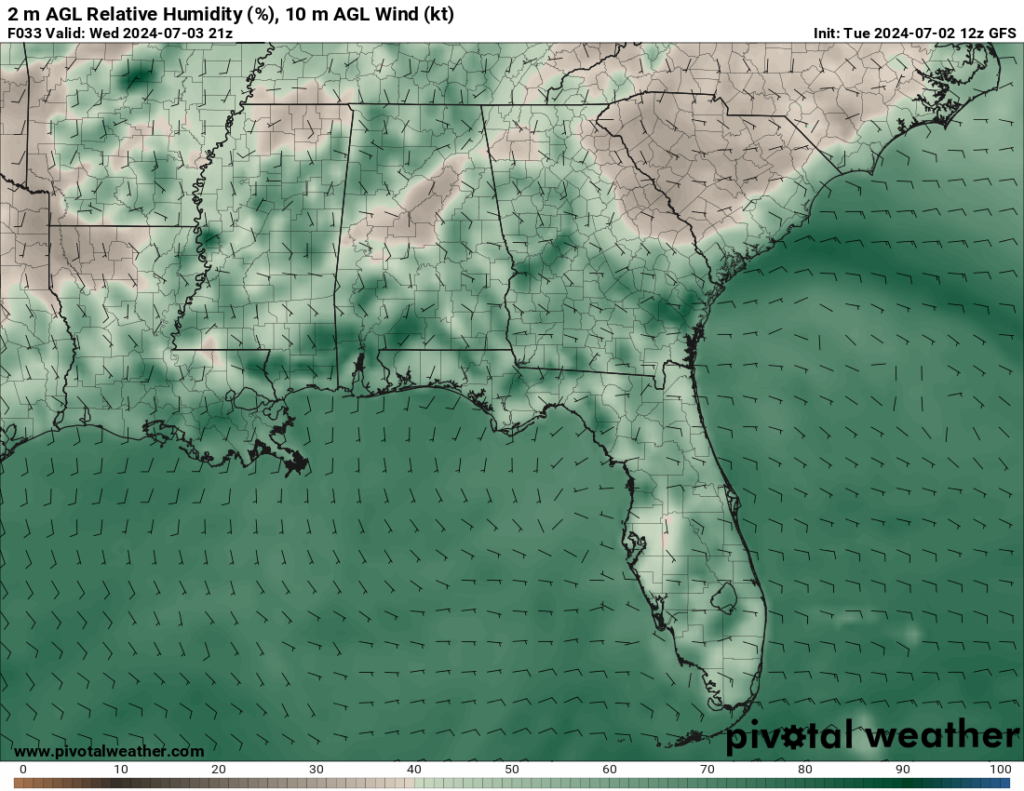
Despite this heat, the increased moisture is creating a higher chance for showers with each passing day. For Wednesday, showers or thunderstorms are likely for most of the area, with a bigger emphasis on locations closer to the coast. These showers further south are expected to start sometime in the morning and continue through the afternoon before fading out. There is a little less of a chance the further north you are, but that chance is not 0. Any showers possible will occur more in the afternoon hours, providing a brief cooldown from the heat.
LOOKING AHEAD:

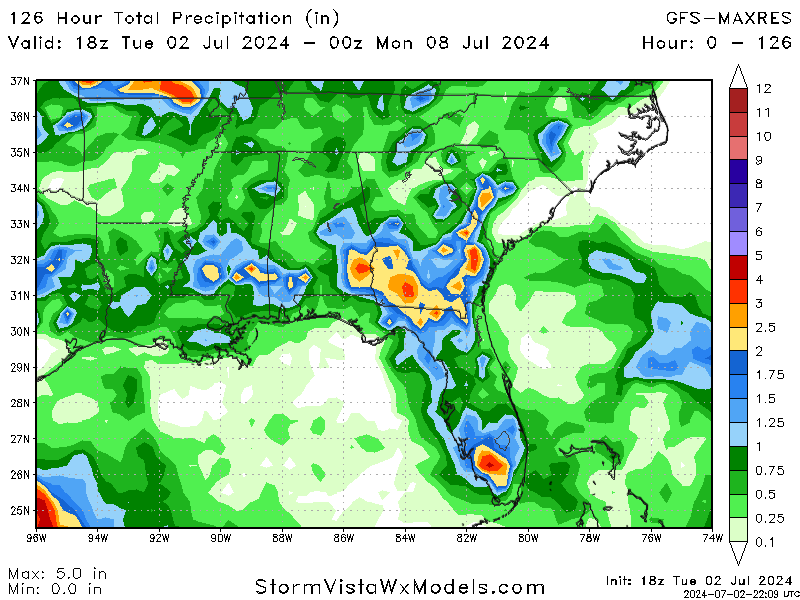
Taking a look at this weekend, we may finally have a change in weather patterns as the ridge we have been experiencing for the last little bit is forecasted to shift to the east, allowing the possibility for a front to slide into our area. While this front may bring the chance for more showers/thunderstorms, we will still be dealing with the same heat issues with high temps and potential heat advisories. The image on the left shower the accumulated precipitation from this evening through Sunday night, so we are likely to get some well needed rain this weekend.
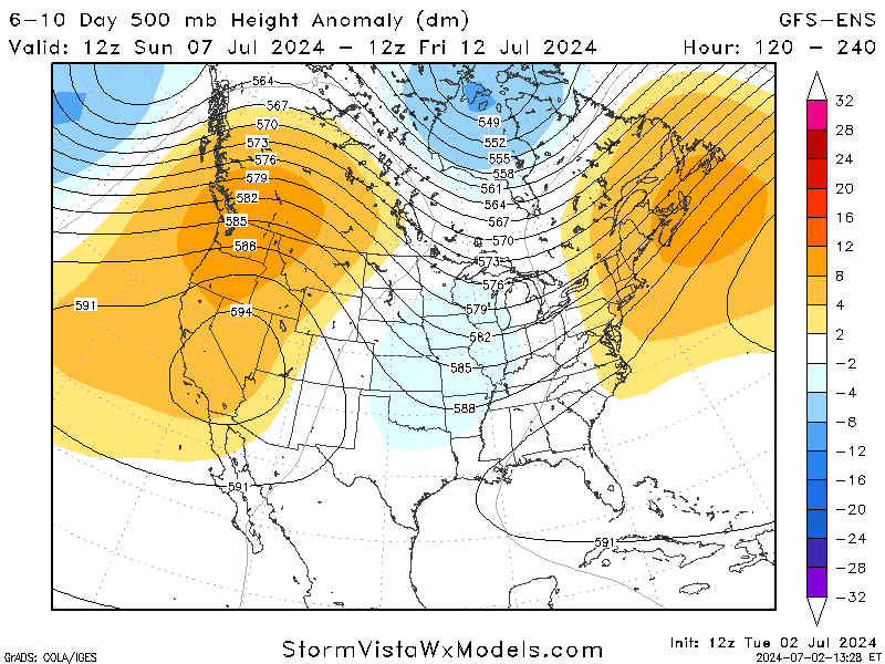
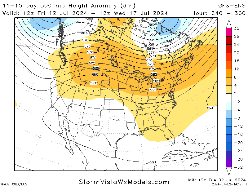
Jumping even further out, the GFS-ENS and other model are in agreement that a trough will move into the region as the ridge shifts eastward. This will allow for more storm chances early next week, but high temperatures are expected to remain. Looking towards the end of next week and the start of the next, a high-pressure ridge is expected to once again dominate the nation. While this is still a little ways out, its important to note this activity.
BRIEF TROPICAL UPDATE:

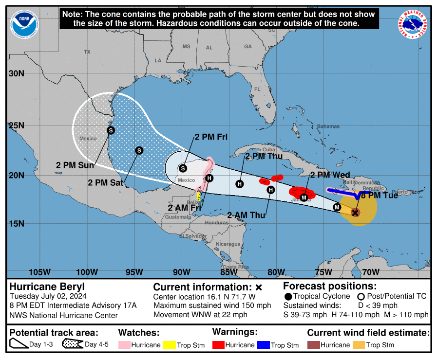
I know everyone is wondering what is happening with Hurricane Beryl. It has weakened down to a Category 4 storm after its record breaking intensification to Category 5 status last night. While it shows signs of weakening thanks to incoming wind shear, this is still a very dangerous situation for areas like Jamaica and the Cayman Islands who are currently under Hurricane warnings. Beryl is expected to almost directly hit Jamaica Wednesday afternoon, before hitting the Cayman Islands early Thursday morning.
Where is Beryl supposed to end up and will it affect the US? The answer to that question is still up for debate, and will depend on where Beryl decides to make landfall on the Yucatan Peninsula. A landfall further south on the peninsula would weaken the storm significantly and narrow the window for US impact. However, if Beryl decides to shift slightly north, this would reduce the weakening effect the peninsula would have a open the window for US impact further.
While it is still to early to fully predict, models expect Beryl to end up making landfall in Mexico or the southern tip of Texas. We will keep you updated as this storm continues to head towards the Gulf. For a more detailed coverage of Hurricane Beryl, take a look at Mason’s Tropical Forecast for today!
Taking a brief look at the other area in the tropics, Invest 96L is showing limited shower and thunderstorm activity. The environment is only slightly favorable for this system to develop with a 10 percent chance as it moves westward at 15 to 20 mph across the western tropical Atlantic and eastern Caribbean Sea. Whether or not it develops, parts of the Lesser Antilles may experience strong winds and heavy rain on Wednesday.


