Happy Tuesday! The next few days look similar to last week, with high chances for rain as the day progresses and high heat indices from increased humidity. These showers/storms are still more scattered, especially the pop-up storms, but will move slower. This may lead to flooding in some areas, especially in the South, where the chances of rain are much higher than further inland.
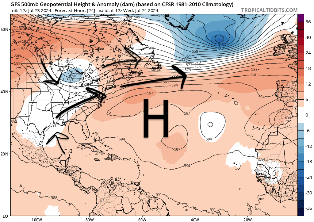
However, we may see a change in the weather pattern next week. Rain chances are expected to decrease as a ridge enters our region. Pop-up showers/storms are still likely with daytime heating and increased moisture, but they won’t be as consistent as the past few days. Let’s get into it!
CONTINUED CHANCE FOR RAIN:
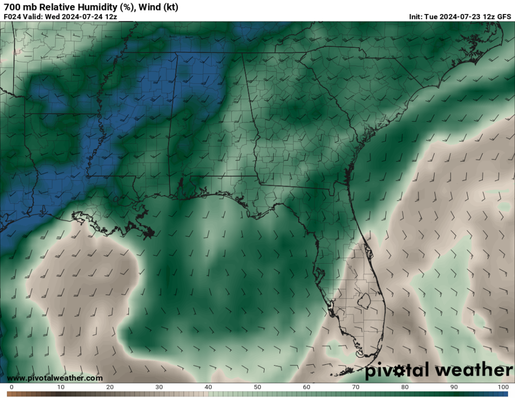
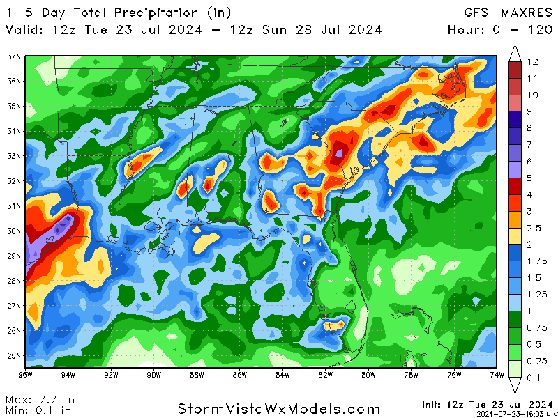
The showers/storms we have seen the past week are expected to stick around for the rest of the week. This is thanks to the low-pressure trough over our area and the moisture coming in from the Gulf to aid in storm development. While none of these storms are expected to be severe, some could produce strong winds and heavy downpours of rain, which will affect any outdoor plans.
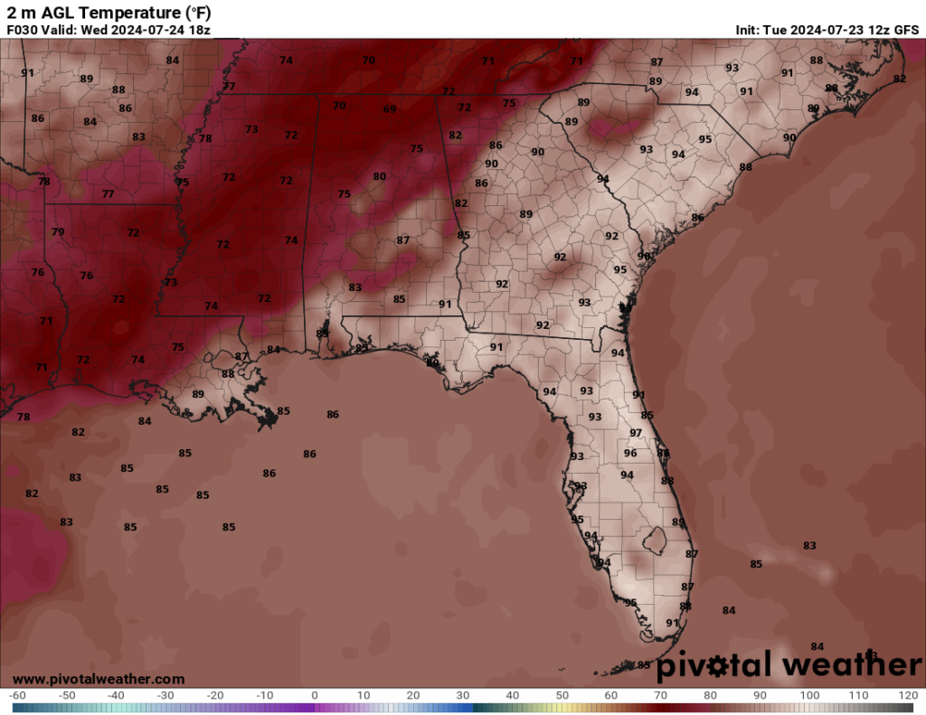
The timing of these showers/storms will vary, but most will occur in the afternoon and evening hours, thanks to daytime heating helping storm development. The highs for tomorrow and the rest of the week are expected to stay in the 80s, with some areas staying in the upper 70s tomorrow.

LOOKING FURTHER OUT:
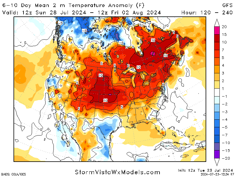
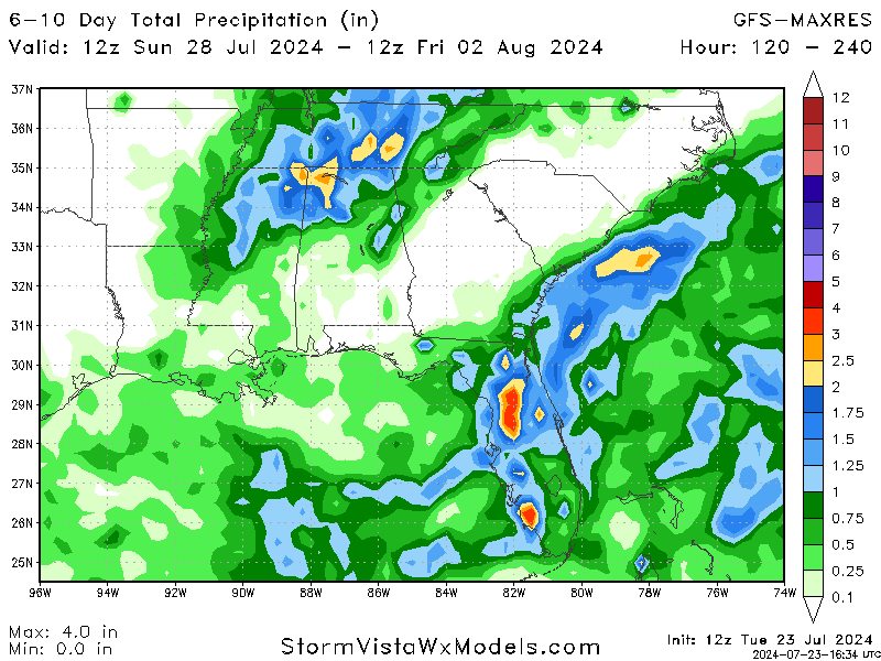
At the start of next week, models agree with a northern shift in the majority of rainfall from our area. While this does not mean the rain is completely gone, the consistency we have seen the past week will lessen and give the ground a chance to dry out more between showers.
Along with the rain shift, temperatures are expected to heat up slightly. This is expected as we get deeper into summer, but it is still not as hot as we saw in June. The moisture inflow from the Gulf will aid in higher heat indices for our region next week, so be prepared appropriately for the heat and rain as we head into next week.
Here is a quick 15-day forecast for the Hattiesburg area. Note that the temperatures for the last couple of days on the forecast may be colder than anticipated. Given the time of year and systems at play, we should expect our highs to be more on the upper 80s side.

BRIEF TROPICAL UPDATE:
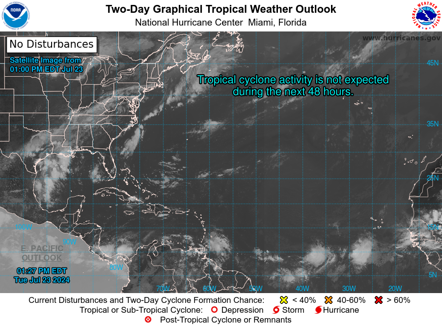
The Atlantic basin is still quiet, with no areas of interest noted by the National Hurricane Center. A dominating high-pressure system over the central Atlantic is helping inhibit any formation and allowing for an inflow of moisture from the Gulf to the southeast.
While there are currently no systems to monitor, we will keep you updated with any news regarding the tropics as the season continues.


