I hope everyone has had an amazing start to their week! The pattern has been pretty similar these past couple of days and it’ll continue to be like this the rest of the week. Chances for showers and thunderstorms will be possible in the afternoon and evening, but it won’t be a complete washout.
A slight pattern change is likely this weekend with more sunshine and a slight warmup in temperatures. We can’t rule out an afternoon shower or thunderstorm, so continue to carry the umbrella with you over the next few days.
Afternoon Rain Chances
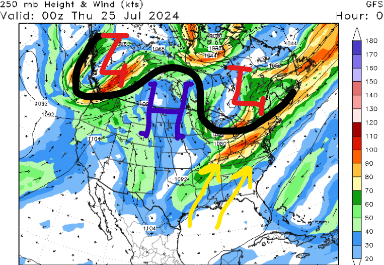

Currently, our area is under southwesterly flow as an upper-level trough is to our north, allowing for moisture advection out of the Gulf of Mexico. With little change expected in this pattern over the next few days, we will continue to have the chance for afternoon showers and thunderstorms.
For tomorrow, most of the region will warm up into the upper 80s before the clouds and rain arrive during the late afternoon and evening hours. Downpours could be heavy at times, especially south of Hwy 84 near cities like McComb, MS and Baton Rouge, LA, so be extra careful on the roads tomorrow afternoon and evening. Most locations should stay below 1″ of rain tomorrow, but there is a minor flash flood threat if some areas do get caught in those heavier bands.
On Friday, southwesterly flow will continue across the region, giving us another chance for afternoon storms. Similar to Thursday, the locations that’ll have the best chance to pick up around 1″ of rain are southeast Louisiana and southern Mississippi. Remember to avoid flooded roads and get all of your outdoor activities done by the afternoon.
Gradual Warmup By Next Week
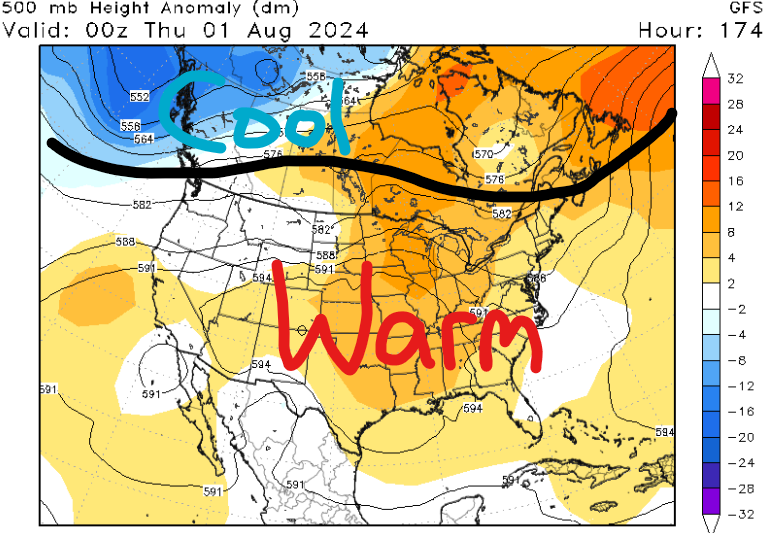
Finally, later this weekend, a pattern change will begin to take place as guidance shows an area of high pressure building over the southeast CONUS. High pressure allows for a lot of sinking air at the surface, so more sunshine is forecasted during the morning and early afternoon on Sunday, Monday, and Tuesday. Even with less pronounced moisture advection, we are still tracking rain chances in the afternoon because of daytime heating.
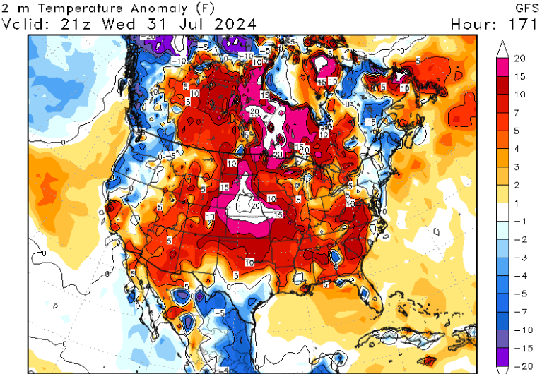
With high temperatures in the low to mid 90s by the start of next week along with moist conditions, heat indices could be greater than 105 F in some locations. Hot conditions look to continue for much of next week with highs in the low to mid 90s. Remember to hydrate and take frequent breaks if you’re outside during the afternoon hours.
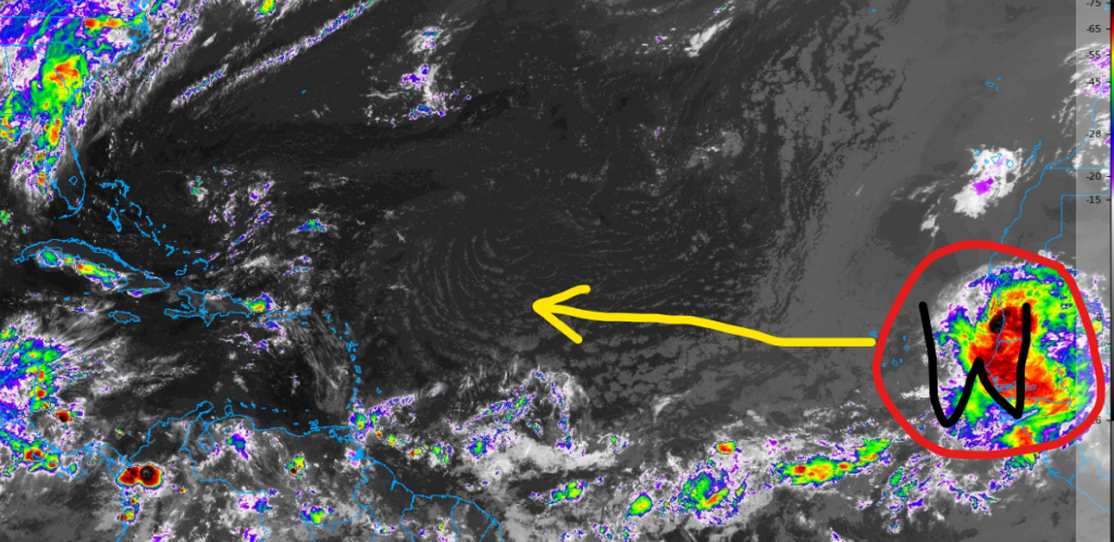
Quick Tropical Update
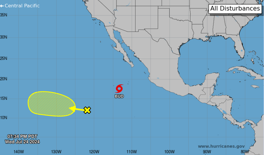
In the eastern Pacific, we have Tropical Storm Bud south of Baja California. Luckily, this storm will continue to fizzle out over the next few days due to stronger wind shear and slightly cooler sea surface temperatures.
The area of interest (AOI) to the southwest of Bud only has a 10% of formation over the next seven days. Rain chances may increase slightly in Hawaii by next week if this disorganized area of showers and thunderstorms doesn’t completely fall apart by the end of the week.
In the Atlantic Basin, we are nearing the time of the year when we watch strong waves come off the west coast of Africa and the European model has hinted at this area circled in red developing by the middle of next week. I have a feeling the NHC will begin to include this wave in their discussion posts by this weekend or early next week as it moves off to the west-northwest.


