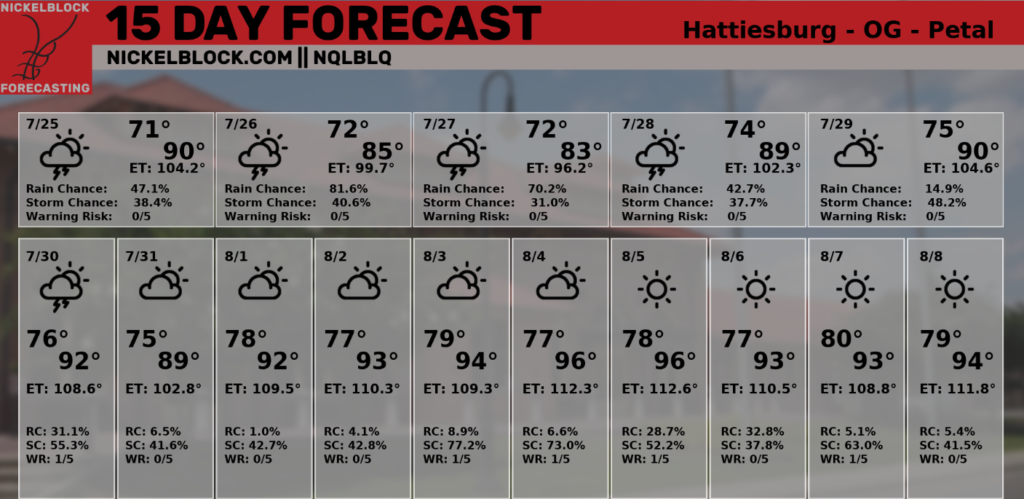
Good afternoon, everyone! Areas near Hattiesburg, MS, Mobile, AL, and Hammond, LA have been dealing with showers and thunderstorms that have produced minor flooding in some areas. Rain should continue to diminish overnight with only a few light showers possible. The forecast will be very similar over the next few days until the heat and sunshine return for most of the region beginning next week.
Rain Chances This Weekend
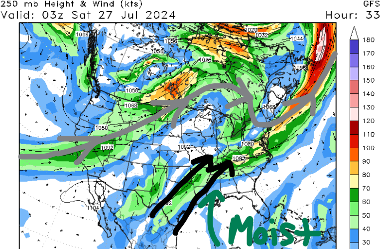
Moisture is continuing to advect into our region due to southwesterly flow as an upper-level trough is to our north. Due to the increase in cloud cover and the lack of ridging, high temperatures have stayed in the 80s for some of us. If it is sunny where you’re at, chances are it’s still pretty humid with dew points in the 70s for most of us.
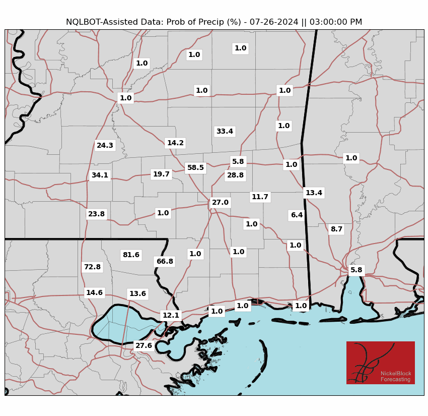
For tomorrow, most of the region will warm up into the upper 80s before the clouds and rain arrive during the late afternoon and evening hours. Downpours could be heavy at times, especially south of Hwy 84 near cities like McComb, MS and Baton Rouge, LA, so be extra careful on the roads tomorrow afternoon and evening. Areas around I-10 have the best chance of seeing rainfall greater than 0.5″. Most locations should stay below 1″ of rain tomorrow, but there is a minor flash flood threat if some areas do get caught in those heavier bands.
On Saturday and Sunday, southwesterly flow will continue across the region, giving us another chance for afternoon storms. Similar to Friday, the locations that’ll have the best chance to pick up around 1″ of rain are southeast Louisiana, southern Mississippi, and southern Alabama. Remember to avoid flooded roads and finish all your outdoor activities by the afternoon.
Heat Returns By Next Week
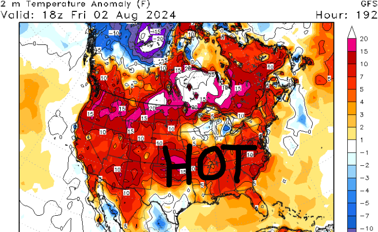
Finally, by early next week, a pattern change will begin to take place as guidance shows an area of high pressure building over the southeast CONUS. High pressure allows for a lot of sinking air at the surface, so more sunshine is forecasted during the morning and early afternoon on Monday and Tuesday.
Even with less pronounced moisture advection, we are still tracking rain chances in the afternoon because of daytime heating. Luckily, it won’t be a complete washout as models are showing little to no accumulation for most of the region.
With high temperatures in the low to mid 90s by the start of next week along with moist conditions, heat indices could be greater than 105 F in some locations. Hot conditions look to continue for much of next week with highs in the low to mid 90s. Remember to hydrate and take frequent breaks if you’re outside during the afternoon hours.
Tropical Update
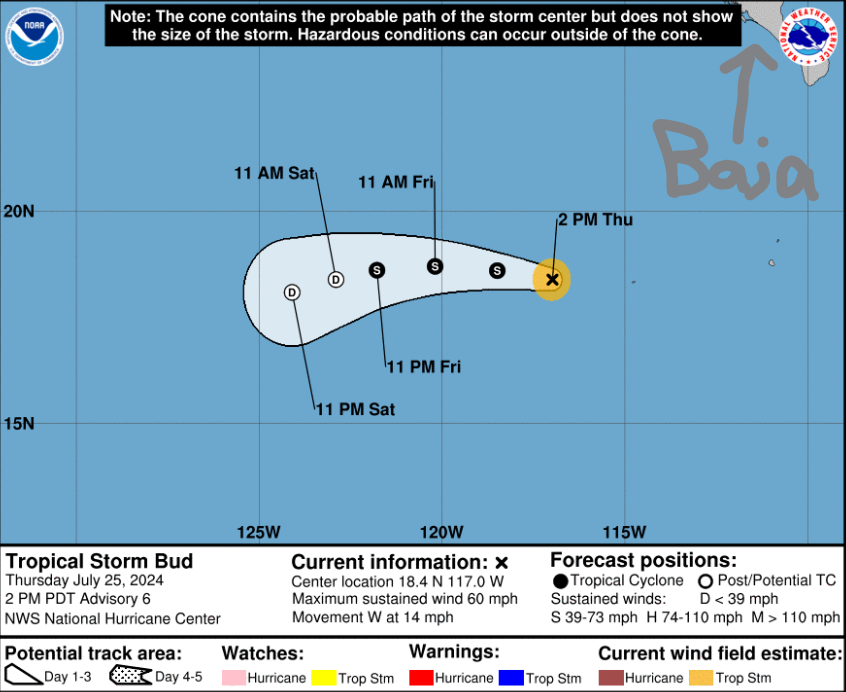
In the eastern Pacific, we have Tropical Storm Bud south of Baja California with winds up to 60 mph. Luckily, this storm will continue to fizzle out over the next few days due to stronger wind shear and slightly cooler sea surface temperatures.
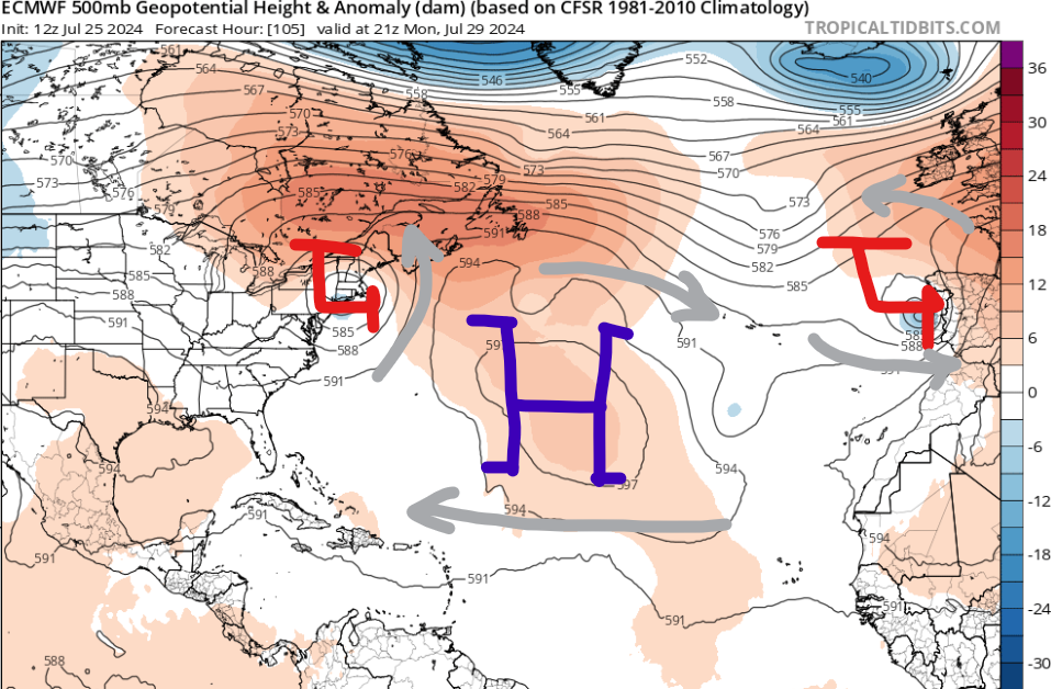
In the Atlantic Basin, we are nearing the time of the year when we watch strong waves come off the west coast of Africa and the European model has hinted at an area developing by the middle of next week. The GFS hasn’t hopped on the train yet, so there is still a lot of uncertainty with guidance.
General steering patterns will take anything off to the west-northwest towards the Leeward Islands. I’ll have more details on this in my tropical outlook tomorrow evening.


