Happy Monday! I hope everyone had a great weekend. The cold front, which has caused daily rain for the past week, has finally made its way out of our area. This departure brings longer dry periods, giving the ground time to dry before the next round of showers/storms. However, the heat will return thanks to a high-pressure system building over the southeast and will continue growing until it dominates most of the country. Highs will jump back into the upper 90s by mid-week, with heat indices reaching well into the triple digits. Let’s get into it!

With the cold front out of the equation, a high-pressure system has plenty of room to make itself comfy over the southeast as it expands over other regions. This system will play a crucial role in bringing back the dreaded extreme heat to close out the month and lowering the chances of rain across the region.
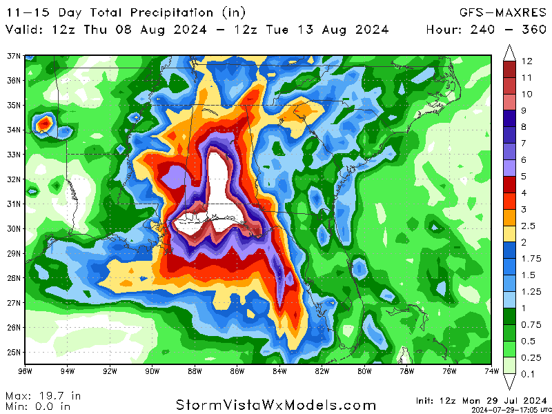
Looking at the surface analysis for 48 hours out, it is safe to say that consistent rain, like we have seen the past week, is gone for now. While scattered showers/storms are likely to develop thanks to daytime heating and moisture from the Gulf, the overall chances have decreased.
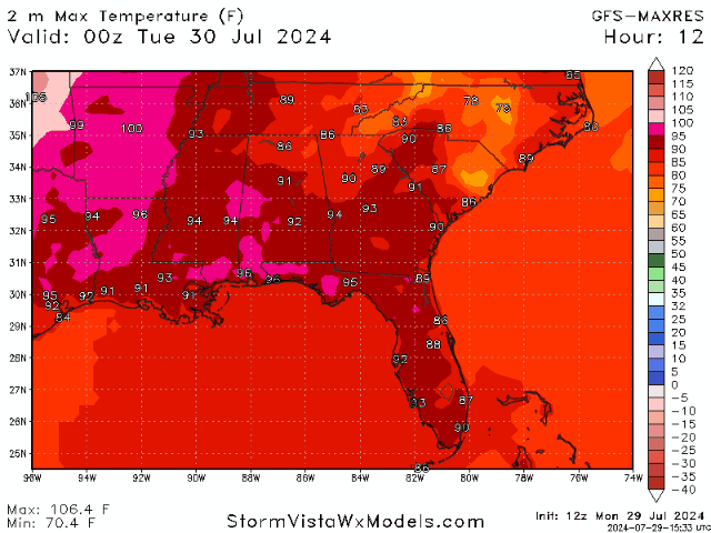
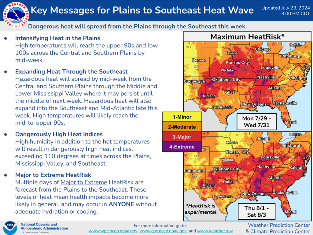
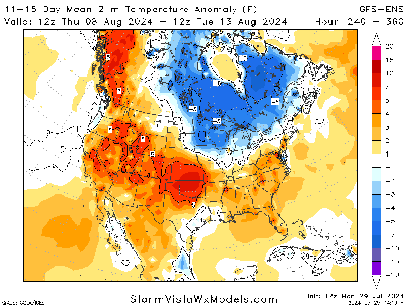
Jumping into the main topic at hand, models agree that another heat wave is making its way toward our area. The timing of this wave varies, with most saying it will start to ramp up mid-to-late this week. The WPC has released graphics regarding the upcoming heatwave, warning people to be aware of their bodies and to stay hydrated in temperatures like this.
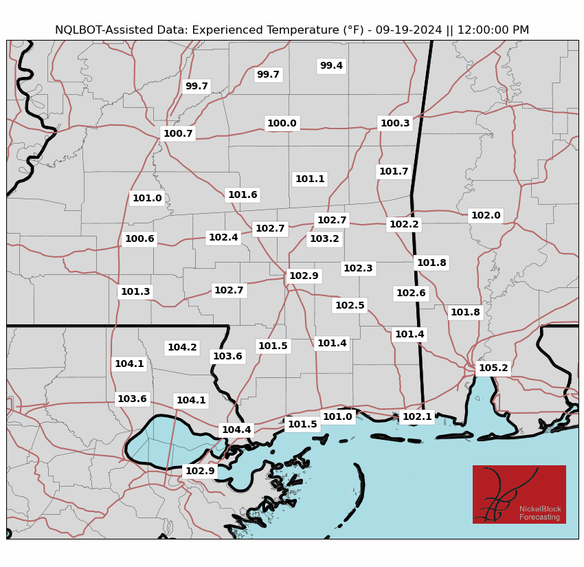
While actual temperatures are below 100, the heat indices are slowly creeping into the triple digits again. Factors like humidity, sunlight, wind, and others contribute to the “experienced” temperature, which shows what your body is feeling. The humidity is expected to be high, adding to these high temperatures. Please stay safe and hydrated over this week.
LOOKING FURTHER AHEAD:
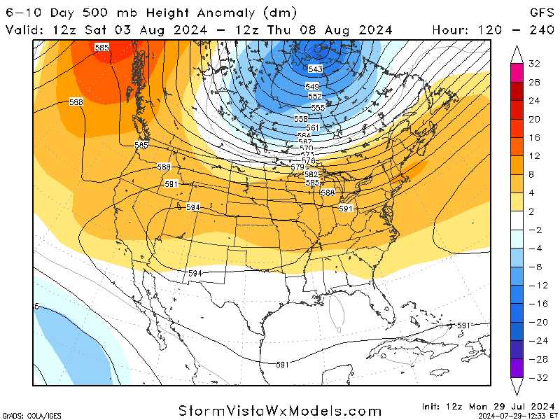
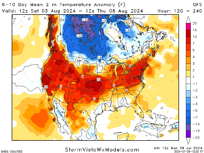
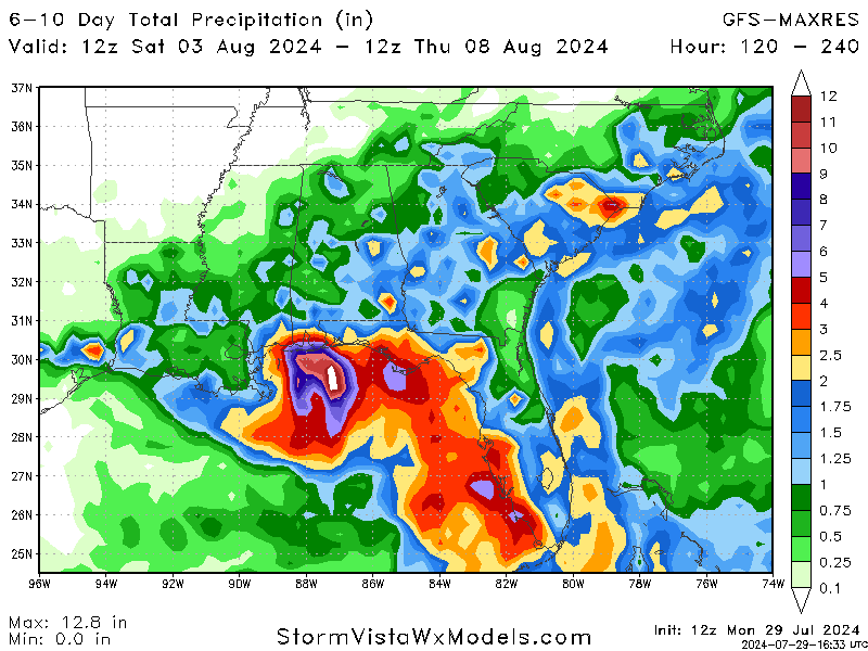
Jumping to the start of next week, the pattern for our area will remain similar to this week. A dominating high-pressure system is helping to keep it nice and warm, along with some rain across the area, emphasizing the coastal regions. Highs are expected to cool off slightly (not enough to tell with humidity) before spiking up again.
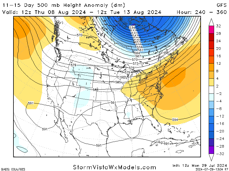
Looking even further to the end of next week, the high-pressure system is expected to shift eastward. This will allow a low-pressure system to come in and help cool us off. This doesn’t mean a pass from the rain, with the constant worry of pop-up storms. This is still a way out, but I wanted to go ahead and mention how the weather is because some people may not even notice.
BRIEF TROPICAL UPDATE:
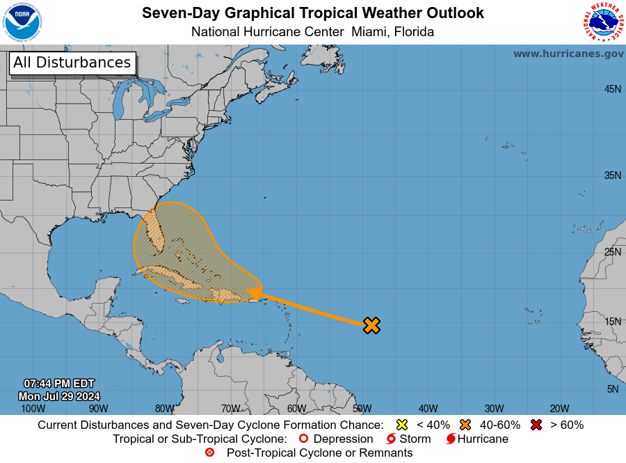
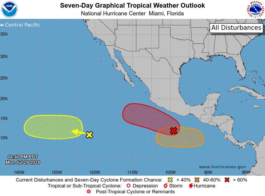
After a short break, we finally have an area to discuss in the Atlantic, while the Pacific is heating up very fast and producing areas of interest.
The spot in the Atlantic (orange) is a weather disturbance expected to interact with a tropical wave in the next day or two. Conditions are likely to become favorable for this disturbance to develop gradually, and it could become a tropical depression by the end of the week when it is near the Greater Antilles or the Bahamas. Over the next seven days, this area has been given a 50% chance of development.
The spots in the Pacific are all unique. The first spot (red) is an area of low pressure a few hundred miles south of the southern coast of Mexico that’s becoming more organized. Conditions are right for it to develop further, and it could become a tropical depression in the next couple of days. It’s expected to move west to west-northwest at 10-15 mph, staying offshore from southern Mexico.
The second spot (orange) is a low-pressure area expected to form offshore Central America and southern Mexico later this week. Conditions are favorable for gradual development, and it could become a tropical depression by the end of the week or this weekend.
The last spot (yellow) is a tropical wave far southwest of Baja California’s southern tip, causing disorganized showers and thunderstorms. This system might develop gradually in the middle to the latter part of the week as it moves west to west-north


