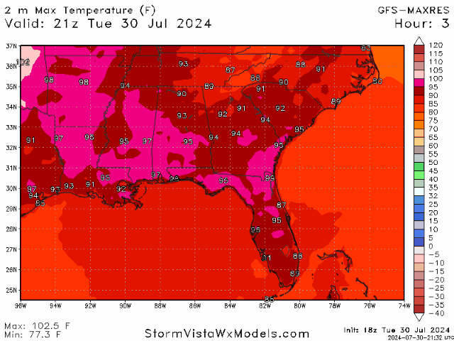
Happy Tuesday! It was a hot one today, and I hate to be the bearer of bad news… but the heat will only get worse from here for the rest of the week. The high-pressure system is locking in the extreme heat that the region is experiencing. Excessive heat warnings and heat advisories are likely to be issued for the remainder of the week. The trend will remain constant as we move towards the weekend, with highs in the upper 90s and high humidity amounts, causing heat indices to range in the 100s and even reaching the 110s. Let’s get into it!
With the high-pressure system here to stay through the rest of the work week, it is safe to assume that it will remain dry and super hot over the next few days. As this high pressure continues to expand into the Great Plains, it will weaken during the weekend and allow for a weak front to bring a chance for rain on Sunday. Other than that, any rain clouds that form are most likely pop-up storms from the daytime heating and moisture coming in from the Gulf
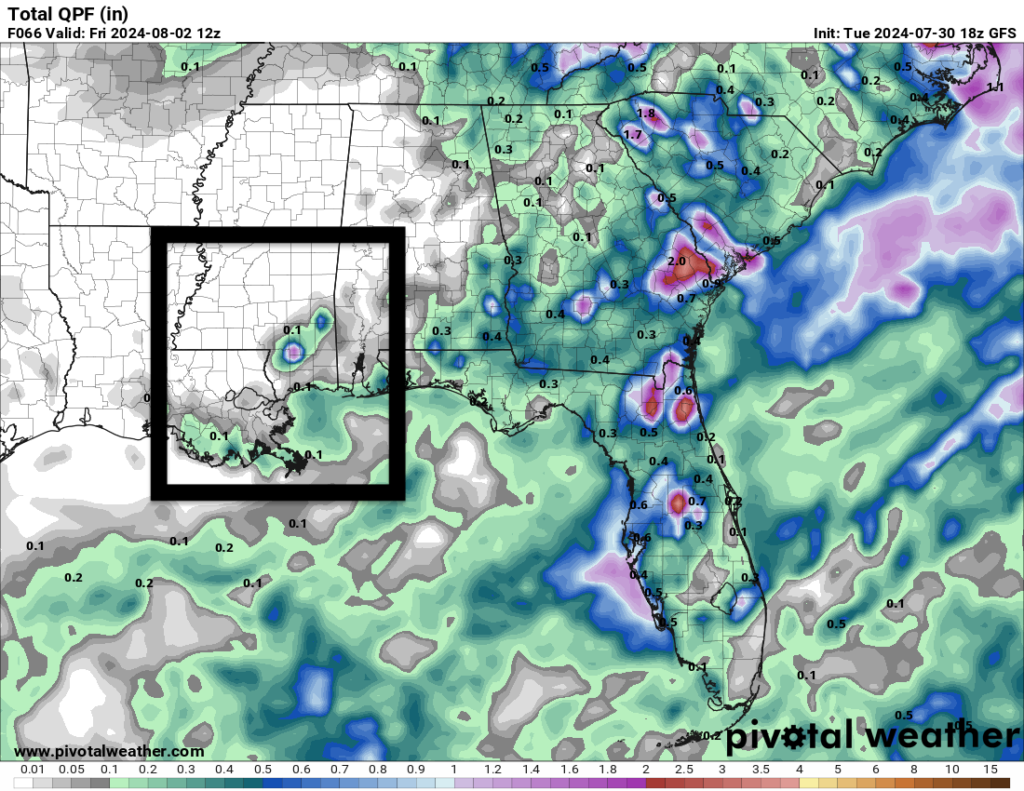
The image to the left shows the total accumulated precipitation for our area through Friday. It doesn’t look very promising for the majority of us. While there is plenty of moisture in the air, the chance for any rain would come in the afternoon hours and focus more towards the coastline.
The bottom line is that it is going to be very very hot. Experienced temperatures, which includes the sun, wind, humidity, and heat, will top around the 110F mark. Make sure to drinking plenty of water, avoid working outside, and pay attention to your body. If you must work outside, take frequent breaks to cool off. Heat stress is dangerous, and it hits you before you know it. Be aware and prepared over the next couple of days.

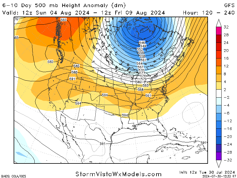
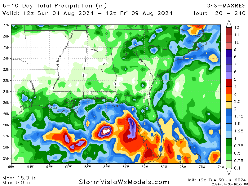
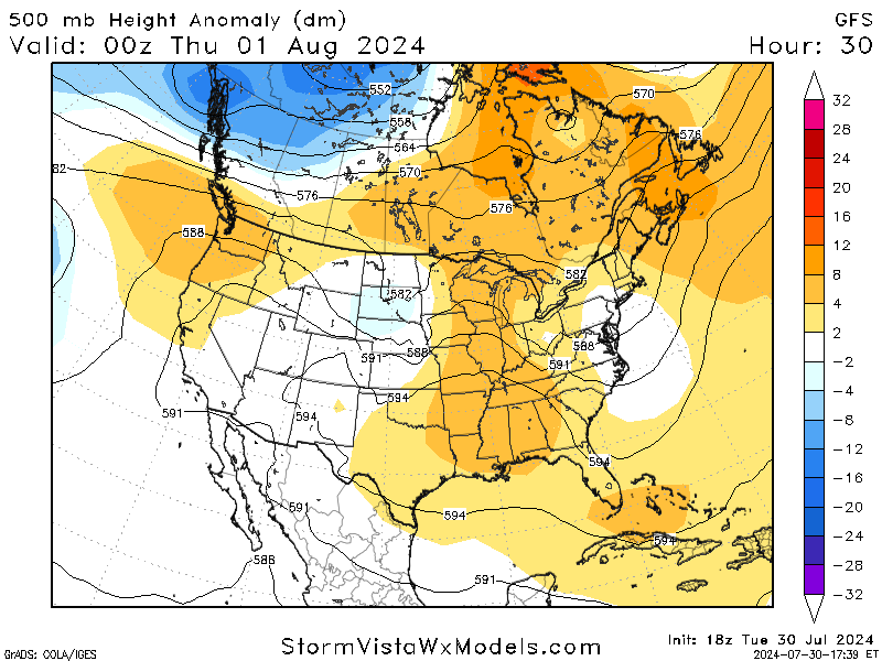
Throughout the weekend and the start of next week, models are in agreement about a mid-level trough forming in Canada above the Great Lakes. Our area is still situated under a high pressure system, and there is no for-sure answer on how this will affect the weather. When looking at total accumulated precipitation maps, most models say that the rain will stay to the south along the coastline while the interior stays high and dry.
Even on the weekend, it is very important to stay properly hydrated and take breaks when needed. Extreme heat can creep up on a person and cause damage before they even know it. Please take the necessary steps to protect yourself and others around you.
BRIEF TROPICAL UPDATE:
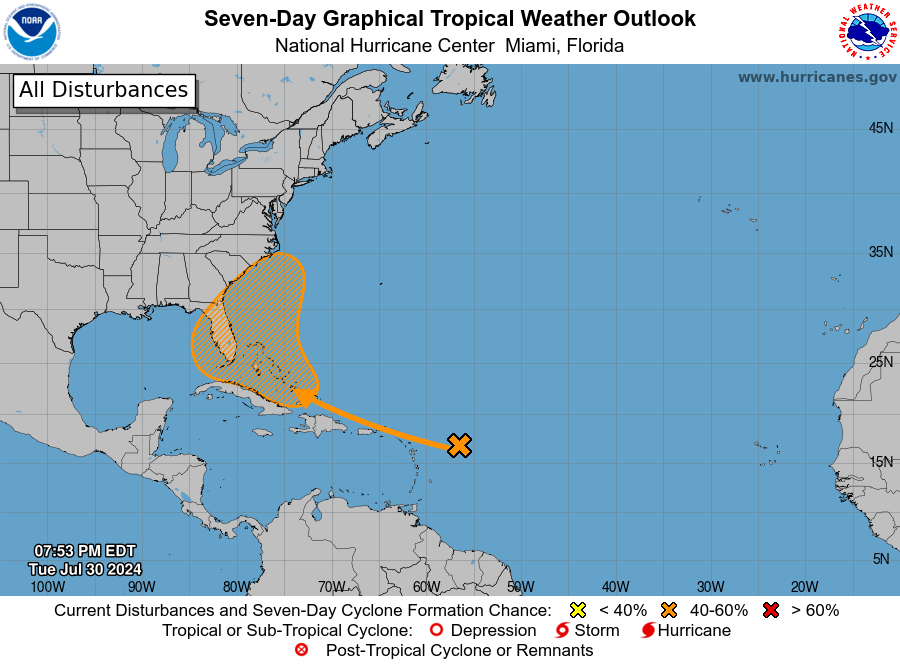
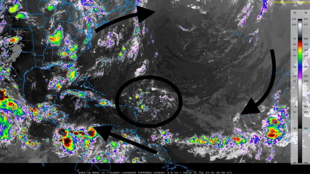
We’re closely monitoring a system in the Atlantic that’s slowly gaining strength due to dry air from Africa. It’s generating thunderstorms, but it is not yet a significant threat. However, it’s crucial to stay informed and prepared as the situation could change.
The environmental setup currently does not strengthen this system, but conditions are expected to become more favorable as it moves over warmer waters, with a 60% chance of development. A tropical depression is expected to develop towards the end of the week as it nears the Bahamas.
As this system continues to move closer to the United States, we will keep you updated with the latest shifts from the heat to the tropics and everything in between!


