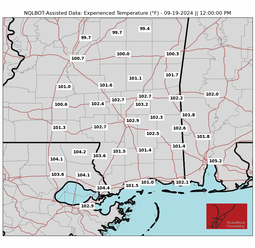
Happy Tuesday! The same weather pattern is expected for tomorrow, with high temperatures and little chance of rain. The chance for a cold front moving through this weekend remains, but it is still possible, with it still being a couple of days out. Highs will remain in the upper 90s well into next week, with heat indices still in the upper 100s to the lower 110s. The chances of rain will remain very low for most of the region. Let’s get into it!

UPPER-LEVEL LOOK:
This week, our region will remain under a dominant high-pressure ridge, the driving force behind the persistent hot and dry conditions. This ridge will maintain control most of the week, keeping temperatures high and rainfall scarce. However, changes are on the horizon as we approach the weekend.
A trough is expected to dip southward from the Great Lakes region, potentially nudging the ridge westward. This could allow a weak cold front to push through the area by Friday into Saturday, bringing increased cloud cover, scattered thunderstorms, and a slight break from the oppressive heat.
NEXT COUPLE OF DAYS & THE WEEKEND:
Hot and mostly dry conditions will characterize midweek weather from Wednesday to Friday. On Wednesday, expect sunny skies with temperatures soaring into the upper 90s and heat indices likely reaching between 105°F and 110°F. Light winds from the north will provide little relief from the oppressive heat. Thursday will see a continuation of this trend, with highs again in the upper 90s and a slight chance of an isolated afternoon shower or thunderstorm, particularly in coastal areas.
By Friday, the influence of an approaching trough will introduce slightly more cloud cover and humidity, along with a modest increase in the chances for afternoon thunderstorms, especially in western and coastal regions. While any rain will be brief, it could offer temporary relief from the heat.
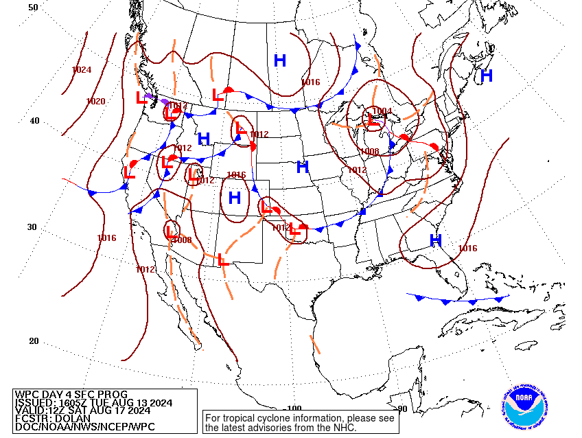
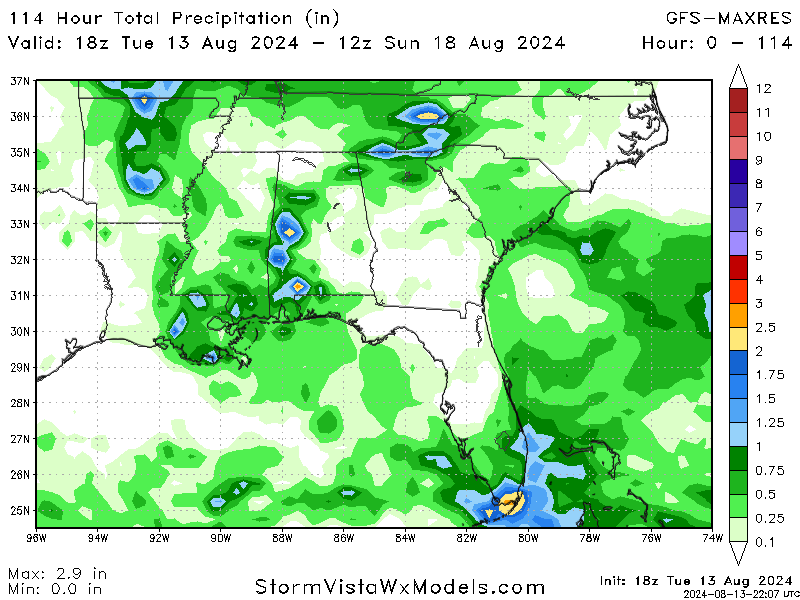
This weekend, the region will see a shift towards more unsettled weather as a trough deepens. This will lead to increased cloud cover and a higher chance for scattered showers and thunderstorms, particularly in the afternoon and evening on both Saturday and Sunday. Highs will be slightly cooler, settling in the lower 90s, though the humidity will make it feel just as warm.
Rainfall will be hit or miss, with some areas potentially experiencing heavy downpours while others remain dry. While the cold front associated with the trough may provide some relief, temperatures will still hover above average for this time of year, especially in coastal areas where showers are more likely.
LOOKING FURTHER AHEAD:
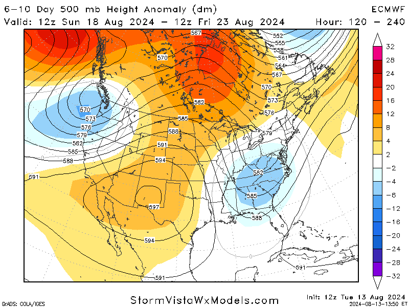
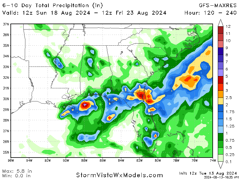
As we head into early next week, the trough that brought some relief will begin to weaken, allowing the high-pressure ridge to reestablish itself. This shift will result in a return to hotter and drier conditions, with temperatures climbing back into the mid-90s.
On Monday and Tuesday of next week, mostly sunny skies will dominate. While there’s a slight chance of isolated afternoon thunderstorms, these will be largely driven by daytime heating and won’t be widespread. Longer-range models suggest the possibility of another trough arriving later in the week, which might bring more substantial relief, but this remains uncertain.
BRIEF TROPICAL UPDATE:
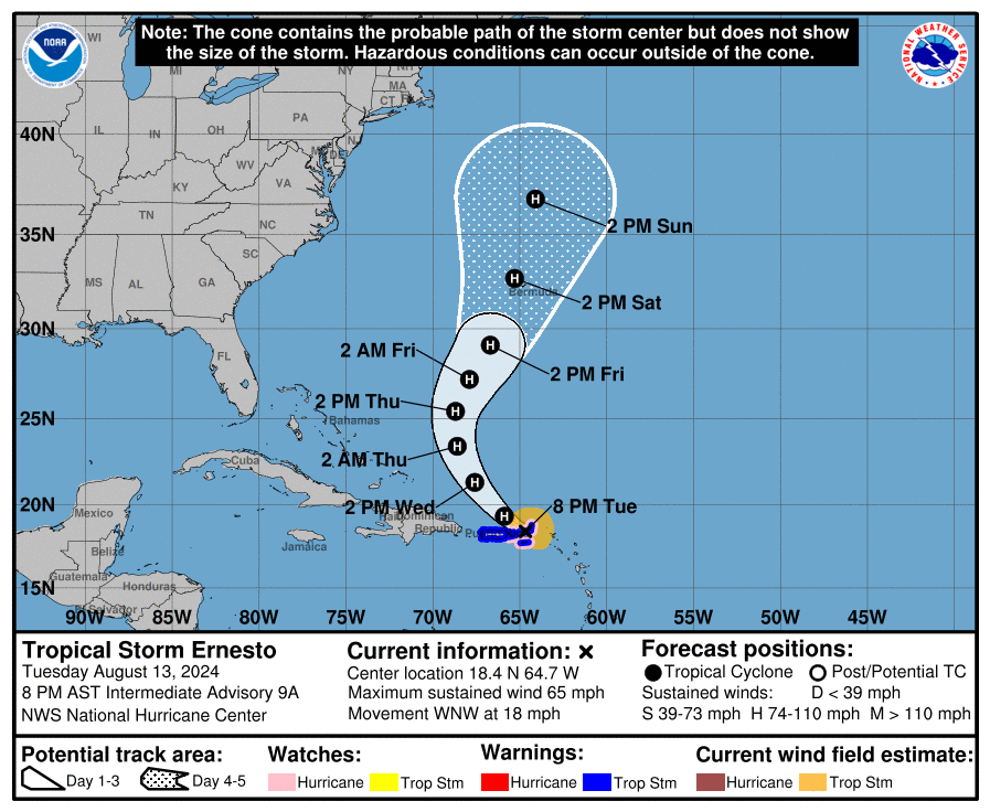
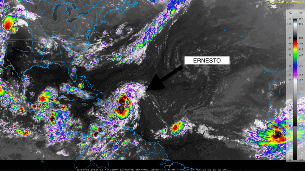
Tropical Storm Ernesto is the main talk of the Atlantic right now. Ernesto is currently located east of the Leeward Islands and is becoming more organized. Its winds are strengthening despite some dry air and westerly shear affecting it. It is expected to become a hurricane by late Tuesday or early Wednesday.
As it continues to develop, the storm poses a potential threat to the Virgin Islands and Puerto Rico, bringing heavy rain, strong winds, and rough seas to the region.
Ernesto is moving west-northwest and is expected to pass over the Virgin Islands tonight and near Puerto Rico soon after. The storm’s path will likely shift northward in a few days, but it might slow down near Bermuda due to a nearby trough. The forecast remains consistent, with no significant changes to its expected path.
Aside from Ernesto, the remainder of the Atlantic is relatively quiet, with no other significant systems expected to develop soon. However, given the time of year, conditions remain conducive for further tropical activity, so it’s essential to stay updated as the situation can change quickly.


