Happy Wednesday, everyone! I hope your week has been going well so far. Unfortunately, temperatures are still hot outside due to high pressure overhead. Thankfully, this pattern will begin to break down as we head toward this weekend with a shortwave trough moving through, bringing rain chances to most of the region.
Heat the Rest of the Week
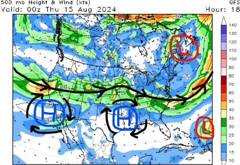
Taking an overall look at the pattern across the U.S., we have mostly zonal flow across the western half of the country, so temperatures are near average. Further to the east, troughing is dominant across much of the Mid-Atlantic and Northeast which will help steer Hurricane Ernesto away from the east coast.
Our region continues to be under the influence of high pressure which means a lot of sinking air at the surface. This dry air allows for a decrease in cloud cover and more time to heat up the atmosphere.
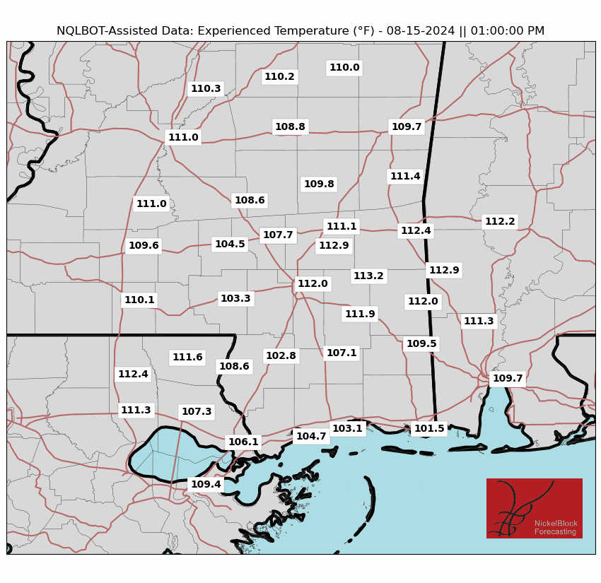
For tomorrow and Friday, high temperatures are forecasted to be in the mid to upper 90s across most of the region. Factoring in moisture and sunlight, heat indices could top 110 degrees, especially tomorrow.
Cities such as Hattiesburg, MS, Jackson MS, and Mobile, AL are some of the locations that will truly feel the heat tomorrow between 11 am and 4 pm.
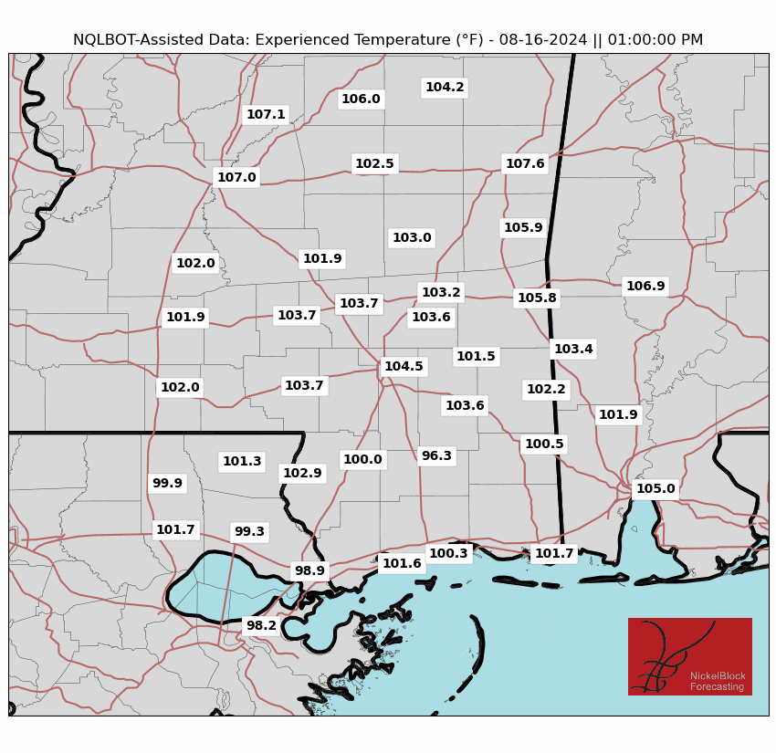
For the rest of the workweek, be sure to limit your time outside at peak hours, especially those prone to heat illness. Also, please drink plenty of water and don’t leave children or pets in your car while it’s shut off.
Weekend Rain Chances
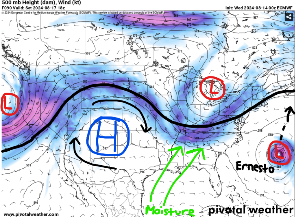
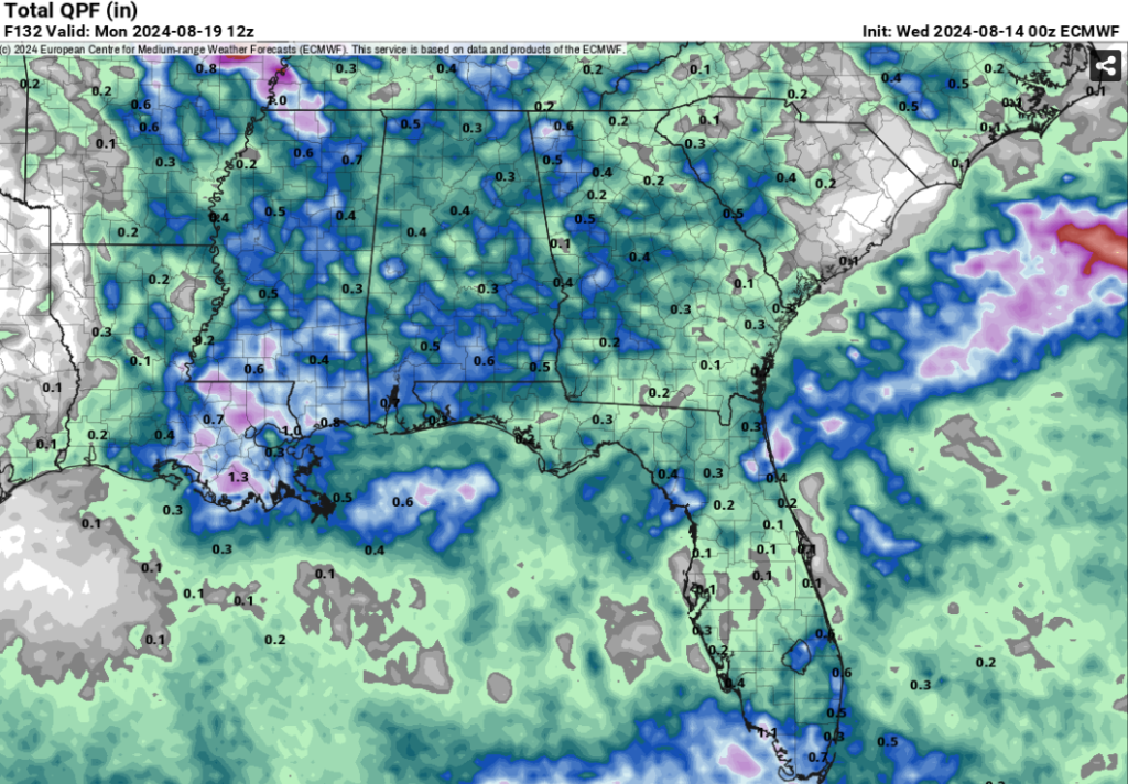
This weekend, rain chances will be more scattered as a shortwave trough will traverse through the eastern CONUS. Out ahead of it, warm moist air from the Gulf is forecasted to surge northward, allowing for an increase in afternoon cloud cover. There will still be plenty of sunshine for a lot of the region and not everyone could see rain each day.
The best chances for rain look to be between Friday evening and Saturday afternoon when we’re out ahead of the shortwave. Some storms could be on the stronger side Friday night into Saturday with gusty winds being the main concern.
This will not be a washout as most locations should stay under an inch of rainfall this weekend. Better chances to see greater than 1” will be closer to the coast. The area could benefit from this rain due to the dry pattern we’ve had the past couple of weeks.
Pattern for Next Week
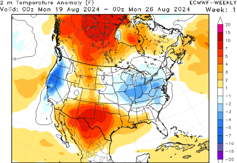
Looking into next week, the pattern hints at warmer than average temperatures for much of the Plains and southern CONUS because of ridging and high pressure. Across the Pacific Northwest and Ohio Valley, average to slightly below average temperatures are possible due to more of a troughing pattern.
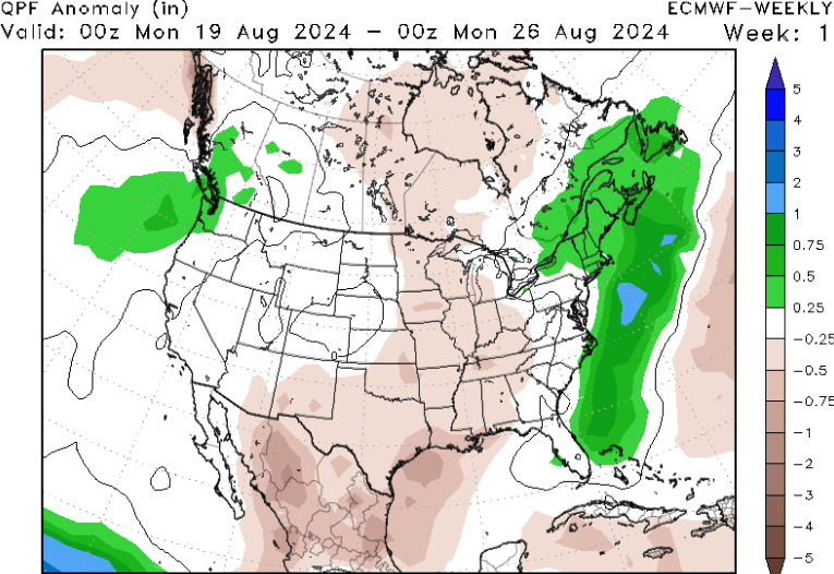
Where we have that troughing in place is where we could see slightly above average precipitation next week due to low pressure. On the flip side, the central U.S. will likely stay below average with more sunshine likely.
So, our area will continue to stay on the hot side with a few rain chances possible. I’ll touch more on next week’s rain in my forecast tomorrow!
Quick Tropical Update
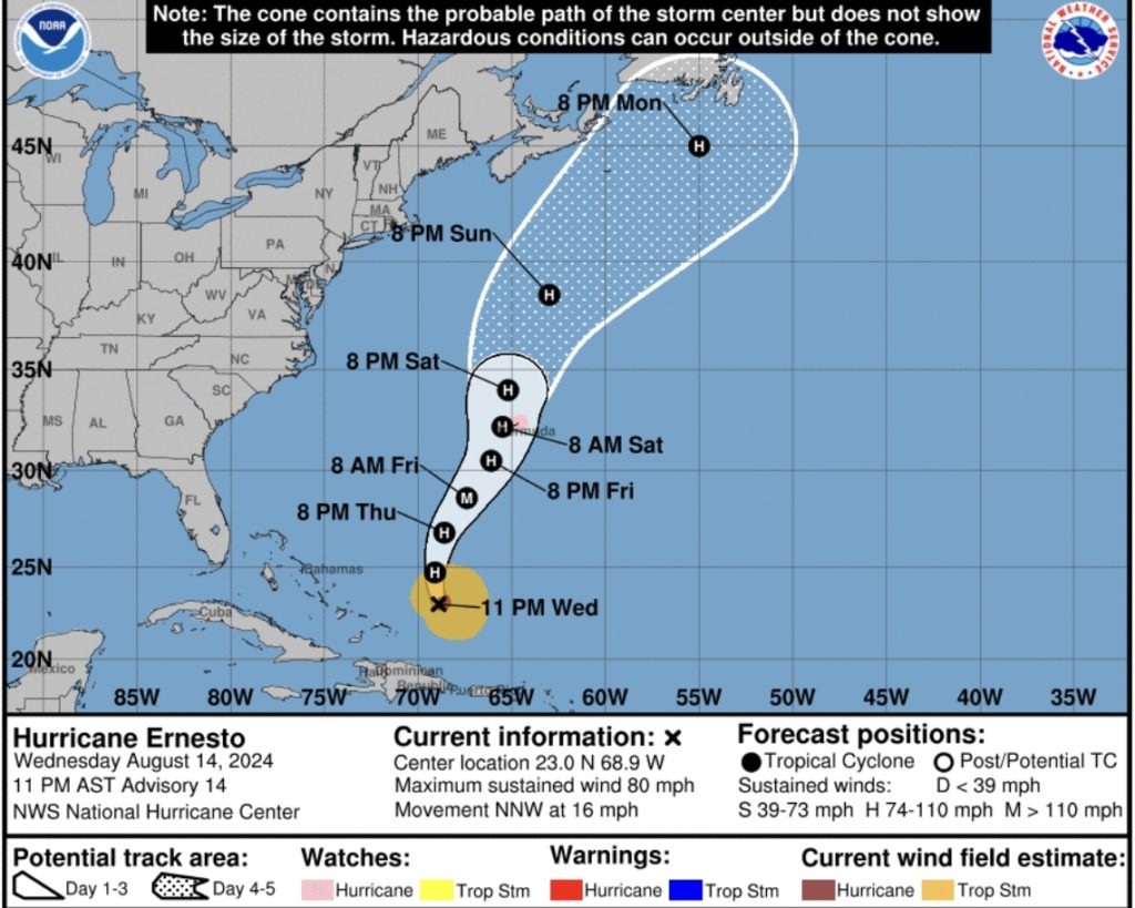
After flooding issues in Puerto Rico, Hurricane Ernesto is now away from land as it moves off to north. Wind speeds are up to 80 mph and this will continue to increase overnight with an eye starting the develop in the inner core. Also, the pressure has been dropping the past couple of hours which is another hint of a strengthening system.
A hurricane watch is in effect for Bermuda as the latest forecast takes the center very close to the island as a strong category 2 hurricane. Storm surge, heavy rainfall, destructive winds, and power outages are all likely this weekend. We’ll have more on this hurricane on Friday.


