Happy Friday, everyone! A weak cold front is forecasted to move through, bringing a chance of storms Saturday afternoon and evening. After that, drier and hotter weather is likely due to high pressure, so be sure to get outside on Sunday before the heat returns next week. Also, we will touch on Potential Tropical Cyclone Four for a second to give you an update on if we can see impacts from this system.
Weekend Pattern
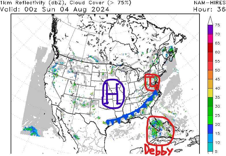
For Saturday, we are tracking an area of low pressure across the Mid-Atlantic. This will drag a cold front into our region by the afternoon, allowing for showers and thunderstorms to develop out ahead of it. Some storms could be on the stronger side with heavy rain, gusty winds, and lightning being the main concerns.
Timing for this rain looks to be between 4 pm and midnight with a few showers possible after that. The best chance for over 0.5″ of rain will be in eastern Louisiana, southern Mississippi, and southern Alabama with some locations exceeding 1″. A few showers are possible on Sunday due to the front slowing down, but most areas should stay dry. Right along the coast is where you’ll have to best opportunity to see rain Sunday afternoon, but it won’t last too long.
Next Week’s Heat
Even with the cold front moving through, temperatures are going to continue to stay near average by the beginning of next week as high temperatures will be in the 90s.
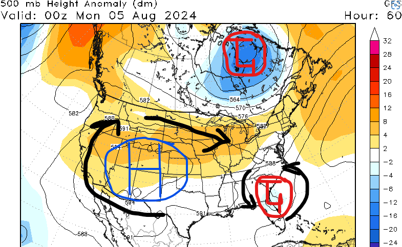
Here is a map of our 500mb pattern. The first main story is “soon to be” Tropical Storm Debby which will likely be impacting Florida, Georgia, and the Carolinas late this weekend into early next week, but confidence still isn’t high on the exact track.
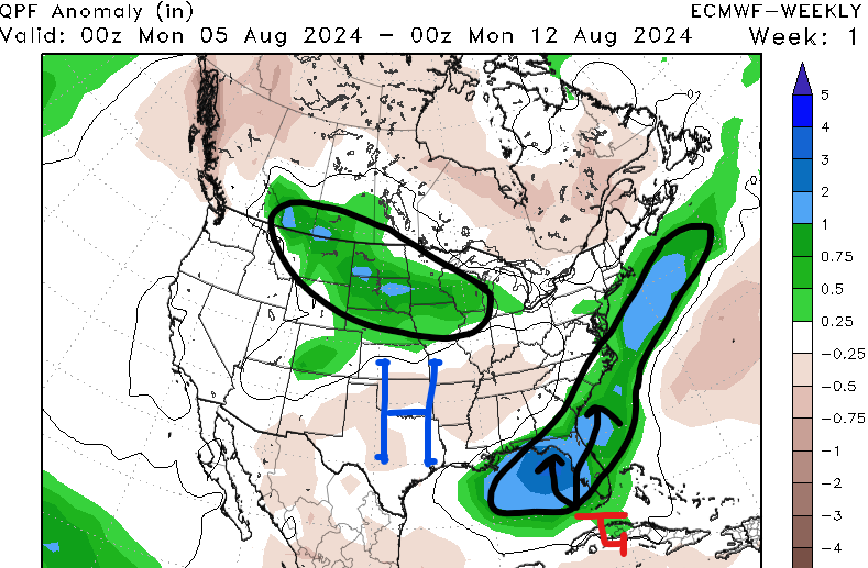
The other feature on this map is a strong area of high pressure that is slowly forecasted to build in across most of the country next week. Being on the east side of this high negates us from seeing “return flow” out of the Gulf of Mexico, so our moisture source will be cut off in the mid-levels of the atmosphere. High pressure allowing for a lot of sinking air which is why we are forecasting less rain chances for the first half of next week at least.

As the aforementioned high shifts to the east, our region will be underneath it, so temperatures are going to be above average with temperatures in the mid to upper 90s and heat indices above 110 degrees. I wouldn’t be surprised if some of us had high temperatures above 100F mid to late next week.
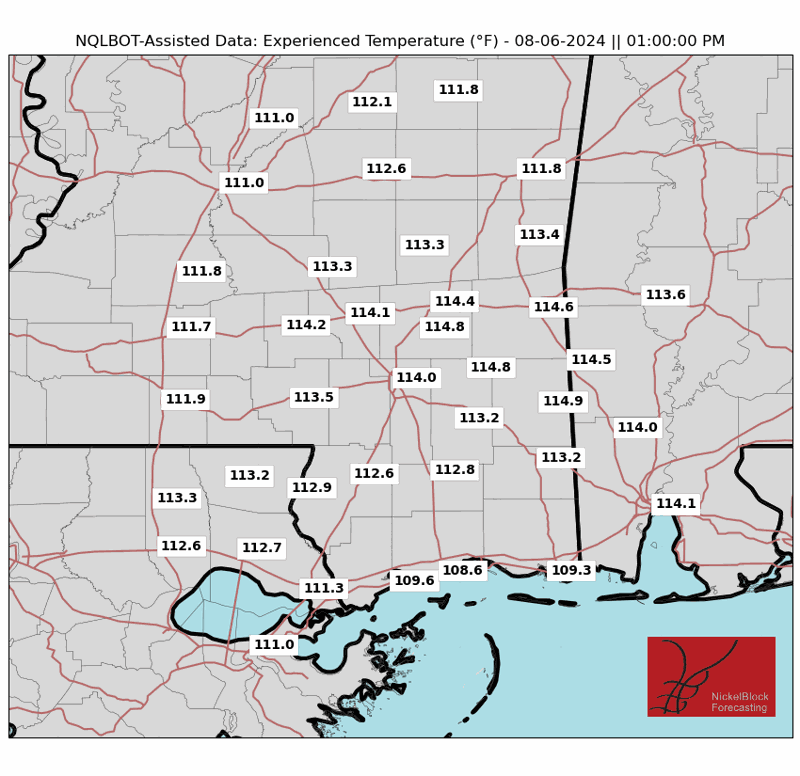
Cities such as Jackson, MS, McComb, MS, Hattiesburg, MS, Meridian, MS, and Mobile, AL will definitely have a head start to the heat as temperatures could feel like 110 degrees on Monday and Tuesday. Try to avoid going outside from 11 am to 3 pm, drink plenty of water, and apply sunscreen to exposed areas if you have to be out.
PTC 4 Has Formed
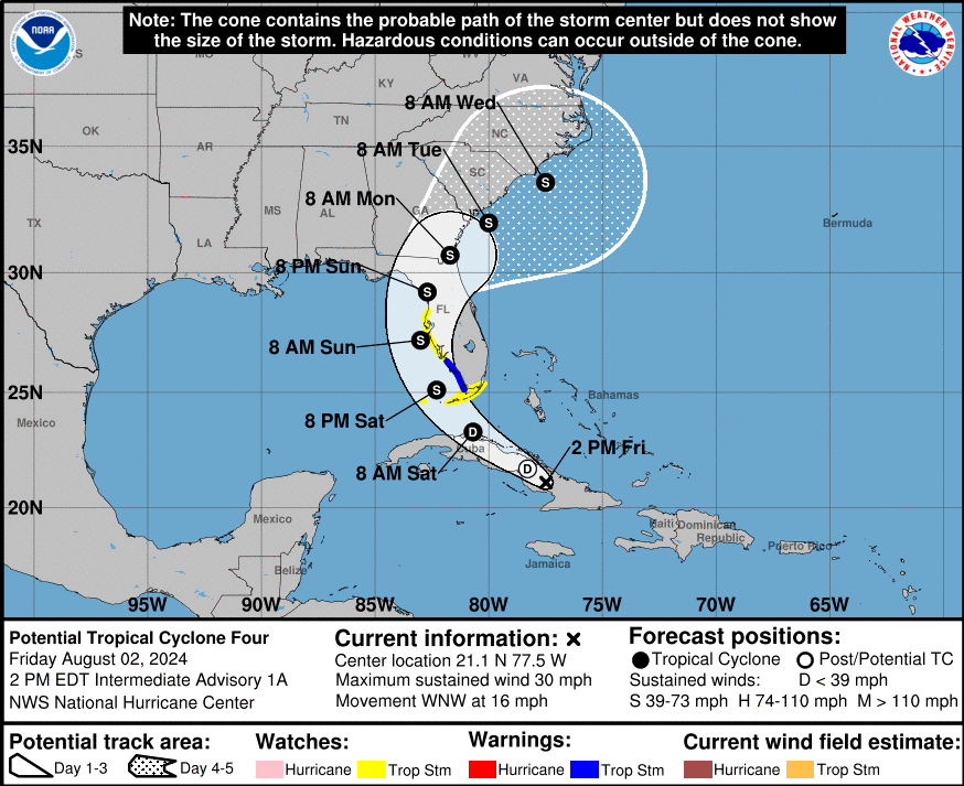
We finally have some more information on now Potential Tropical Cyclone Four. The system is still disorganized and does not have a true center of circulation. Where that ends up happening is how much the forecast cone will shift.
As of now, confidence is leaning more towards a landfall in Florida as a tropical storm or weak hurricane. However, we must continue to check the newest forecasts, especially if the center of the storm shifts south or west. If this were to happen, then it could stay in the Gulf longer and pose risks to southern Mississippi and southern Alabama.
Heavy rain will be the main story with soon to be Tropical Storm Debby as locations in Florida could pick up over 6″ of rain this weekend and early next week. Be sure to check out Seth’s latest tropical forecast from today!


