Happy Monday! I hope everyone had a great weekend. It will be another hot week for us, especially since Hurricane Debby is taking most of the moisture with it as it moves to the east. This leaves dry air in our region, reducing the chance of the pop-up storms we usually see in the afternoon. Highs are expected to be in the upper 90s, with heat indices closing in on the 110s. Let’s get into it!
SYNOPTIC SETUP:
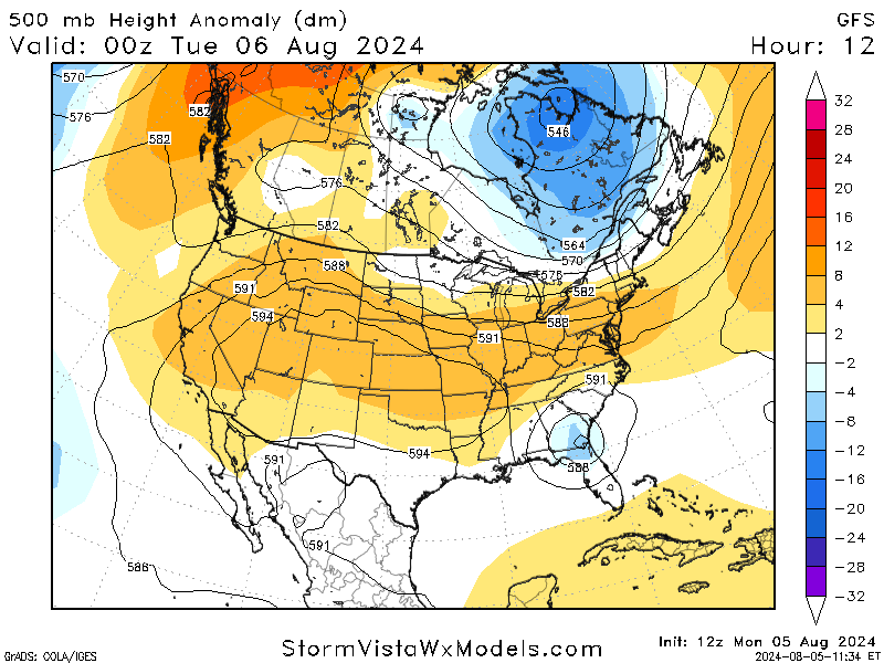
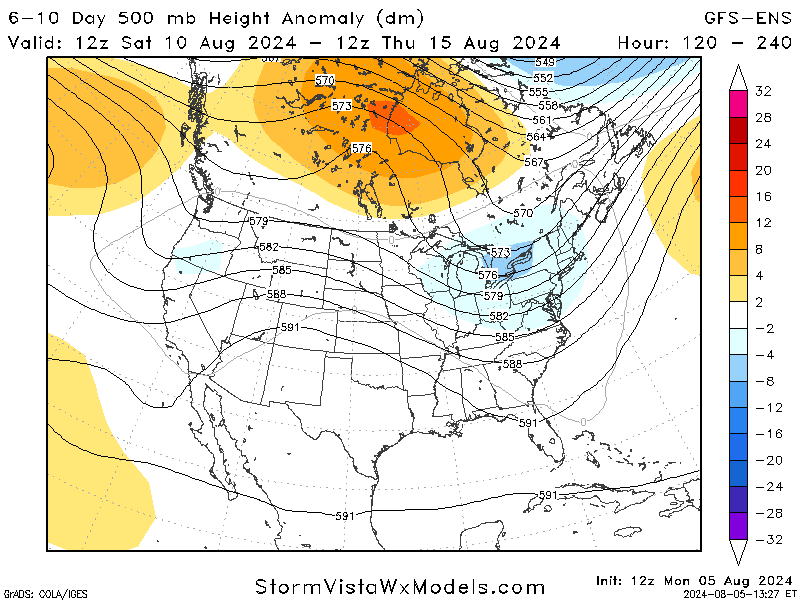
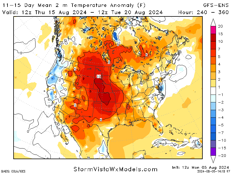
500mb height for Mon-Fri // Courtesy: StormVista
As we start the week, a ridge of high pressure looks to dominate our region. The blue spot of low pressure is Tropical Storm Debby. This ridge will keep the atmosphere stable, which means no great chances for rain and no major heat relief.
Towards the end of the week, we will start to see the ridge shift west, making way for a low-pressure trough from the northern plains, along with the remnants of Debby to the east in Georgia. Despite this change in pattern, rain is still expected to be very limited in our area.
NEXT COUPLE OF DAYS:
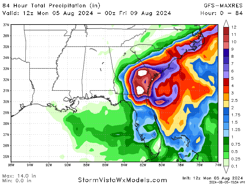
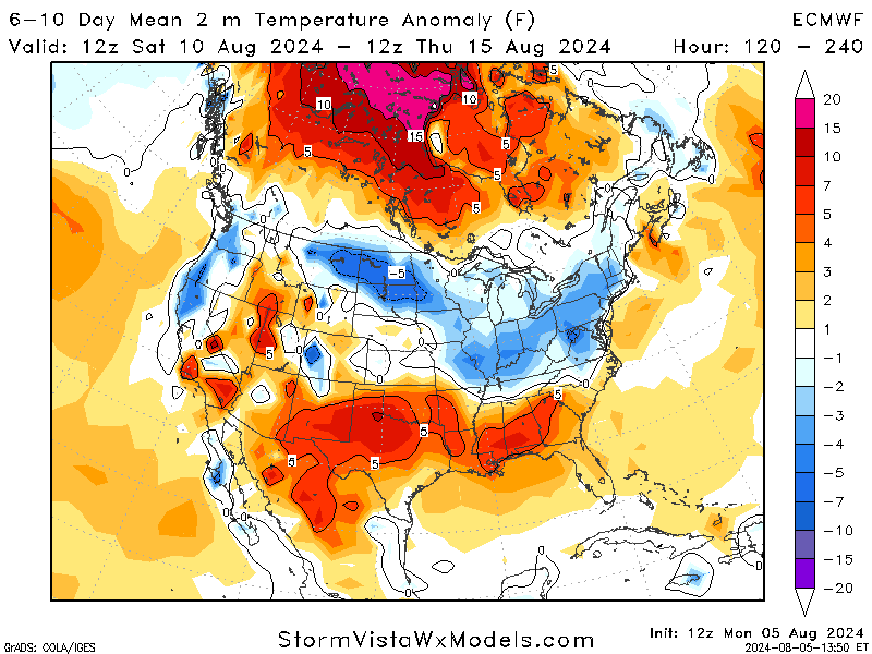
The next couple of days will be hot, dry, and hot. Tropical Storm Debby is pulling moisture up the coast, leaving our area with very dry air and preventing our usual pop-up showers/storms from developing. This lack of moisture will also cause extreme temperatures to continue as we move towards the weekend. Most of the precipitation will stay on the east coast as Debby continues to move up into the Carolinas.
Moving on from the lack of precipitation, high temperatures are expected to be in the upper 90s, with some areas reaching triple digits! While the temperatures are already hot enough, the “experience” temperatures (heat indices) will jump up around the 110s during the hottest parts of the day. This trend is expected to continue throughout the week and into the weekend. The NWS is likely to issue excessive heat warnings for most of the region, so keep that in mind as you plan this week.
I know it sounds repetitive, but please, please, please stay hydrated and take precautions while in this extreme heat. While heat is not as attention-catching as tornados or hurricanes, it is the deadliest hazard, known as the “silent killer,” so please take the steps necessary to protect yourself from this extreme heat.
LOOKING AHEAD:
Looking ahead to the weekend and the start of next week, the ridge is expected to move out of the east while a weaker trough moves across the country’s northern half. Temperatures are expected to stay hot in our area, which is typical for this time of year.
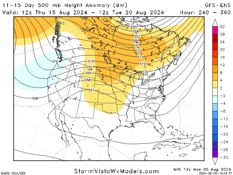
Looking even further ahead to the end of next week, a ridge is forming across the Great Plains, bringing high temperatures along with it. While this is still too far out to be certain, heat will be a common factor throughout the next two weeks, so prepare accordingly.
BRIEF TROPICAL UPDATE:
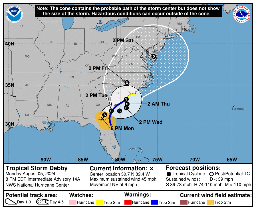
Tropical Storm Debby made landfall this morning as a Cat 1 Hurricane in the Florida Big Bend. It has since weakened to tropical storm status but continues bringing heavy rain to Florida, Georgia, and the Carolinas. As Debby moves east, the center may move offshor quicker than expected and intensify a little. But the main threat is the HUGE amounts of rain and catastrophic flooding concerns for all impacted areas, especially Georgia and South Carolina.
While our region is expected to stay dry, Debby brings historic rainfalls to the area along with a life-threatening storm surge in coastal areas. In areas where Debby has passed, please exercise caution as the flooding has caused numerous hazards, like downed power lines, and also stay aware of the heat.


Thank you. Good work. What are the other two systems in the Atlantic doing?