Happy Tuesday! It was a hot one today, with heat indices ranging around 110F for our area, and it will stay that way over the next couple of days. Rain chances continue to dwindle as Debby pulls moisture towards the East Coast, leaving dry air over our region. I hate to sound like a broken record, but it’s going to be hot. Let’s get into it!

HOT AND DRY THROUGH THE WEEKEND:
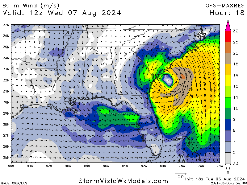
Our area is facing extreme heat and a lack of precipitation that is expected to last through the weekend. While Tropical Storm Debby is not far away, it pulled the majority of moisture in the air to the East Coast, and all of the rainfall associated with the system stayed well to the east of us.
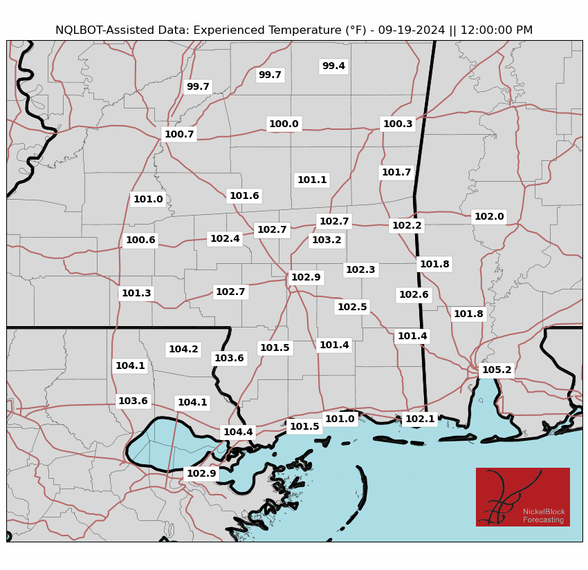
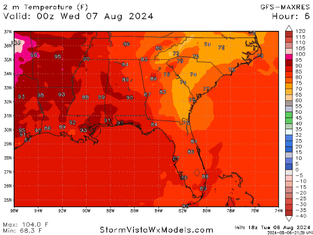
The other main factor of our forecast is the heat (yet again). The lack of moisture paired with the high-pressure ridge has made for plenty of hot days. Highs remain in the upper 90s and lower 100s, while heat indices jump up to around 110F and some places reach as high as 115F! North/northwesterly winds are expected tomorrow as Tropical Storm Debby continues its path north.
This extreme heat trend is expected to last through the weekend, with temperatures slightly cooling down to the mid-90s thanks to a cold front moving into the area. While it may not feel very different, thanks to the “experienced” temperatures, it is worth noting.
WHAT ABOUT NEXT WEEK?
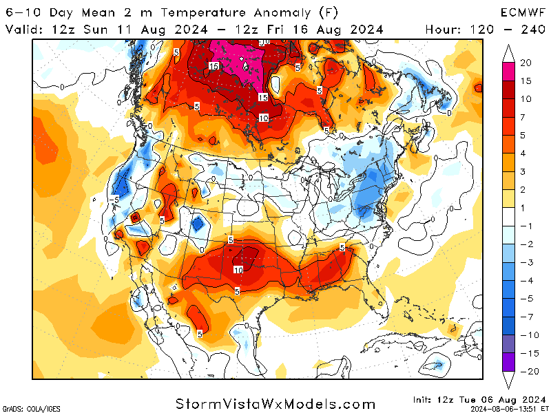
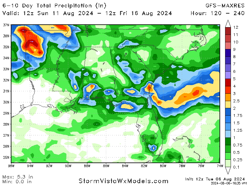
Looking at the start of next week, models are in agreement with continued heat across the southeast. A weak ridge is expected to stick around our area, which makes it very likely for the heat to continue. Along with the heat, some models hint at a chance for some showers as we enter next week. While nothing significant is expected, getting a couple of showers to the dryer areas would be nice. It is still too early to be sure, but high temperatures are expected, and there is a better chance for scattered showers in our area to come next week!
BRIEF TROPICAL UPDATE:
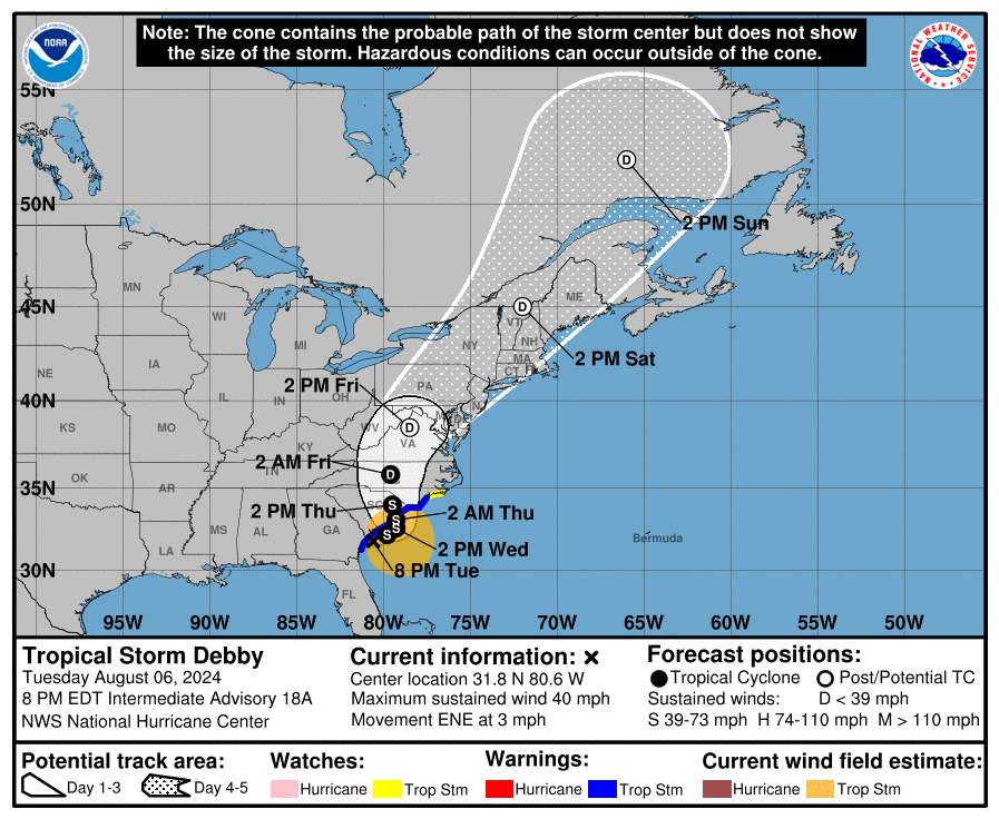
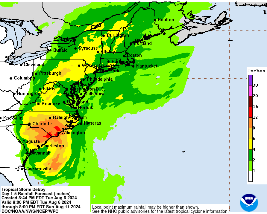
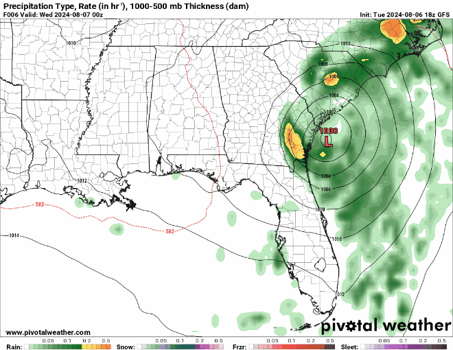
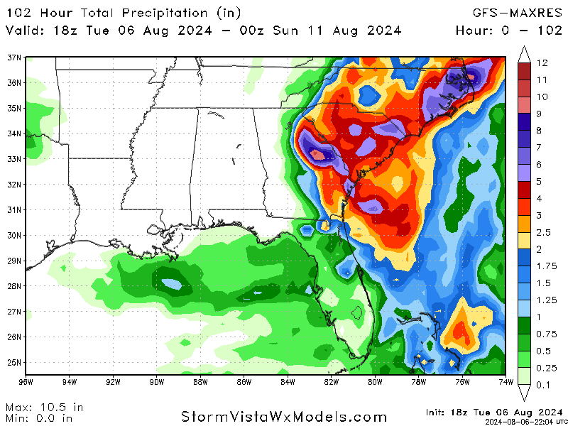
Tropical Storm Debby has caused significant damage and disruption as it moves up the East Coast. The storm, which initially made landfall in Florida as a Category 1 hurricane, has now been downgraded to a tropical storm. It has brought heavy rainfall and flooding to Florida, Georgia, and the Carolinas. At least five people have died due to the storm—four in Florida and one in Georgia.
The storm is expected to continue moving north, affecting areas in Southern New England, including New Hampshire and southern Maine, over the upcoming weekend. The National Weather Service has warned of potential heavy rain, with forecasts suggesting 3 to 6 inches and up to 8 inches in some areas, which could lead to flash and urban flooding.
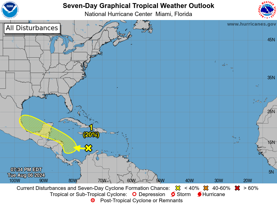
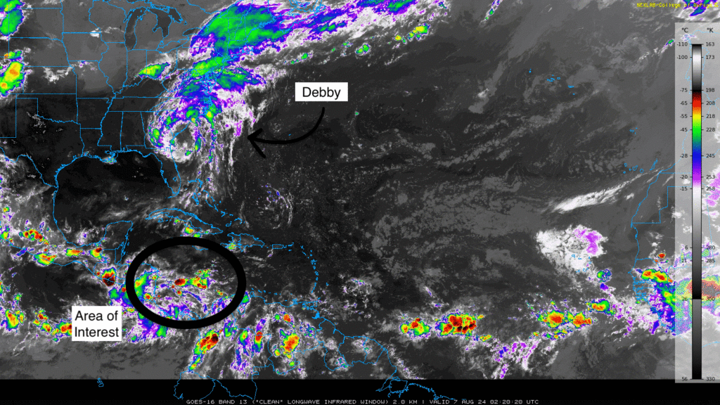
Besides Debby, a tropical wave in the central Caribbean Sea has a 20% chance of further development. Showers and thunderstorms are associated with this system. They are expected to develop slowly as they move into the western Caribbean Sea and approach Central America by the end of the week. By the weekend, the northern part of this wave may reach the southwestern Gulf of Mexico, where conditions could slightly favor its slow development.


