I hope everyone is having a great start to their week! Unfortunately, more heat is likely not just this week but next week as well. High pressure will continue to dominate the southern U.S., limiting rain chances for the rest of the week. We’re going to be stuck in this pattern for the next 1-2 weeks, so I’d recommend developing a routine that works best for you!
Current Setup
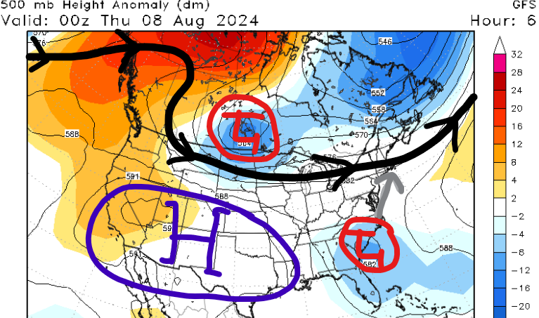
Across the CONUS, our main weather feature continues to be Tropical Storm Debby which is forecasted to impact the Mid-Atlantic and Northeast the rest of the week. High pressure and hot temperatures have been dominating the southern U.S. and this trend looks to continue over the next few days. Cooler weather is likely this weekend for the Midwest due to a strong cold front moving in from the north.
More Heat This Week

High pressure has been the theme across the southern U.S. as temperatures have been above average the past few days. While much of the southeast was socked in cloud cover from Hurricane Debby, our region has stayed mostly sunny with high temperatures in the 90s.
While our mid to upper-level flow may weaken the rest of the week, high pressure at the surface will continue to dominate over parts of Texas. Being on the eastern side of the high, dry air will filter down from the north and limit rain chances. Furthermore, the sinking air will continue to limit upward motion in the atmosphere, so limited cloud cover is likely for the rest of the week.
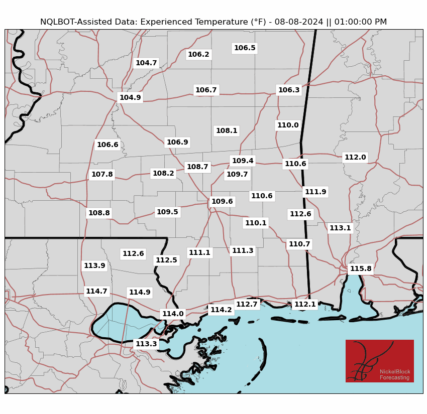
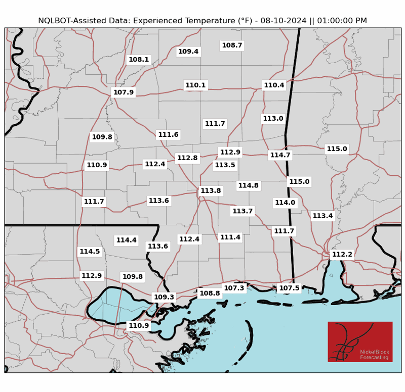
High temperatures the rest of the week look to be in the mid to upper 90s due to the atmosphere heating up faster with more sunshine present. Heat indices could exceed 110 degrees in some locations, especially near the coast such as Mobile, AL or Biloxi, MS.
Limit time outdoors, especially during the early afternoon hours as heat illness can occur quickly. Find shaded areas if you have to go outside and take frequent hydration breaks. I’d recommend getting your outdoor chores done early in the morning or late in the evening. Finally, do not leave your children or pets in the car without it running. The inside of the car can heat up rapidly in just minutes!
Weekend Cooldown Further North
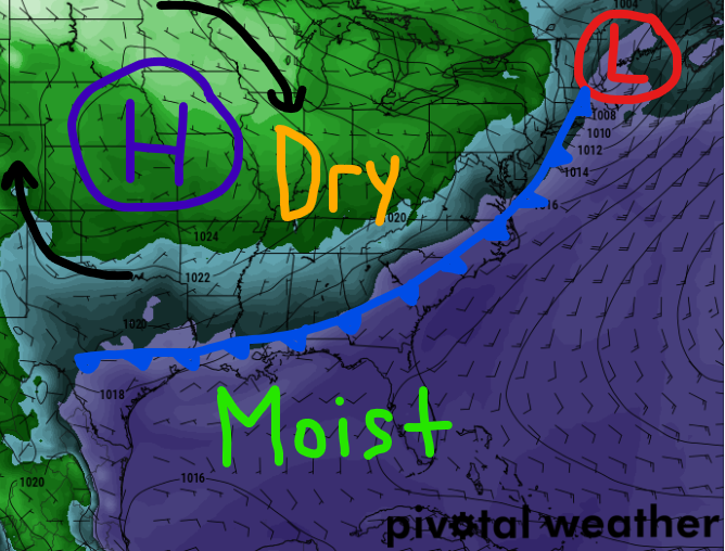

An upper-level low is forecasted to move across the Upper-Midwest and Northeast early this weekend, dragging a strong cold front southward. Behind the front, fall-like dew points are possible across the northern and central CONUS.
Unfortunately, for our region, only a slight drop in dew points is likely as the cold front won’t be THAT extreme. It will definitely feel nicer compared to what we’ve been seeing, however, to feel a real change in the air, you’d have to go north of I-20 where dew points could be in the low 60s this weekend across northern Mississippi.
A few clouds are possible for the region Friday evening, but no rainfall is expected from this front. Our next best chance for showers and thunderstorms won’t be for a while as it’ll continue to be hot and dry Friday through Sunday.
Next Week’s Pattern
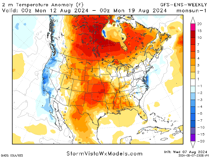
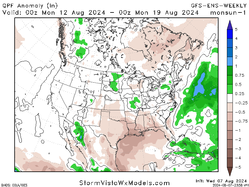
These are some tough graphics to show, but we aren’t forecasting much of a change in temperatures or precipitation over the next 1-2 weeks. High temperatures should remain slightly above average and models are showing that our region has the best odds of seeing limited rain chances for next week.
In fact, much of the U.S. will likely be above average in temperatures, and not many places will see widespread rainfall either. A higher likelihood of precipitation looks to be across Hispaniola and the Bahamas due to a potential tropical wave.
Quick Tropical Update
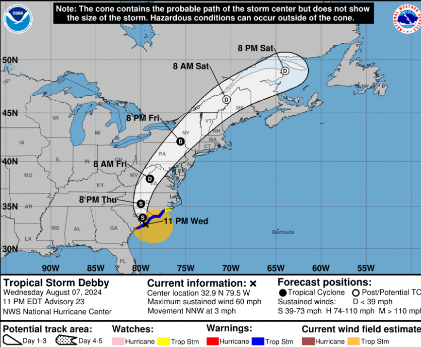
As of now, the only area highlighted by the NHC is Tropical Storm Debby which continues to produce heavy rainfall over the eastern CONUS. Flooding is likely across portions of the Mid-Atlantic and Northeast through Saturday before the system gets picked up by our cold front and pushes it out to sea.
After Debby, guidance is beginning to hint at an area of formation in the main development region over the open Atlantic next week. Obviously, it’s way too far to know where that’ll be going, but we’ll continue to keep you up-to-date on the latest trends.


