Today looks mild and a little breezy. Severe weather is back in the forecast for tomorrow – it must be Fall. Appropriate on the heels of Fall Severe Weather Awareness Week.
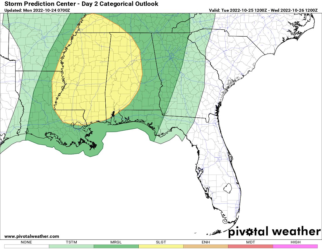
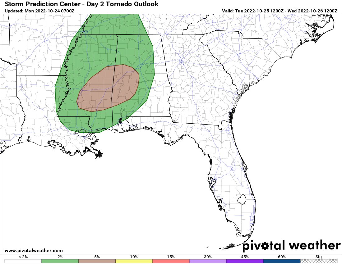
The Storm Prediction Center has outlined most of the area with a Slight Risk for severe weather. A Marginal Risk around the periphery. The main concern is for storms to develop tomorrow will be brief heavy rain, lightning, gusty wind, small hail and the potential for a tornado or two.


The timeline on the threat looks to be between about 9a and about 2p.
Right now it doesn’t look like the tornado threat will be for EF3s, EF4s, or EF5s. But EF0 and EF1 tornadoes will be possible. I don’t think we can rule out an EF2, but we may not have all of the ingredients for the “big boys” tomorrow.
You can see one ingredient already showing up on radar: Shear. Shear is one of the things we need in order to organize thunderstorms. And organized storms are more likely to actually become severe.
On the radar this morning, you can see some of the patches of rainfall (though, there isn’t much to the rain this morning) are moving from southwest to northeast, others are moving from south to north.
The difference between which rain is moving which direction has to do with how high up it is in the atmosphere. And, as most of you remember, the change in direction with altitude is the definition of shear!
Now, we don’t expect severe storms today. But this background shearing already in place is a good indicator of what is to come. The other indicator is the forecast data from the computer weather models. And I’ll be honest, here, this looks like a pretty low-end severe weather threat.


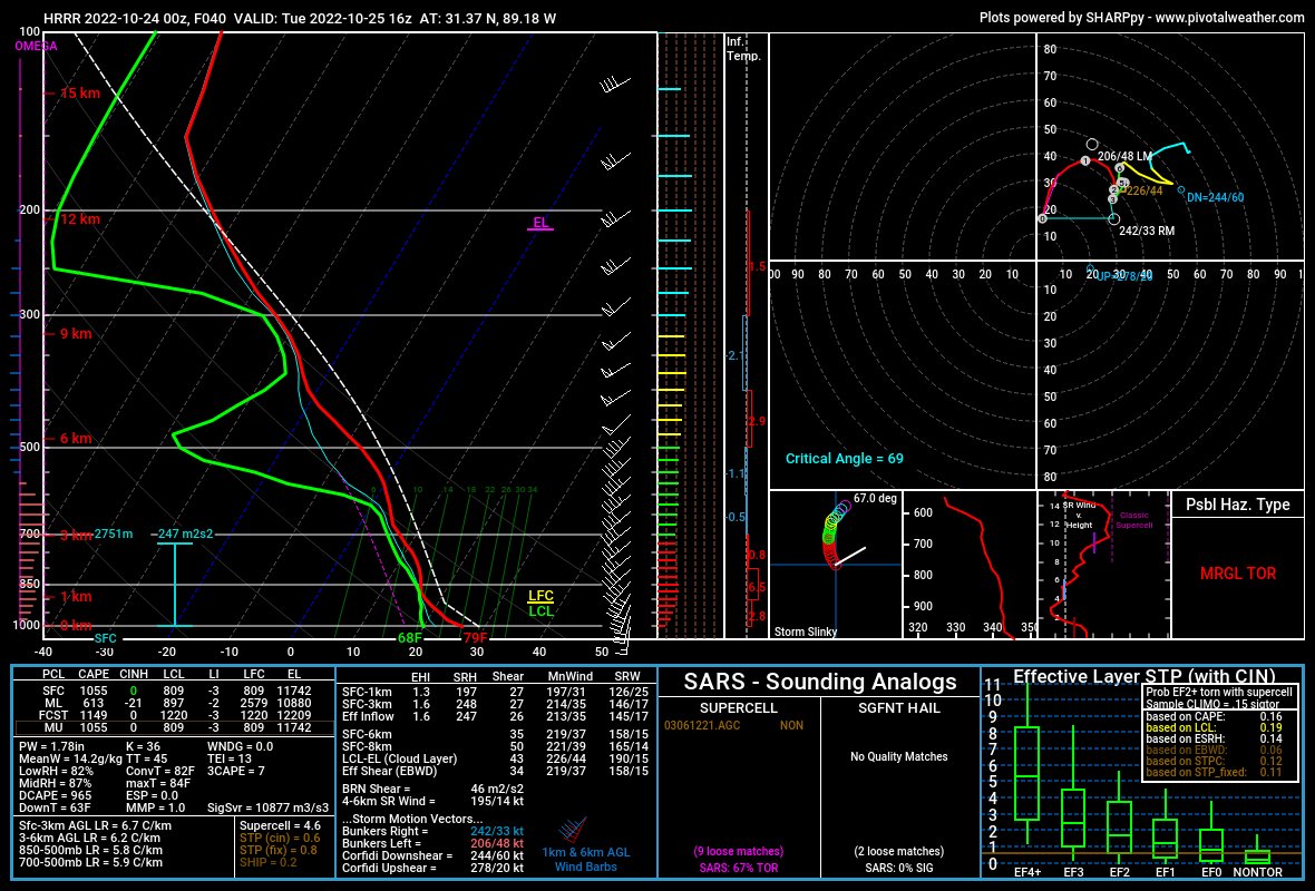
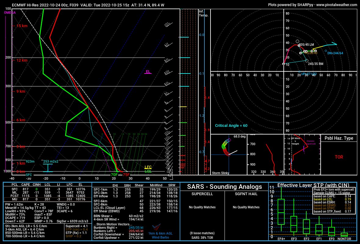
The data from the two forecast soundings (skew-ts) above would tell me that any risk for severe weather was going to be rather isolated. So, not everyone will se severe weather. In fact, not everyone will see meaningful rain! Instead, we will have to keep tabs on radar in case any isolated, discrete storms (the loner storms hanging out on their own) can get rooted and become severe.
Otherwise, it’ll be a quick downpour, a few strong gusts of wind, some lightning, and that is about it.
The model guidance from the HRRR model shows this pretty well. Notice no big line of storms, no scary supercells, just a line of a few isolated storms with some brief heavy rain, lightning, gusty wind, small hail and the potential to produce a quick tornado.
Once we get through this, it is back to nice weather!
DAY TO DAY FORECAST
Today
Mostly sunny. Highs around 80. Southeast winds 5 to 10 mph.
Tonight
Partly cloudy in the evening, then mostly cloudy with a chance of showers after midnight. Not as cool with lows in the upper 60s. Southeast winds around 5 mph with gusts up to 20 mph. Chance of rain 30 percent.
Tuesday
A chance of thunderstorms. Showers. Highs in the lower 80s. Temperature falling into the upper 70s in the afternoon. South winds 10 to 15 mph with gusts up to 25 mph. Chance of rain 80 percent.
Tuesday Night
Mostly clear. Much cooler. Less humid with lows in the upper 40s. Northwest winds 5 to 10 mph.
Wednesday
Sunny. Highs in the lower 70s. North winds 5 to 10 mph.
Wednesday Night
Clear. Lows in the mid 40s.
Thursday
Sunny. Highs in the mid 70s.
Thursday Night
Mostly clear. Lows in the upper 40s.
Friday
Mostly sunny. A chance of showers in the afternoon. Highs in the mid 70s. Chance of rain 30 percent.
Friday Night
Mostly cloudy with a chance of showers. A slight chance of thunderstorms after midnight. Lows in the mid 50s. Chance of rain 40 percent.
Saturday
Partly sunny with a chance of showers with a slight chance of thunderstorms. Highs in the lower 70s. Chance of rain 40 percent.
Saturday Night
Partly cloudy. Lows in the mid 50s.
Sunday
Mostly sunny. Highs in the lower 70s.

