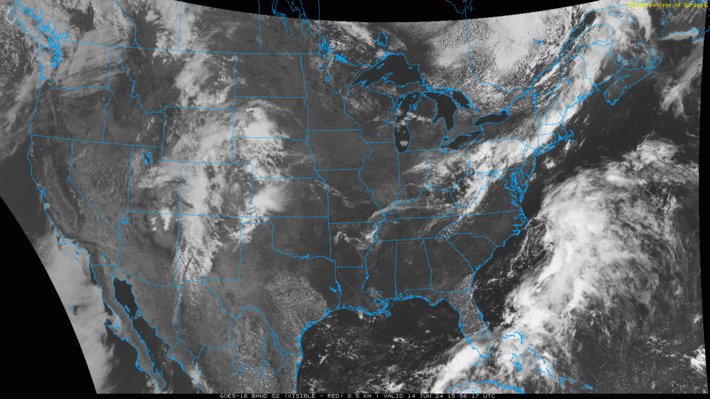
Hi everyone, I hope that you had a great week. We have quite a lot of exciting and extreme weather in store for the nation today. Our three primary weather concerns are severe weather in the high plains, flooding and heavy rain in Florida, and a heat wave for the central plains. As we continue to the summer season, we are in the process of switching from severe weather and cold snaps to heatwaves and an increase in tropical disturbances and flooding. We have a lot to cover in today’s forecast, so let’s get into it!
Severe Weather Expected
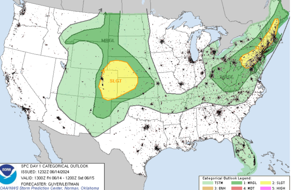
There are two areas of concern regarding our severe weather threat today. Those are the I-95 corridor in the Northeast and the High Plains, which are both at a slight risk or level 2 of 5 in the threat of severe weather. Some of the cities that could see severe weather are Boston, Hartford, New York City, Philadelphia, Baltimore, and Denver (my hometown). The severe weather in the Northeast is being caused by a cold front associated with a center of low and moderate shear in the lower levels. Storms are expected to ride the frontal boundary, with a few of these cells possibly becoming supercells. The main threat from these storms will be high winds and large hail. Moving out west, a stationary front and low-level southerly flow will support a moist airmass. Storms should start developing in the mountains and move off the Front range, with some of these storms becoming severe on the plains. The primary threats with these storms are strong winds, destructive hail, and a tornado or two. Both of these areas can expect storms between the hours of 3 PM and 10 PM local time. Persons in these regions should prepare for severe weather this evening.
More Heavy Rain for a Rain-Soaked Florida
Over the last couple of days, a tropical disturbance from the Gulf of Mexico has drenched the state of Florida. Although Florida is in their wet season, the amount of rain that has fallen in the region is extreme, even by Florida standards. Some areas of the state (particularly South Florida) have seen over a foot of rainfall in the last few days. This has led to numerous flooding reports and has forced a state of emergency for southern Florida.
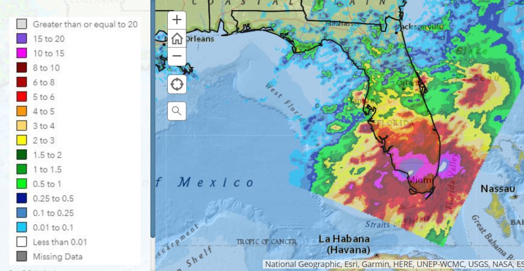
Looking at the next couple of days, more heavy rain is expected for South Florida, although the amount of rainfall is expected to be much less than the past couple of days. I am anticipating that the center of low that dropped the heavy rain will move to the northeast over the next couple of days. Even though the center of the low is moving away, leftover tropical moisture is expected to bring numerous showers and thunderstorms to the southern part of Florida. Although rainfall amounts won’t be high, ground moisture is already high. Thus, flooding is expected in South Florida.
Heat Expected for the Nation’s Center
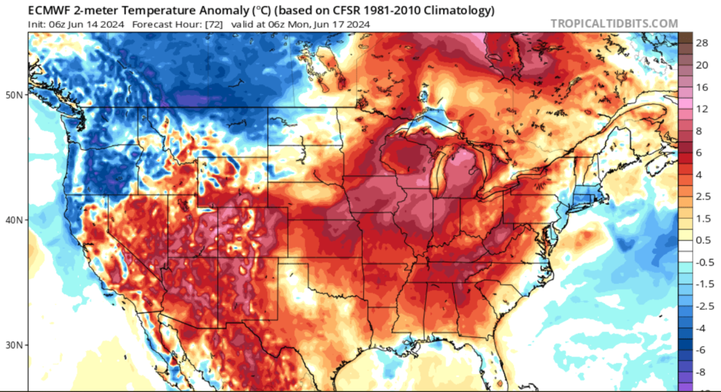
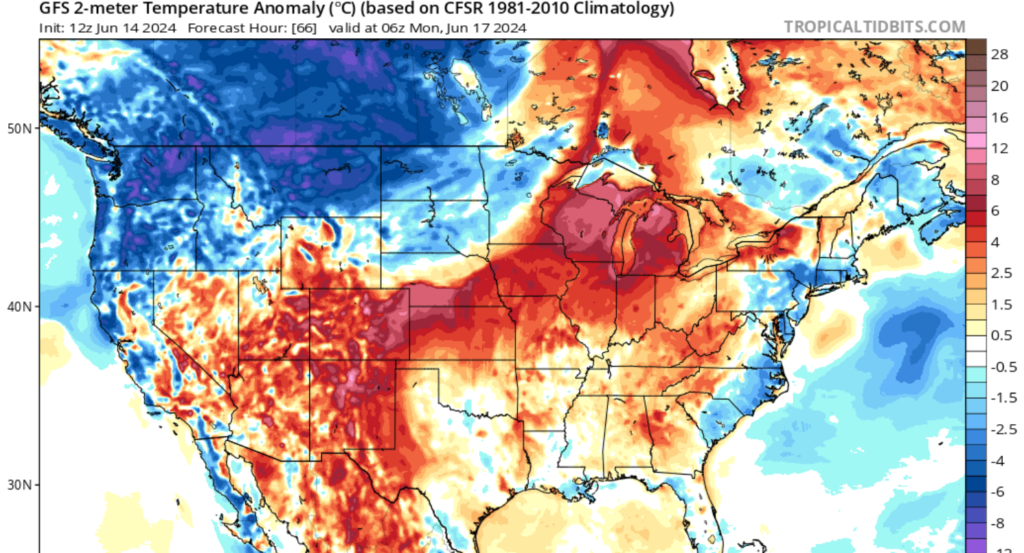
Changing gears from the heavy rain, the heat is on for the nation’s center. Temperatures are expected to be 5 to 15 degrees above average from the Great Lakes region to the Great Basin. Cities such as Chicago, St. Louis, Kansas City, Denver, and Salt Lake are expected to see above-average temperatures early next week. A warm front associated with a center of low in the northwest is expected to draw this warm tropical air from the Gulf of Mexico, bringing humidity to the Mid-West and Great Lakes regions. Make sure that you take heat-related measures early next week.
Overall, we have quite a lot of extreme weather that is expected to cause impacts throughout the United States over the next couple of days. Remember that late spring and early summer can bring all types of weather, so it’s critical to stay weather alert at all times.


