Today, expect increasing heat stress with dry afternoon conditions as high pressure over the north-central U.S. brings west-northwest flow to the region. A mid-level ridge centered over west Texas and the Four Corners will build eastward, which will start to warm us up in the coming days.
It is another Buster Poindexter forecast:

High temperatures and heat advisories in effect throughout the week. Dry conditions will dominate through Friday as high pressure migrates from the Southern Plains and merges with a subtropical ridge. Afternoon highs will reach the mid to upper 90s, with heat indices between 105-110F. That may hold all the way through Friday and Saturday.
By Saturday evening and through Sunday, a weak cold front might bring scattered showers and thunderstorms, particularly east of I-55, but highs will remain in the upper 90s to low 100s, with heat indices still in the 105-110F range. Heat indices may decrease slightly by next Monday.
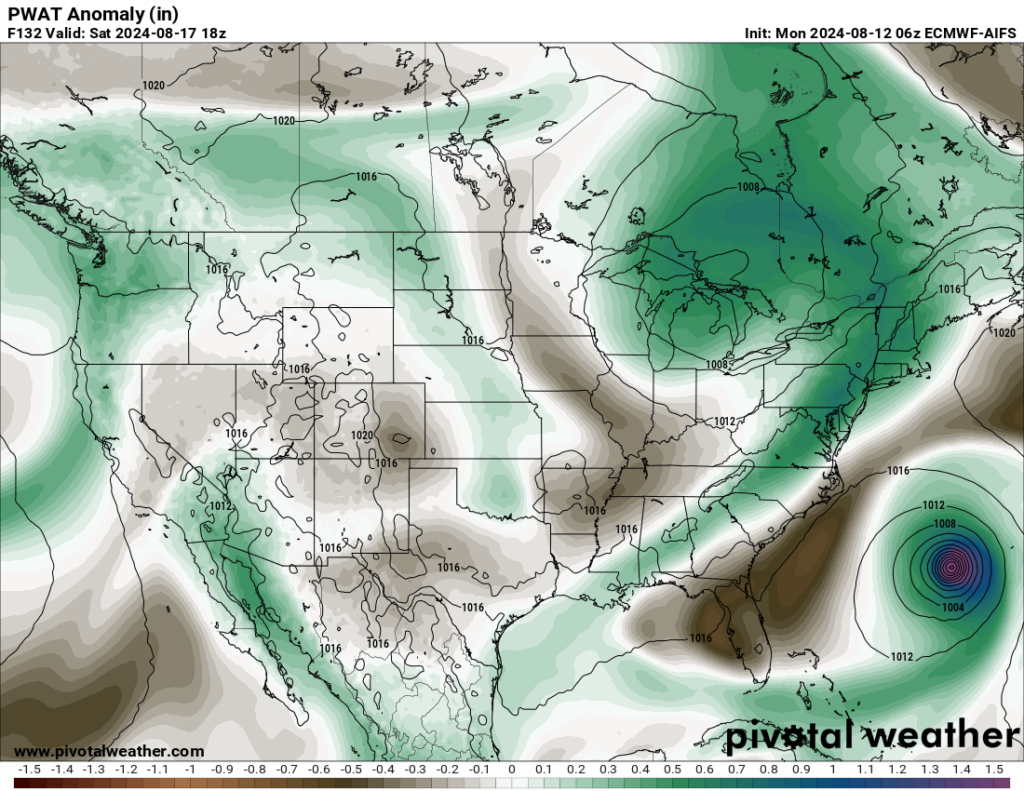
The European AIFS model (their AI model) shown above indicates that some cooler, drier air may press in behind said cold front and hang around for a few days. Keep in mind that “cooler” is a relative term here, meaning “less hot” with highs still in the 90-degree range. But perhaps not 100F. There is another cold front out there, too, perhaps.
It is something worth monitoring and I’ve added it to the official forecast for everyone to watch how it unfolds.
REGIONAL DAY TO DAY FORECAST
Today: Sunny. Highs in the upper 90s. Northeast winds around 5 mph, becoming northwest around 5 mph this afternoon.
Tonight: Mostly clear. Lows in the mid 70s. Southwest winds around 5 mph in the evening, becoming light and variable.
Tuesday: Sunny. A slight chance of showers and thunderstorms in the afternoon. Highs in the upper 90s. Northwest winds around 5 mph. Chance of rain 20 percent.
Tuesday Night: Mostly clear. Lows in the lower 70s. Southwest winds around 5 mph in the evening, becoming light and variable.
Wednesday: Sunny. A chance of showers and thunderstorms in the afternoon. Highs in the upper 90s. Northwest winds around 5 mph. Chance of rain 30 percent. Heat index values up to 108.
Wednesday Night: Partly cloudy in the evening, then becoming mostly clear. Lows in the mid 70s.
Thursday: Sunny. A chance of showers and thunderstorms in the afternoon. Highs in the upper 90s. Chance of rain 30 percent. Heat index values up to 110.
Thursday Night: Partly cloudy in the evening, then clearing. Lows in the mid 70s.
Friday: Mostly sunny. A chance of showers and thunderstorms in the afternoon. Highs in the mid 90s. Chance of rain 40 percent. Heat index values up to 110.
Friday Night: Partly cloudy in the evening, then becoming mostly clear. Lows in the mid 70s.
Saturday: Sunny. A chance of showers and thunderstorms in the afternoon. Highs in the mid 90s. Chance of rain 30 percent. Heat index values up to 110.
Saturday Night: Mostly clear. Lows in the mid 70s.
Sunday: Sunny. A chance of showers and thunderstorms in the afternoon. Highs in the upper 90s. Chance of rain 30 percent. Heat index values up to 110.
15 DAY FORECAST


Nick. So sorry you are having such a bad time trying to relay important information to us. We certainly do appreciate your effort and support. Wish we could make it easier on you. Thank you for your diligence.