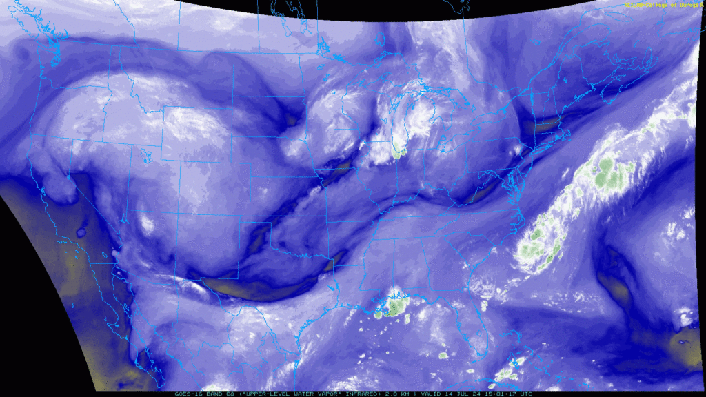
It’s been quite a sizzling week for much of the U.S., and the heat is expected only to spread eastwards. Heat advisories have been issued from California to Massachusetts. Areas of the Western U.S. are starting to see some relief, while regions of the Mid-West and East Coast are expected to see above-average temperatures. Not only will temperatures be sizzling today for these regions, but the humidity will make it feel much hotter than it is. While parts of the county are baking today, other areas could see severe weather. Areas around the Great Lakes and Upper Midwest are in the bullseye for severe thunderstorms today, with high winds and large hail being the primary threats.
The heat spreads east
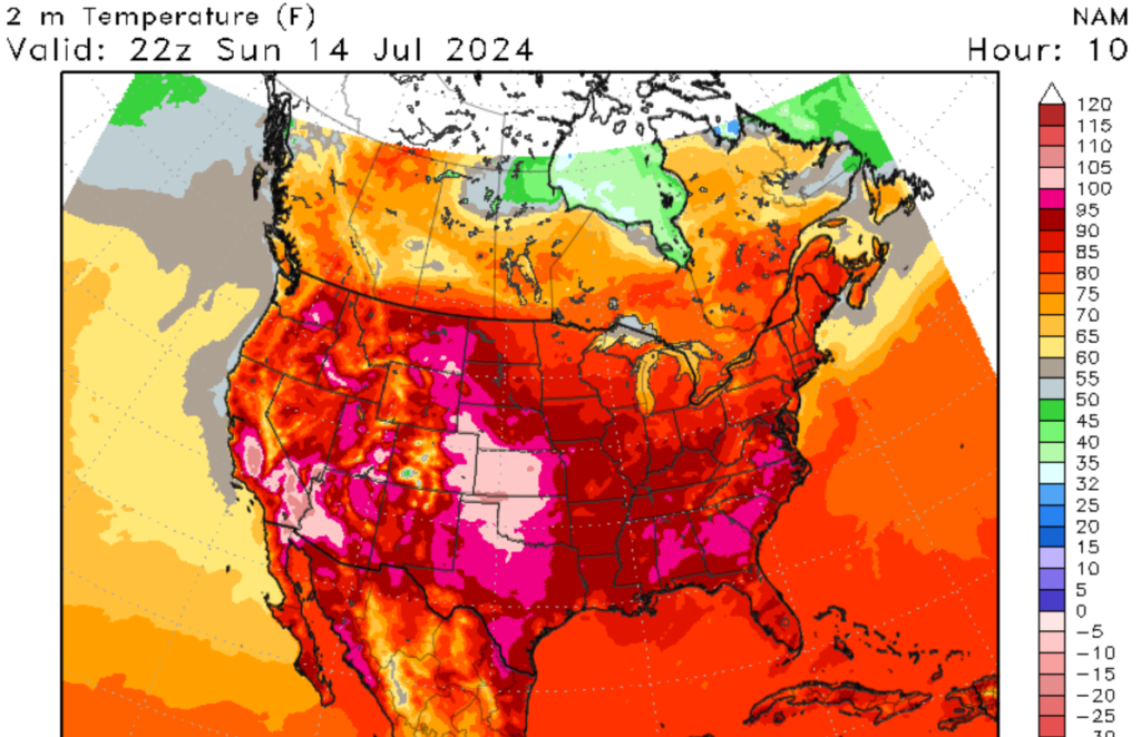
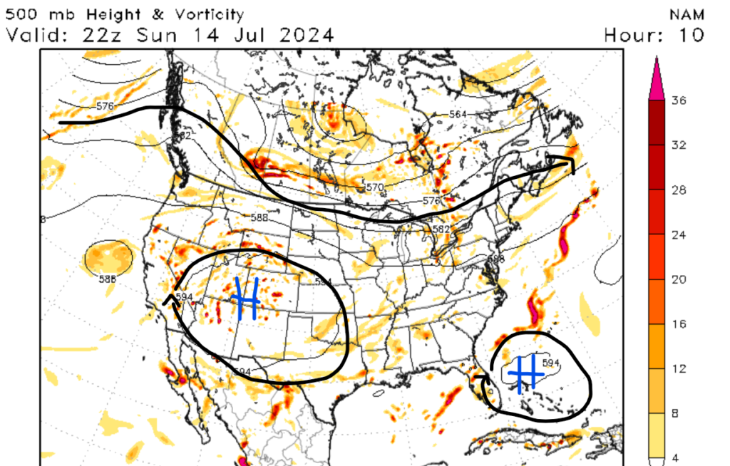
If you have been paying attention to the weather news, one thing that has been talked about recently is the above-average temperatures inundating the Western U.S. This pattern will change as the subtropical high-pressure system is expected to weaken, allowing the heat to spread eastwards. Portions of the Western U.S. will have to deal with one more day of recorded breaking heat, with most lower elevation areas seeing temperatures of at least 100 degrees Fehernight. For reference, it’s 9:52 am MDT when I am typing this, and it is already 87 degrees Fahrenheit in Denver, Colorado. This is good news for areas of the Intermountain West, as recorded breaking heat has initiated this region for the last few days. This change in the pattern will allow for subtropical moisture to make its way into the Southwestern U.S., allowing for critical monsoon moisture to make its way north. Although the heat won’t be as intense today, red flag warnings and fire weather warnings have been issued for parts of California, Nevada, Oregon, Washington, Idaho, Wyoming, and Colorado.
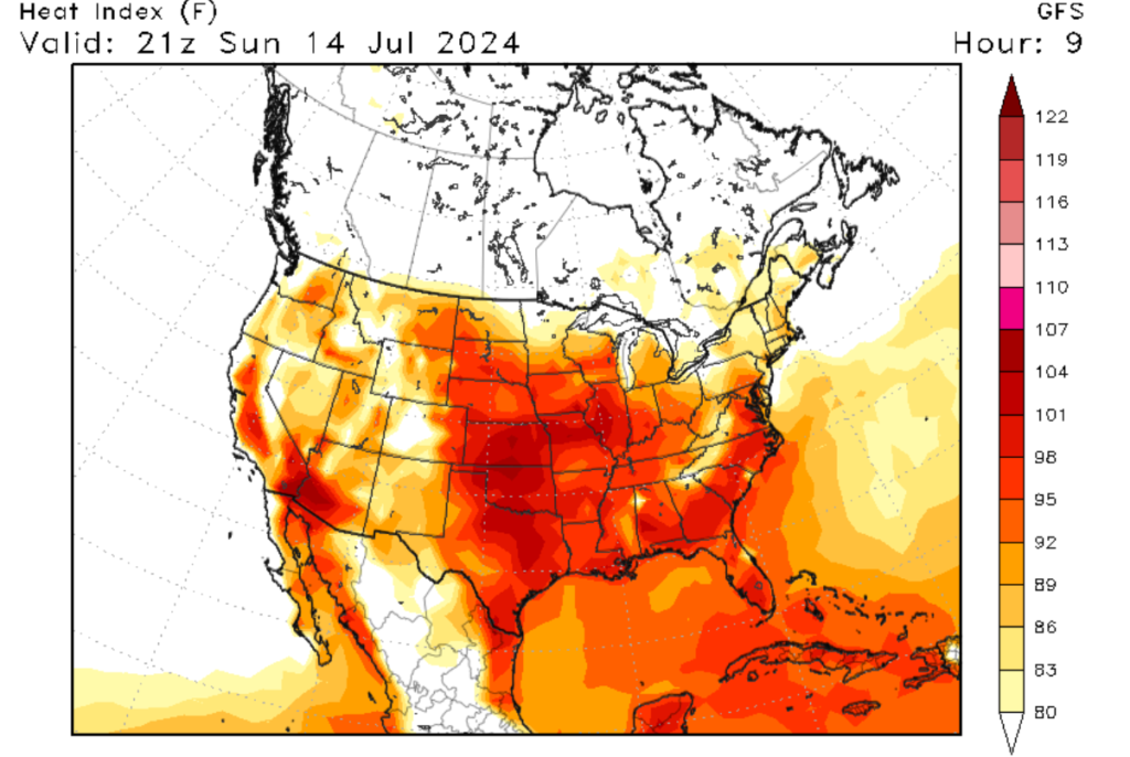
As this heat dome moves east, it will initiate the more humid Eastern U.S. Portions of the Mid-West, Southeast, and Mid-Atlantic could see heat index values of well over 100 degrees Fehenight. A good majority of the Mid-West, parts of the Southeast, and parts of the Mid-Atlantic are under heat advisories. Due to the humidity, overnight lowes will not relieve these regions. The only sort of relief is the chance of showers and thunderstorms expected in the afternoon hours, although the relief will only be short-lived. Please make sure that you drink a lot of water and watch for heat-related illnesses if you are spending time outside.
Severe weather is expected for the north
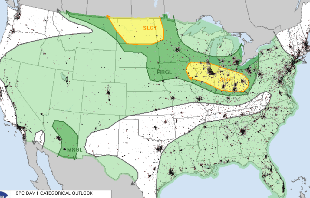
Switching gears now, let us discuss the chances of severe weather today. Parts of the Great Lakes region and the Upper Mid-West could see severe weather this afternoon through this evening. A flow in the northern U.S. will draw in moisture and energy from the south and dry air from the southwest, allowing lines of severe thunderstorms to form by mid-afternoon. A warm surface with dew point values in the 60s and 70s will allow for CAPE values to increase throughout the day. A steep mid-level lapse rate for the Great Lakes region will allow for the rapid development of severe storms by this afternoon. Damaging winds and hail will be the primary threats with these storms. Looking to the Upper Mid-West, a trough in Alberta, Canada, and substantial moisture in the low levels will allow for the development of scattered severe storms by this afternoon. These storms could produce large hail and damaging winds, with a few tornados possible by this afternoon.
Looking into the Future


Looking into the future, the heat is expected to return to the Western U.S. as another upper-level ridge is expected to set up in this region. I am forecasting that this ridge will go further north, which would affect parts of the Northwest and Southern Canada. The combination of hot weather and dryer conditions could increase the fire risk in this region. Speaking of rainfall, most of the Southeast and East Coast should expect above-average rain next week as a cold front associated with a low-pressure system is expected to move through this region. Regardless of where you are in the United States, it is always important to stay weather alert, especially if your area is being affected by extreme weather.


