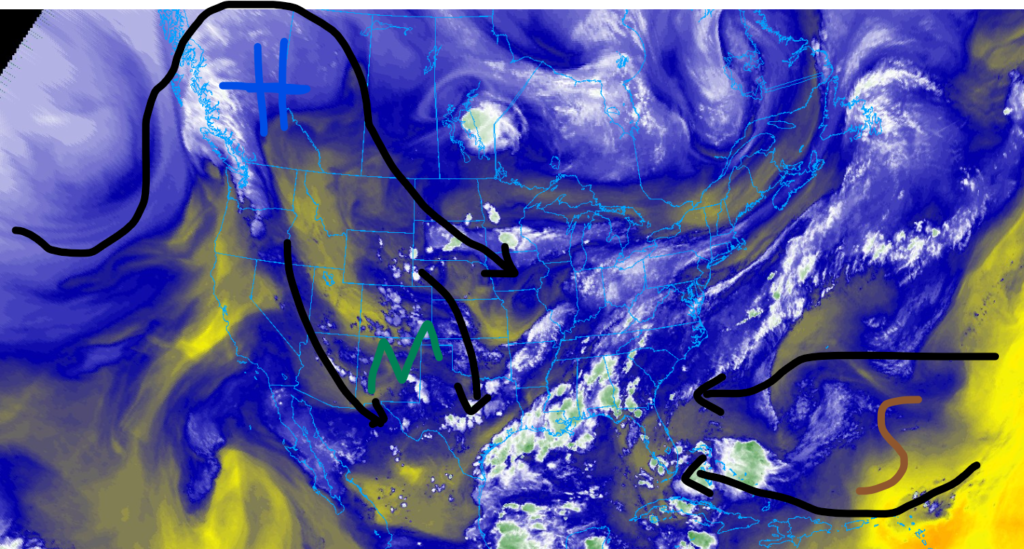
Happy Sunday, I hope that your weekend is going well. We have quite a lot to talk about for this forecast, so let’s get into it. Looking out west, we have an extremely strong upper-level ridge that’s affecting areas as far north as Northern Canada and as far south as Southwestern Arizona. Temperatures are expected to run as high as 20 degrees Fehenight above average for this time of year. Combine this with drought conditions in the Northwest; wildfire conditions are expected over the coming days. Further south, monsoonal moisture has the southern Rockies on alert for flash flooding, especially in burn scar areas. Down in Florida, a high-pressure system in the Atlantic is allowing dust from the Sahara Desert to cause dirty rain, coating everything in dust and impacting the air quality.
Big ridge out west
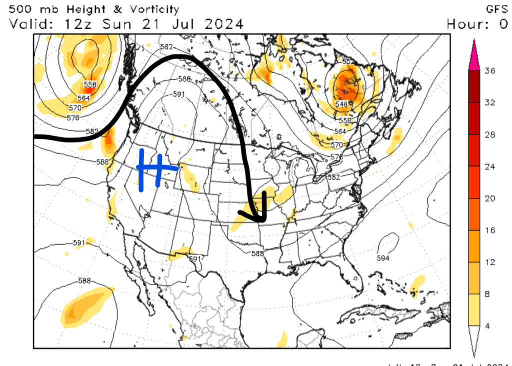
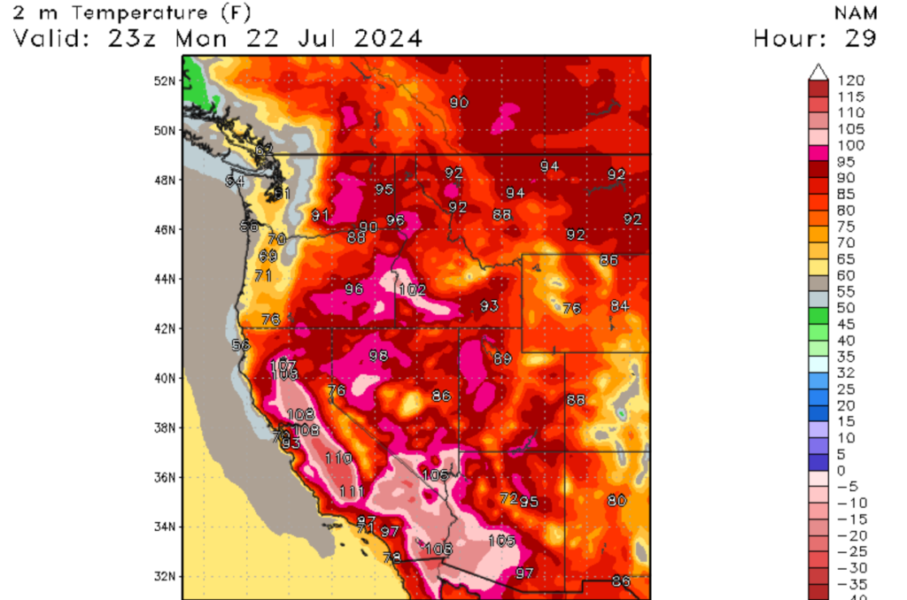
It seems that the Western U.S. is in the grips of another heat wave, although this ridge is moving much further north than other ridges we have seen this summer. The consequence of this is significantly above-average temperatures expected for the Pacific Northwest, a region that rarely sees temperatures this high. Afternoon high temperatures could top 95 degrees Fahrenheit in places such as Boise, ID, Spokane, Washington, and Helena, Montana. Areas further south could see temperatures well over 100 degrees Fahrenheit, with a few regions possibly topping 110 degrees Fahrenheit. These high temperatures pose a danger to those who aren’t prepared, especially for regions in the Pacific Northwest. Luckily, a low-pressure system off the coast will keep coastal cities, such as Seattle, WA, and Portland, OR much cooler. This heat wave is expected to stick around the region for at least a few more days.
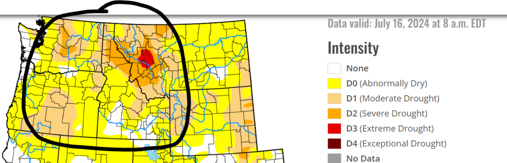
Because of the dry soil and plant life of this region, this heat wave is increasing the risk of wildfire. The Northwest part of the U.S. has a lot of forest and plant life that is susceptible to wildfires during dry and hop periods during the summer, and this is one of those periods. Please make sure to follow local rules regarding fire burning and always put out any fires that you start. Dry lightning is another concern as these thunderstorms don’t produce any rainfall, only lightning, which can quickly start a wildfire.
A wet and stormy Southern Rockies
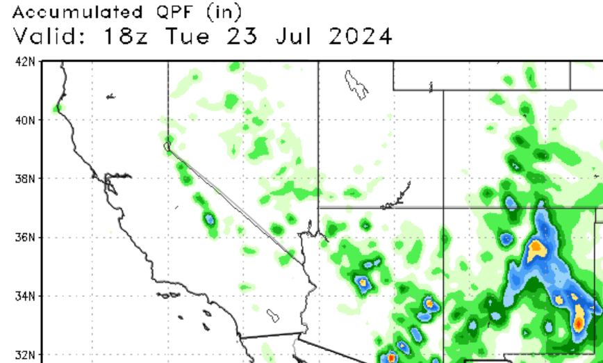
It’s quite a different story down south, as the monsoon season is in full swing. In case you don’t know, the Southwestern U.S. has an annual monsoon season in July and August, which is caused by a semi-permanent high-pressure system that moves in from Mexico. This allows for moisture to flow from the Pacific and is a critical source of rainfall for this dry region. We are expecting shortwave energy to cause convective showers and thunderstorms in the four-corner region.
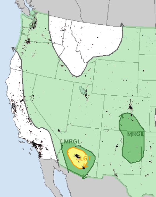
Some of these storms will and have produced heavy rainfall, prompting flood watches for portions of New Mexico. This is especially true for areas that were affected by wildfires earlier this summer, as the lack of plant life loosens the dirt, causing flooding and mudslides. The rainfall on the map to the left may not look like much, but last night here in Denver, a rain gauge near my home picked up 0.85 inches of rainfall in less than an hour, which is about 6% of the annual precipitation for the region. Looking at the severe weather threat in Arizona, the primary threat will be high winds from downbursts, as a deeply mixed layer of hot air will support severe wind gusts. Residents in the Phonix Metro Area should prepare for gusty winds through this evening.
A dusty and wet Florida
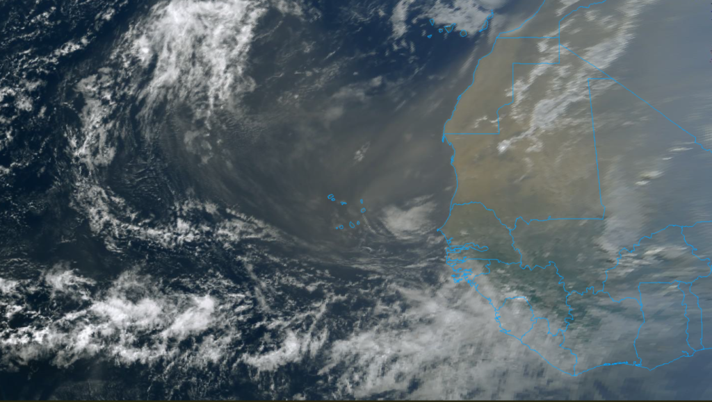
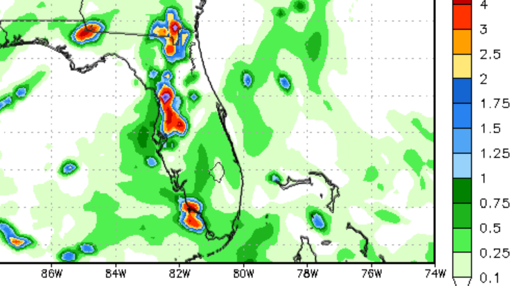
Over the last couple of days, multiple tropical waves and a large area of high pressure in the Atlantic have lifted dust from the Sahara Desert in Africa. The resulting dust has made its way across the ocean and found itself in Florida and parts of the Caribbean. The major negative impacts that this dust has are worse air quality and “dirty rain” which is when the dust falls from the sky during thunderstorms. The expected rainfall over the next couple of days will cause things to be coated in dust. The good news about the dust is it’s dry and windy, two things that tropical cyclones don’t like.
Looking into the future


Looking into the future, the heat dome that is currently baking the Pacific Northwest is expected to move east and start baking the Centeral and Northern Plains. Temperatures are expected to run 5-15 degrees above normal for this time of year. Parts of the south and coastal Northwest should see cooler-than-average temperatures next week. Precipitation values are expected to be below average for parts of the northern plains, which is never a good thing. Parts of the Southeast and Southwest should expect above-average precipitation. Remember to always stay weather-ready no matter where you live.


