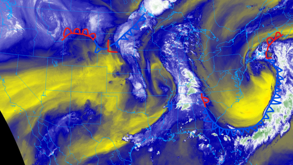
We have had a lot of interesting weather this last week and I am expecting this trend to continue today. Looking at the Northern Plains, we have a slight risk of severe this afternoon. Areas under this threat extend from northern Kansas to Southern North Dakota. Looking further east, a multiday heavy rainfall event is expected to cause flooding issues in parts of the Upland South. It is quite the opposite out west, where above-average temperatures are filing critical fire weather, especially for parts of Utah, Colorado, and Wyoming.
Severe weather is expected today
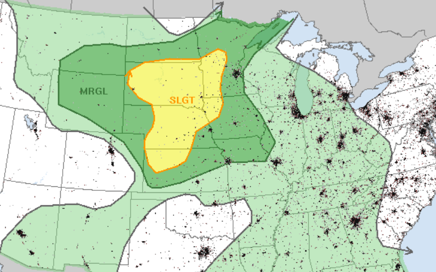
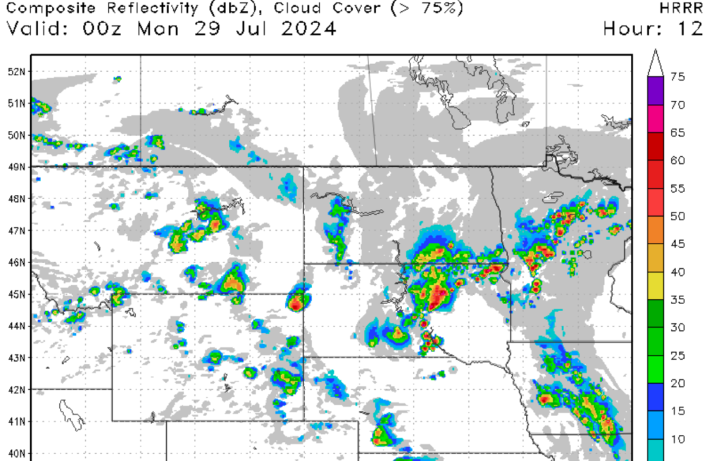
For our first piece of weather information today, we have a severe weather threat for a large portion of the Northern Plains. I expect the daytime heating of the land will allow for mid-level convective activity to initiate storm development by the early afternoon hours. Strong mid-level winds and a sufficient deep layer in the region will help promote cell development for the regions in the slight risk zone. For areas further east, a more marginally unstable environment will limit severe weather potential. Looking into Wyoming and Southern Montana, a shortwave trough will promote an outflow boundary, with gusty winds being the threat.
For our regions in the slight risk zone, I suspect that high winds will be the primary threat, as the outflow boundary of these supercells will promote high winds of over 70 MPH. A few of these supercells could produce large hail and an isolated tornado or two can’t be ruled out for parts of Central South Dakota. Other areas under a severe weather threat won’t have as strong of a mid-level flow, limiting the tornado chances.
Flooding in the south and Ohio Valley
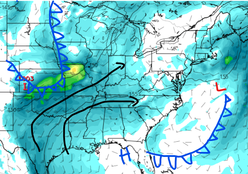
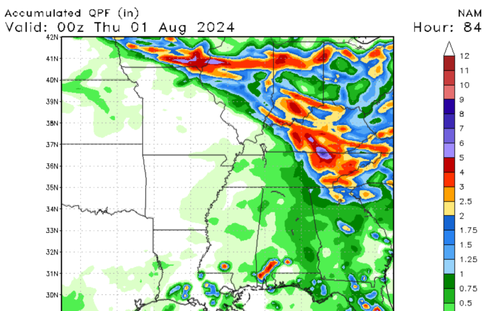
We have a slight risk of flooding for parts of the Upland South and Lower Ohio Valley that’s expected to occur over the next couple of days. The region is expected to be between two frontal systems as seen in the image to the left. A southerly flow from the Gulf of Mexico will enhance moisture availability for the region, represented by the black lines. Over the next couple of days, numerous heavy thunderstorms are expected to move through the region through at least Tuesday as the frontal systems continue to move eastwards. Storms may build on each other as the frontal system moves through the region, increasing the flood threat. Make sure to be prepared for flash flooding and move to higher ground if flooding occurs.
Fire concerns out west
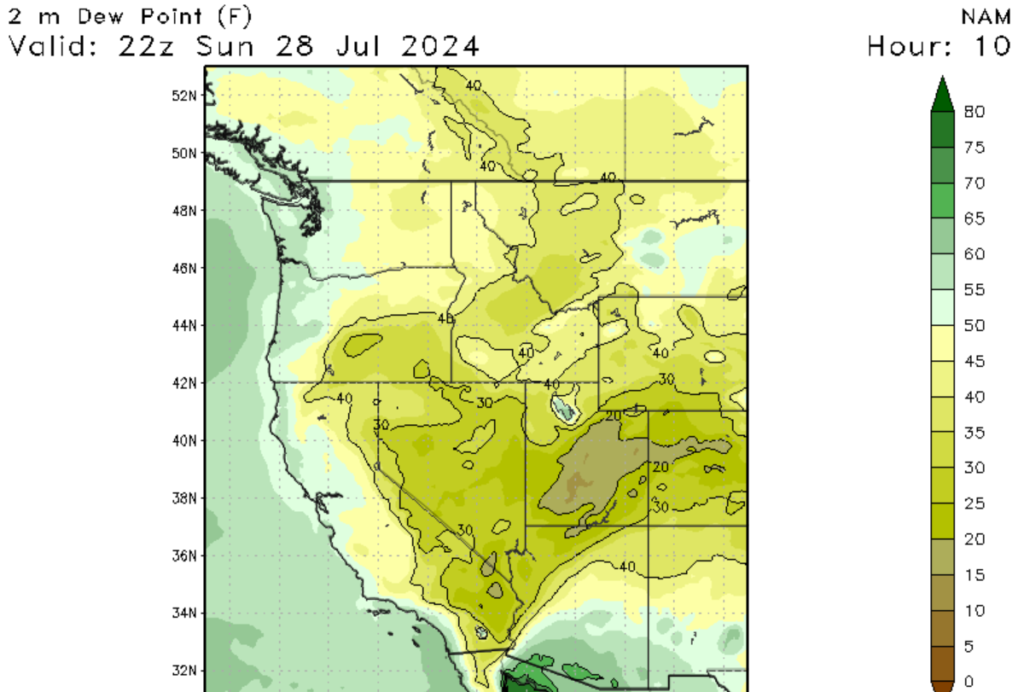
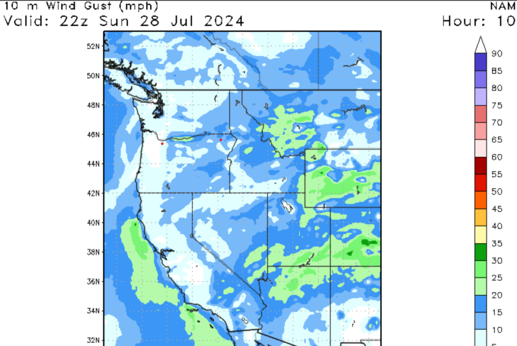
Looking out west, fire weather is the primary concern. A southwesterly wind associated with the divergence section of a high-pressure system in Centeral Colorado is causing low dew point values for parts of Eastern Utah, Western Colorado, and Southwest Wyoming. Winds could gust as high as 40 mph, and relative humidity values are expected to be around 5-10%. These factors will create critical fire weather for these regions; as such, a red flag warning has been issued for the regions matched earlier. Always make sure you have a way to extinguish fires you created and make sure to follow the rules and regulations when creating a fire.
A look Ahead


Looking at the 6 to 10 day outlook for the United States, the two primary long-term weather models (GFS and EURO) are trending towards a heat wave for the Western U.S. The heat is likely expected to start cooking parts of the west starting next week. High temperatures could top 100 degrees Fehenhigh from Northern Washington State to the Centeral Planis. The only areas of the west that won’t see dangerously high temperatures are higher elevations and mountainous regions. Please make sure that you are weather-ready and stay in an air-conditioned building during high temperatures.


