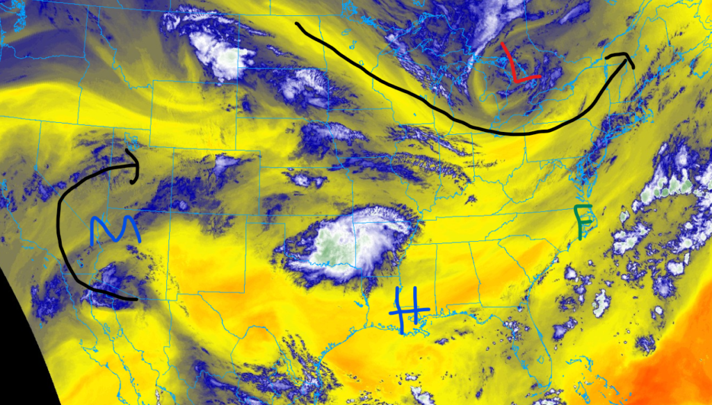
Hello there. Thanks for reading this national forecast report for August 11th, 2024; there is a lot to discuss in this discussion. If you have been paying attention to the weather news recently, you may have seen that Hurricane Debby caused severe flooding in the Southeast. Well, for parts of the Carolina coast, more rainfall is expected through tomorrow, adding to the flooding situation. Moving further southwest, heat is expected to inundate parts of the Southern Plains and the Florida-Georgia border. Moving westwards now, the four corners regions should expect numerous thunderstorms, thanks to the seasonal monsoonal moisture. Looking further north, parts of the Innermountainwest are experiencing drier than average weather, leading to wildfire concerns for the region.
Flooding for parts of the Carolinas
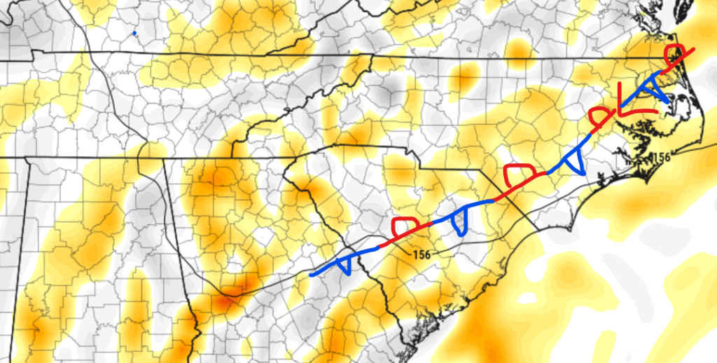
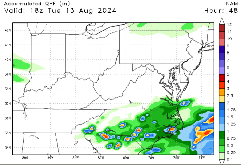
Things have been quite wet for the Southeastern U.S., and I only expect that trend to continue for parts of the Carolinas. Thanks to a stationary front and low-pressure system drawing in moisture, numerous showers and thunderstorms are expected for parts of this region. Some of these storms could produce heavy rainfall, leading to more flooding issues. This area has already experienced heavy rainfall from Debby, which means that the ground is already soaked. Those living in the area should keep a close eye out for floodwaters and make sure to stay up to date on the latest flooding information.
Heat expected for parts of the South
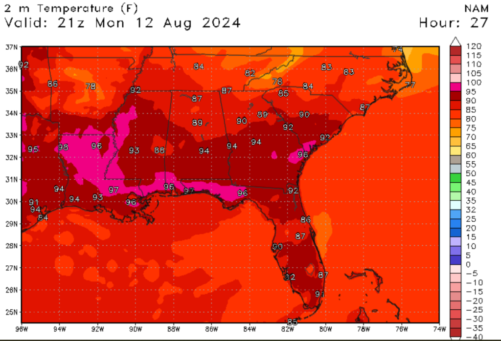
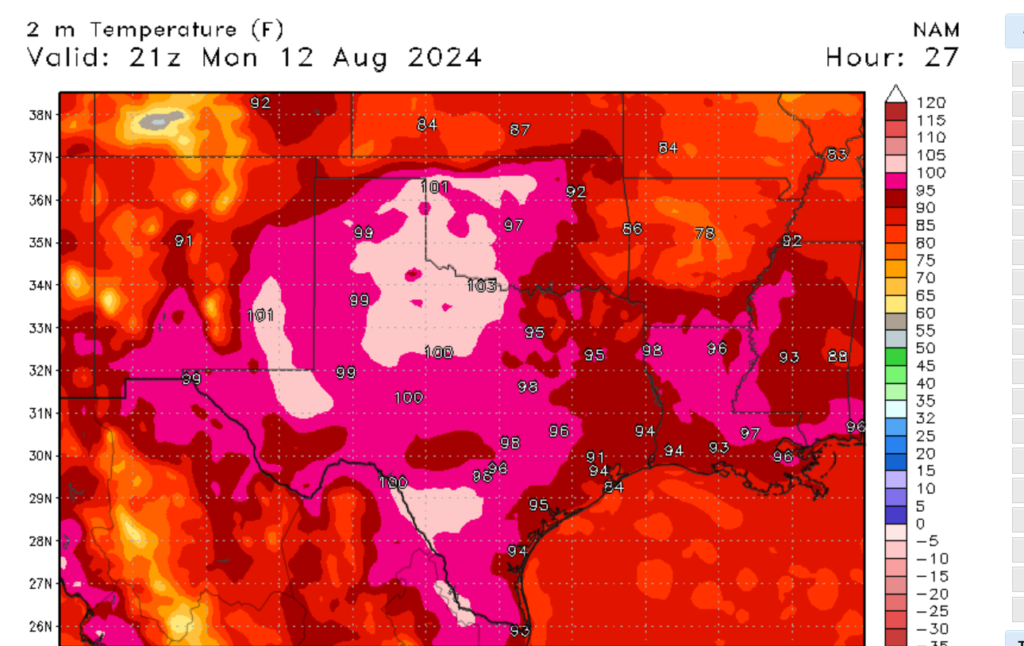
Things have been quite hot for parts of the United States this summer, and that trend is expected to continue through the early part of next week. Temperatures across both regions are expected to climb into the mid-90s, with triple-digit heat expected for parts of Texas, Oklahoma, and New Mexico. Dew points in more humid areas are expected to reach into the mid-70s, making the heat index values climb to well over 100 degrees Fehernight. A large area of high pressure is the primary reason why these areas are experiencing above-normal temperatures. Those living in the affected areas are advised to take heat-related precautions and to try not to spend extended time outside without the proper clothing.
Monsoonal moisture for the Four Corners region
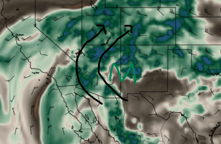
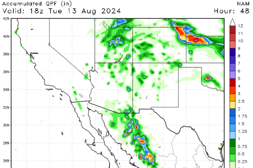
Moving further west now, the seasonal monsoonal pattern that set up in the latter half of the summer is in full swing across much of the Southwestern U.S. A combination of winds flowing off the Pacific oceans and diurnal heating of the environment will produce scattered showers and thunderstorms for the region. Over the next 48 hours, most of the rainfall should fall in Centeral Utah and Western Colorado, with isolated showers expected for parts of Northern New Mexico and Arizona. This moisture is critical for this arid part of the Country, so enjoy the moisture and the picturesque thunderstorms while you can.
Fire Concerns in the Intermountain West
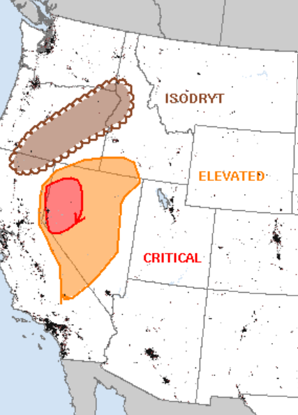
It’s quite a different story further to the north, where fire is the main concern. A large upper-level trough associated with a cold front is expected to move off the Eastern Sierra Mountains tomorrow afternoon. High wind gusts, dry vegetation of the Great Basin, and low relative humidity ahead of the cold front will promote critical fire weather for parts of Western Nevada and Southeastern Idaho. Further North in Eastern Orgean, the upper-level trough is expected to continue eastwards towards the Northern Rockies. This region has enough instability and moisture to promote thunderstorm development; however, most of these storms will be dry, with only lightning expected. This will increase the chances of fires, as little to no rainfall is expected with these storms. Remember to follow local laws regarding fires in your area.
A look ahead


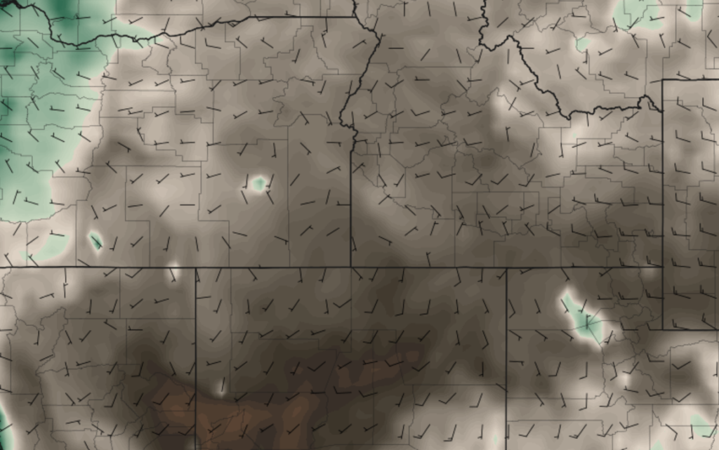
Looking to the future, above-average temperatures are expected to set up in parts of the Great and High Plains. Computer models suggest that a large area of high pressure is expected to move in from the Pacific Ocean. As seen in the images above, the models agree that the mid-section of the county should see above-normal temperatures. The question is where exactly these high temperatures are expected, as there is some disagreement on that aspect. As we get closer to this forecasted time period, I would be able to give a more detailed report on what areas should expect above-average temperatures.


