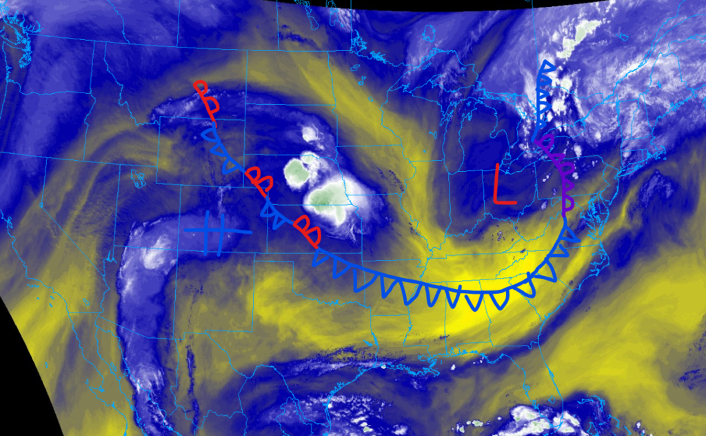
Happy Sunday; I hope that your week went well. We have a lot of information to discuss about today’s weather across the nation. The biggest piece of weather to talk about is a large cold front associated with a low-pressure system that is moving abnormally far south for this time of year. This is a double-edged sword, as it will cool parts of the Southeast down, which has been sweltering for the last couple of days. The bad news is that areas ahead of the front are at risk for severe weather this afternoon through the evening. Parts of the Mid-Atlantic are under the greatest threat of severe weather today, with flooding being a major concern. As Tropical Storm Ernesto passes by the United States, hazardous beach and ocean conditions will exist for parts of the Eastern Seaboard.
Heat is expected to drop slightly for parts of the Southeast
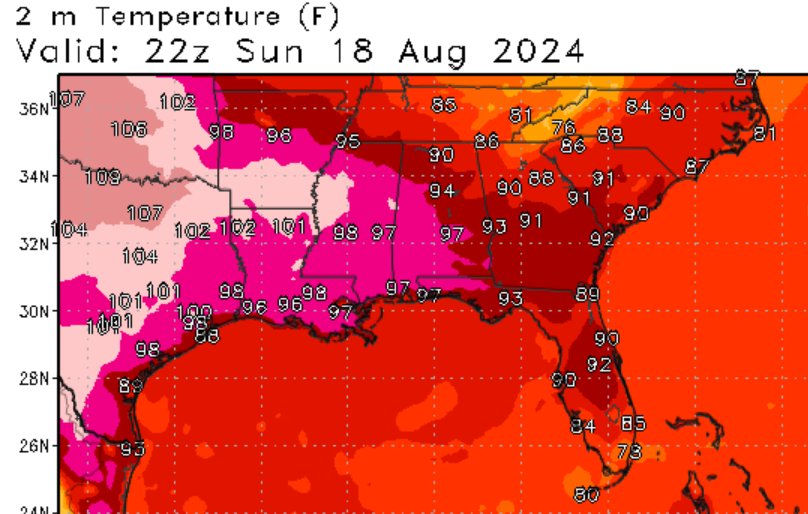
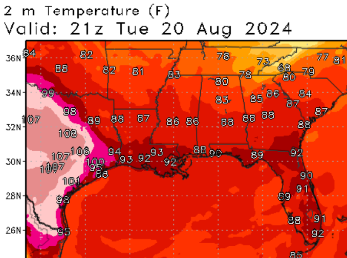
Parts of the Southeast have been sweating it out over the last couple of days. The good news is that this cold front that I talked about earlier will allow temperatures to drop slightly for the Gulf Coast States. For areas further west, a stubborn area of high pressure won’t allow this front to push as far south, reducing its effects on the temperatures. Although a cold front is passing through, air temperatures are still expected to reach the upper 80s to low 90s for much of the region. However, relative humidity values are expected to lower after the front moves through, making it more tolerable to be outside. Make sure to watch for heat-related illnesses and take frequent breaks if spending extended time outside.
A large area of severe weather
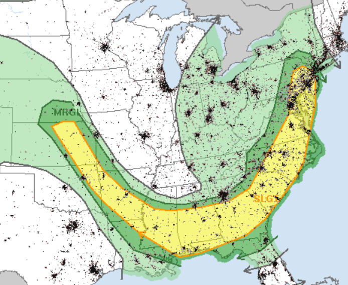
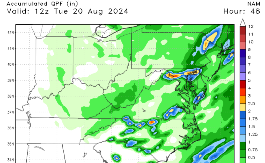
The bad news of this cold front is that it will prompt severe weather across a large swath of the Eastern United States. From Northern Kansas to the southern suburbs of New York, there is a slight risk of severe weather. For Areas in the Southeast, high dewpoint values are prompting CAPE values of over 2500 J/kg. Because of dry air in the upper atmosphere, damaging winds from microbursts will be the primary threat from these storms, but a few locations may see hail from an isolated supercell or two. Otherwise, I think multicell storms will be the norm across this area.
Areas in the Mid-Atlantic will need to worry more about heavy rainfall and an isolated tornado or two in addition to the aforementioned risks. Since this area is closer to the center of the low, the cyclonic flow of the low-pressure system will promote strong to severe storm growth, with multiple multicell storms possible by this evening. Similar to areas further south, high dew point values will promote CAPE values of over 2500J/kg. Heavy rainfall of 2” per hour may lead to flooding in urban areas, as flood watches have been issued for the Philadelphia and Baltimore Metro Areas. For anyone in the slight risk zone, please pay attention to the weather radar through this evening.
Hazardous beach weather expected in the Eastern Seaboard
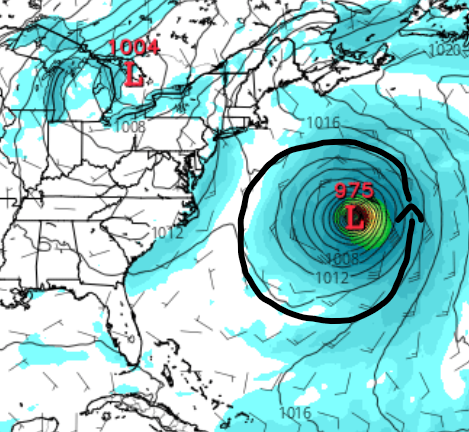
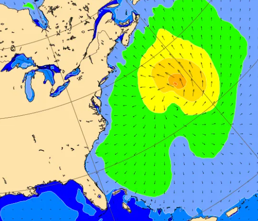
Although Tropical Storm Ernesto did not directly impact the United States, its effects are still quite apparent. Areas along and near the coastline will experience increased wave height and rip currents. As Ernesto churns up the Western Atlantic, those wanting to swim need to be extremely careful, as multiple people have either drowned or were injured by strong waves and rip currents across the Eastern Seaboard.
A look into the future


Looking into the future, the models agree that the center of the nation should expect above-normal temperatures by the end of this week. High pressure will continue to dominate the region, bringing more summer heat to the central part of the U.S. A trough is expected to move in from the Pacific Ocean, dropping temperatures across the Pacific Northwest. Not only will temperatures be cooler, but some scattered rain showers are possible for this area, which is quite abnormal for this time of year.


