Looking into next week, there’s not much to report on except consistently hot days. Since Tropical Storm Debby is moving towards Florida, it’s also feeding most of that moisture to it as it rides up the Gulf of Mexico.
This, along with dry air aloft will limit much of the convective development we would normally get to spark some pop-up thunderstorms. As the hurricane exits (likely) to the east, dry air from the north will also inhibit much of the convective development towards the surface.
The heat will get worse as the week goes on. While we’ve already felt the effects in the past several days, the heat index will rise into the 110s by the middle of the week thanks to the dry air I mentioned earlier. So it’ll be very hot and very humid going on from now. I have a feeling the National Weather Service will put out an excessive heat warnings in most of the Deep South for the next week.

Looking at the extended forecast, there won’t be much relief from the heat until the beginning of next week. This is likely due to Debbie turning extratropical at the end of its cycle and extending a cold front down to the Deep South. Even the low temperatures are high and may reach the upper 70s to even 80 by the end of this week. Temperatures look to hinder a bit due to the rain, but this won’t really stop the August heat for very long.
Hurricane (likely) Debby
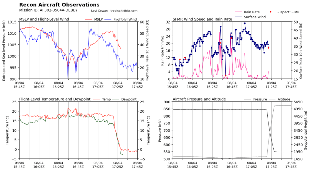
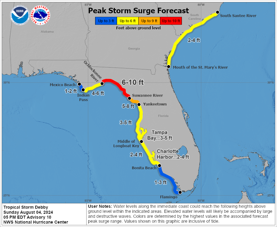
So far, Debby has strong tropical storm force winds. Overnight, this storm will likely become a hurricane thanks to the overnight latent heat from the Gulf waters. Hurricane force winds will be a major concern for those closest to the eye wall in Florida and possibly even areas of Georgia as it makes landfall and moves in. Another major concern for those on the coastline is possible storm surge. Areas between the Ochlockonee and Suwannee Rivers may see up to 10 feet of surge and other areas may see up to 9 feet of surge around the landfall.
Another big concern for those in the path of the hurricane is flash flooding, and later on, possible river flooding. Areas in the path may see up to 10 inches of rain and as it moves inland into Georgia and South Carolina, possibly up to 15 inches. Debbie will hang around as it moves inland contributing to the heavy rain across the coastal states. Areas will likely get tropical storm force winds along with the heavy rain.
To reiterate, there is strong, up to 10ft storm surge possible in areas near the hurricane’s landfall. Hurricane force winds are going to happen even as it moves inland. Plenty of rain will be possible as this moves slowly northeast towards the Atlantic coast, so be prepared for flash flooding, and eventually, flooding across Florida, Georgia, and South Carolina. Please heed any warnings sent out from your local weather service office or the National Hurricane Center if you live in these areas.
Regional Day-to-Day Forecast
This Afternoon – Sunny, with a high in the mid 90s. Heat index values as high as 100. Northeast wind around 5 mph.
Tonight – Mostly clear, with a low in the mid 70s. Northeast wind around 5 mph becoming calm.
Monday – Sunny and hot, with a high in the upper 90s. Heat index values as high as 106. North northeast wind 5 to 10 mph.
Monday Night – Mostly clear, with a low in the mid 70s. North northeast wind around 5 mph becoming calm.
Tuesday – Sunny and hot, with a high near 100. Light north northwest wind becoming north 5 to 10 mph in the morning.
Tuesday Night – Mostly clear, with a low in the upper 70s. North northwest wind around 5 mph becoming calm.
Wednesday – Sunny and hot, with a high in the low 100s. North northwest wind 5 to 10 mph.
Wednesday Night – Clear, with a low in the upper 70s. North northwest wind around 5 mph becoming calm.
Thursday – Sunny and hot, with a high in the low 100s. Northwest wind 5 to 10 mph.
Thursday Night – Mostly clear, with a low in the upper 70s.
Friday – Sunny and hot, with a high in the upper 90s.
Friday Night – Partly cloudy, with a low in the upper 70s.
Saturday – A 20 percent chance of showers and thunderstorms. Sunny, with a high in the mid to upper 90s.


