Another area of low pressure will swing through the southeast opening the door for showers and storms to develop across Louisiana, Mississippi and Alabama. Storms will move from west to east across the Gulf Coast during the day on Wednesday and then into the overnight hours through Thursday morning.
Quickly, now… no time to waste
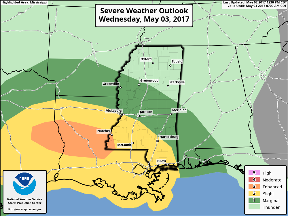
South Mississippi is under a Slight and Marginal Risk for severe weather. All modes of severe weather will be possible. For south Mississippi, the main concern will be between 10pm and 3am for heavy rain, frequent lightning, wind gusts more than 65mph, small hail and the possibility for a tornado.

Depending on which model you use, the timing can change a bit, but generally the 10pm onset of severe weather should hold within an hour or two.
But Nick, when will it hit my house?
Here is a quick look at the timeline based on the 21z RPM model:
This will give you an idea regarding when the rain and storms will be near you.
Yeah, yeah. But Nick, we know there is more to it than just one model
You’re so right!
The model shown above is one of three possible outcomes we are facing with this round of storms. It is the least severe and driest possible scenario. It shows a warm front that barely moves Gulf moisture into the area and develops multiple storms along the warm front. This, in effect, suffocates the cold front as it passes through, leaving it with little Gulf moisture and heat to work with.
The model run just six hours earlier, at 15z, painted a different scenario:
This scenario would likely be the most severe possibility. A warm front lifts through the region and opens the door for a cold front to move through with ample Gulf moisture in place. We would have to keep an eye on every storm south of that warm front for supercellular development. This would also up the chance that a tornado could develop across the Pine Belt.
Between the two ends, we have the third possible scenario:
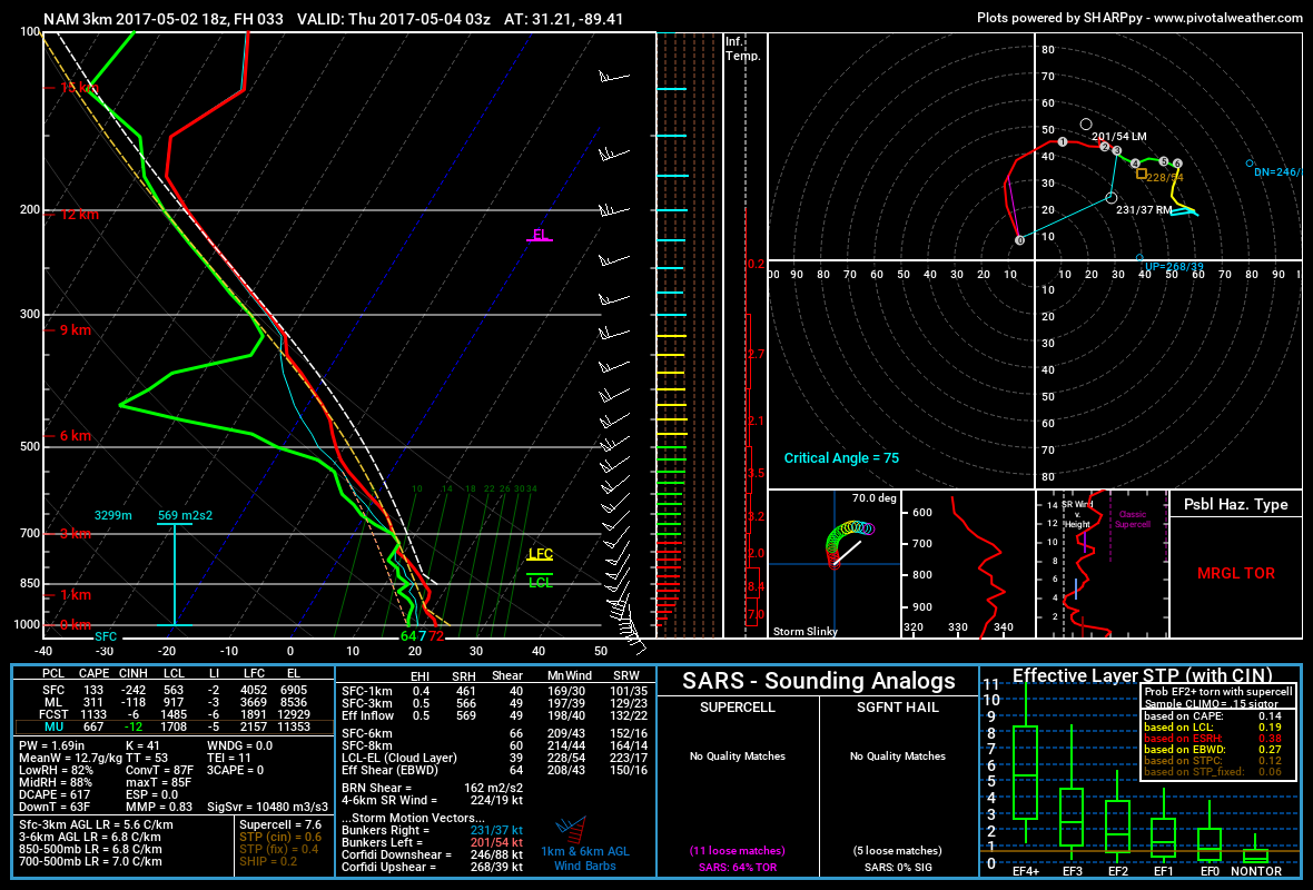
Just because it is between the two above, doesn’t mean it is the most likely. This scenario is suggested by the 18z NAM3k model. It shows a line of strong storms moving through with about 1″ to 2.5″ of rain. Most of the severe weather is south of our area and into the Gulf of Mexico.

Above is the forecast sounding from that model. It shows more elevated instability, rather than surface-based. That would hold the tornado threat down a bit. Also, the downdraft CAPE and MLLCL numbers aren’t consistent with a true tornado threat for south Mississippi, too.

However, those deficiencies could be overcome by other atmospheric factors. So, even in this case, a tornado could not be ruled out.
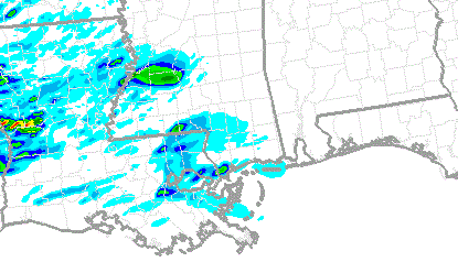
Another thing worth noting is that the SPC SSEO model is showing a few trails of decent updraft helicity tot he west of the area at 7pm Wednesday night. This model isn’t designed to identify rainfall rates or where storms are located, but instead, it predicts atmospheric parameters. Then meteorologists take those parameters and make a prediction based on those numbers.
So, areas with a higher updraft helicity would indicate the development of stronger storms across the area.
So which one is it? Which one is the right one?
We don’t know that for sure, yet. However, model trends seem to side with the most severe, sadly. The short-range models that look out 36 to 48 hours tend to lift the warm front through the area and stall it out around I-20 then slide the cold front through behind it.
In fact, the HRW WRF-ARM and HRW-NMMB both show the convection along the warm front fizzling out before the cold front arrives.
While that doesn’t mean a severe weather outbreak will happen, it does mean the threat for severe weather would remain.
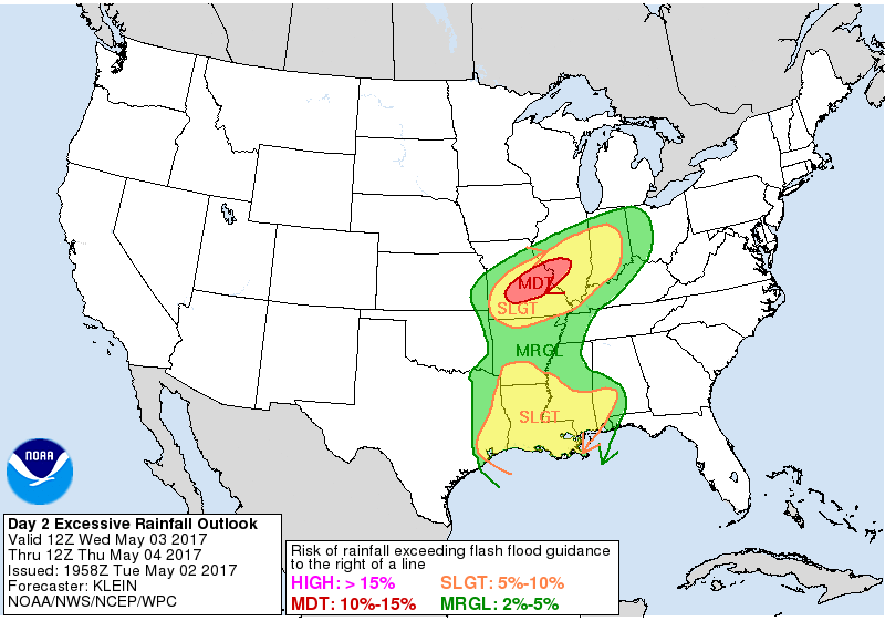
Another note worth noting? The local National Weather Service offices as well as the Weather Prediction Center are concerned about very heavy rain as well as flooding across the area.

So even if the area is able to dodge severe weather, there is still a decent shot the Pine Belt gets some flooding
The bottom line?
South Mississippi is under a Slight and Marginal Risk for severe weather. All modes of severe weather will be possible between 10pm and 3am. Look out for heavy rain, frequent lightning, wind gusts more than 65mph, small hail and the possibility for a tornado.

