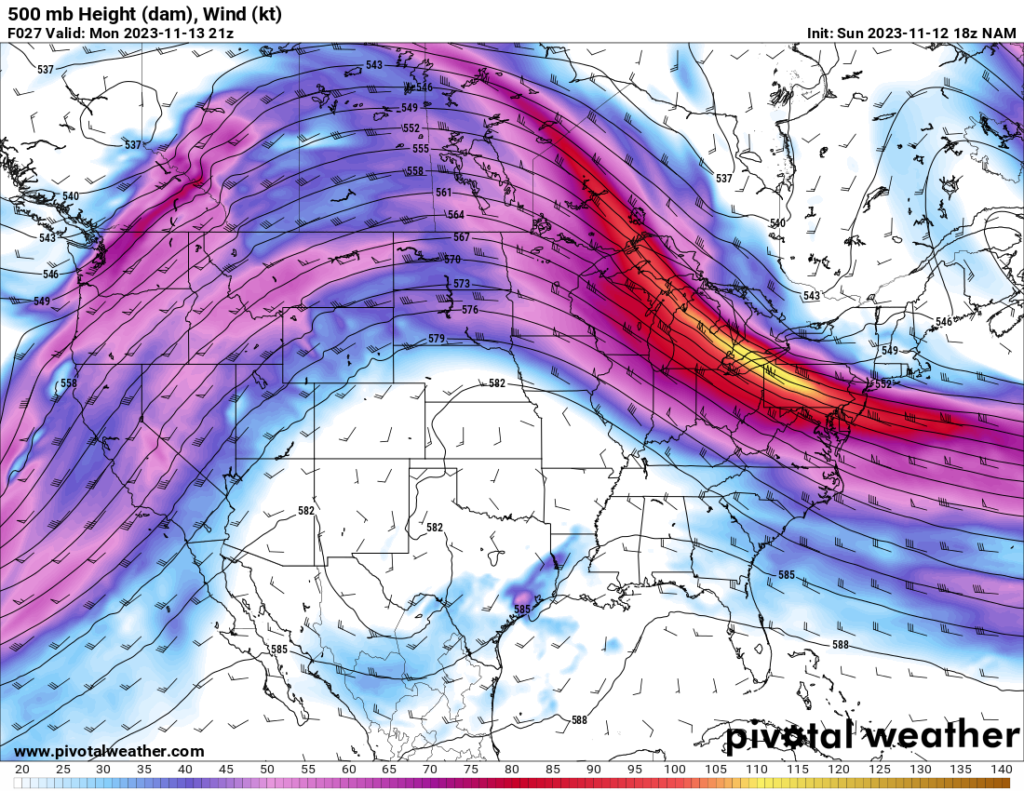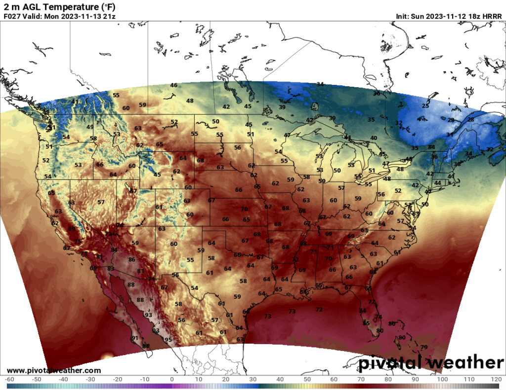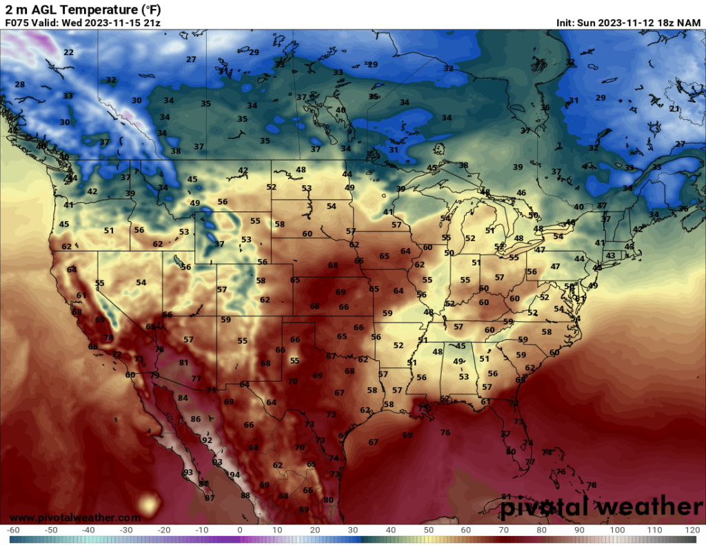
The pleasant temperatures over the Central US are here to stay for a few days as a ridge continues to move over the Plains states. Highs will stay in the 60s and even low 70s in a few places. Temperatures will be chilly to cold in the Northeast and Northwest, but no unseasonably cold temperatures are expected for the first half of the week.


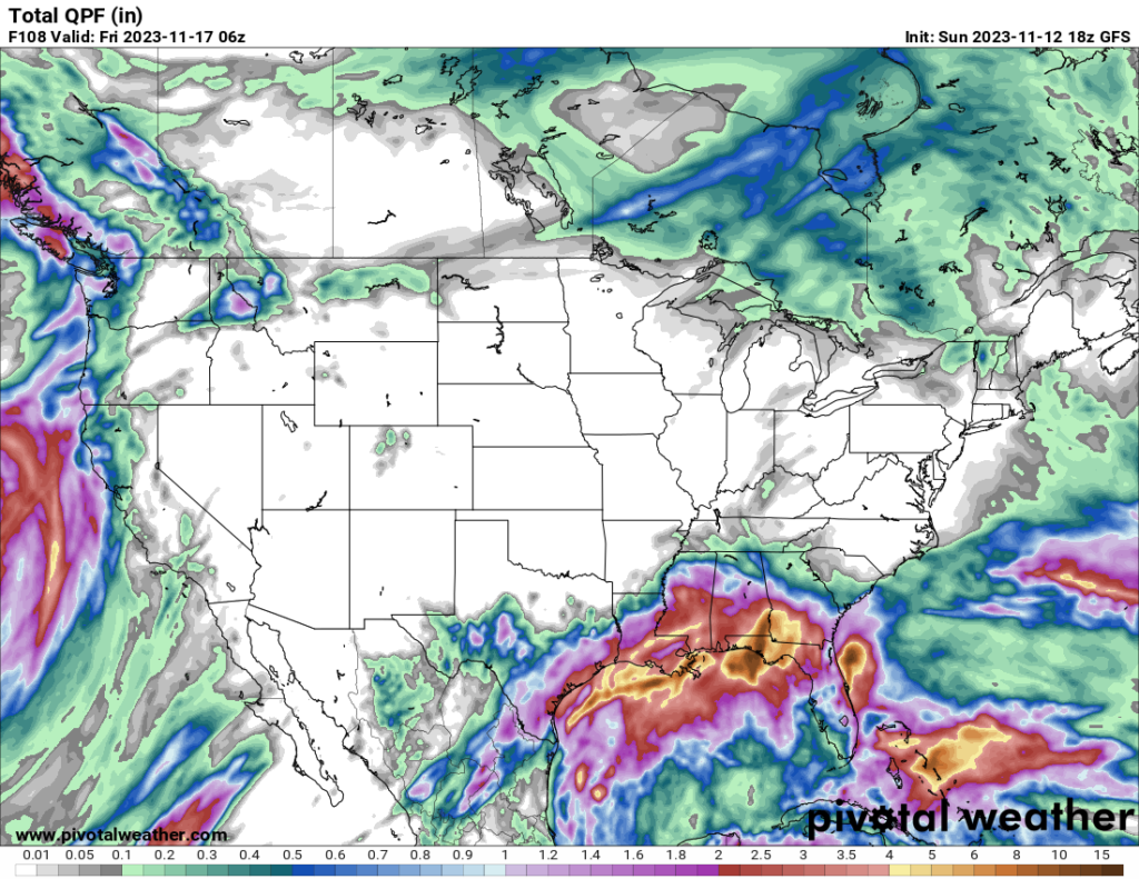
The biggest thing on my mind over the next few days is the large amount of precipitation expected over the Gulf Coast region. A shortwave trough currently moving across Mexico and the Southwest is approaching the Gulf and will promote lifting on its east side, leading to high precipitation. The current GFS model estimates that most areas along the Gulf Coast will see anywhere from 2-4 inches of cumulative precipitation over the next few days, but locally higher amounts are possible. While this will no doubt put a dent in the drought the area is experiencing, there is a concern for flooding. Residents in this area should prepare for that possibility and pay attention to their local forecasts and take flood watches and warnings seriously. Although it has been stated before by many other meteorologists, it is crucial not to attempt to drive through any flooded roadways, even if it seems safe. Remember that flooding usually kills more people annually than tornadoes or hurricanes.


