If you like dry and hot, you’ll love this forecast! That said, it will be slightly cooler today than, say, the previous few — but it is still plenty warm.


Expect quiet and dry conditions, with temperatures slightly cooler due to a weak cold front moving in from the northwest. Highs will reach the low to mid-90s, a welcome break from the recent upper 90s and near 100-degree days. The heat advisory will not be in effect today. Ahead of the front, increased winds will bring sustained speeds of around 10 mph, with gusts up to 20 mph.
Tomorrow, the heat and humidity will make a brief comeback, especially in southern areas. Highs in the upper 90s and dewpoints in the 70s will push heat indices to around 105F,
This Weekend through Early Next Week this drier pattern will break down a bit and allow for a shot for rain to return. Not a good chance, but your typical afternoon storms will redevelop in some spots. We will hold a 20-to-30-percent shot for rain by each day early next week. Highs will hold in the 90s to around 100F.
A quick note from the NWS: Due to recent low rainfall, the region’s fuel moisture levels are dropping, raising wildfire concerns. With the dry air and higher winds expected, especially on Saturday, we’ll need to monitor wildfire danger closely this weekend and into early next week.
REGIONAL DAY TO DAY FORECAST
Today: Sunny. Highs in the mid 90s. Northwest winds 5 to 10 mph.
Tonight: Mostly clear. Lows in the mid 70s. Northwest winds around 5 mph.
Friday: Mostly sunny. Highs in the upper 90s. North winds around 5 mph. Heat index values up to 108.
Friday Night: Partly cloudy in the evening, then becoming mostly clear. Lows in the mid 70s. North winds around 5 mph.
Saturday: Sunny. Highs in the upper 90s. North winds around 5 mph.
Saturday Night: Mostly clear. Lows in the lower 70s.
Sunday: Sunny. Highs in the upper 90s.
Sunday Night: Mostly clear. Lows in the mid 70s.
Monday: Sunny. A slight chance of showers and thunderstorms in the afternoon. Highs in the upper 90s. Chance of rain 20 percent.
Monday Night: Mostly clear. Lows in the mid 70s.
Tuesday: Sunny. A slight chance of showers and thunderstorms in the afternoon. Highs in the upper 90s. Chance of rain 20 percent. Heat index values up to 105.
Tuesday Night: Mostly clear. Lows in the mid 70s.
Wednesday: Sunny. A chance of showers and thunderstorms in the afternoon. Highs in the upper 90s. Chance of rain 30 percent. Heat index values up to 110.
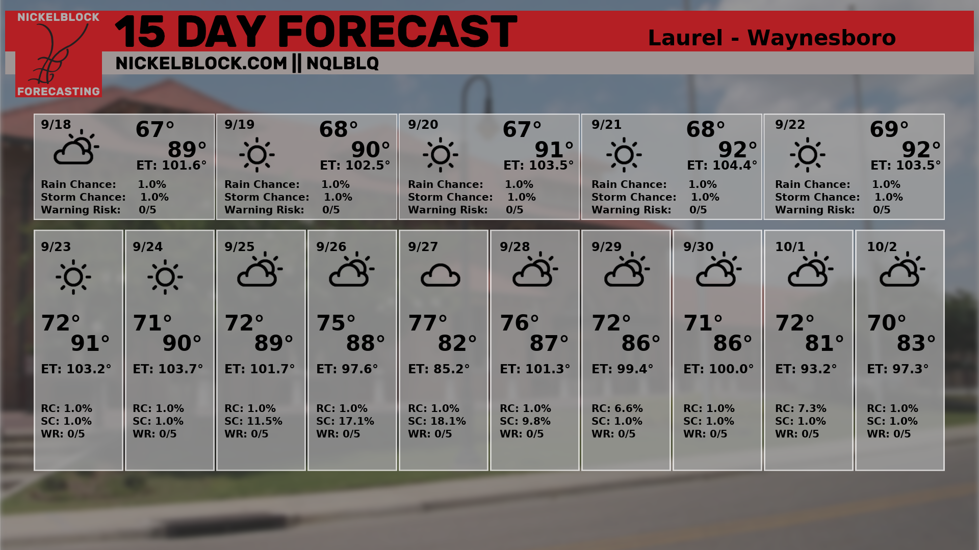
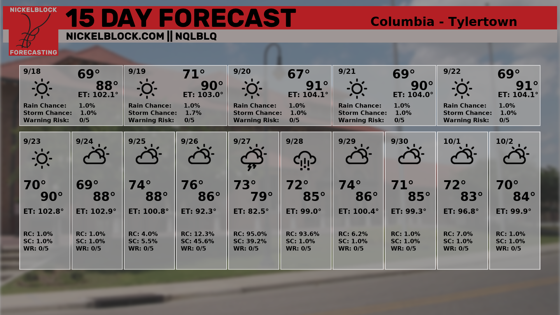
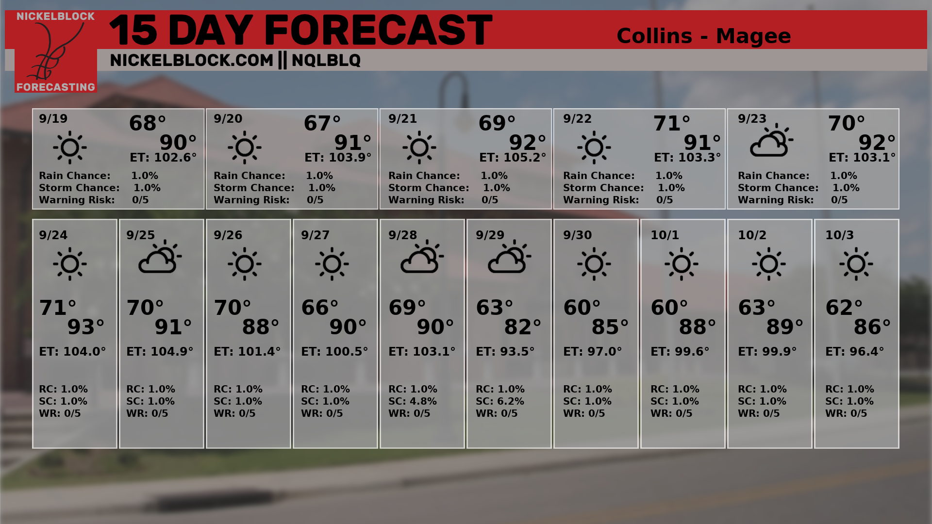
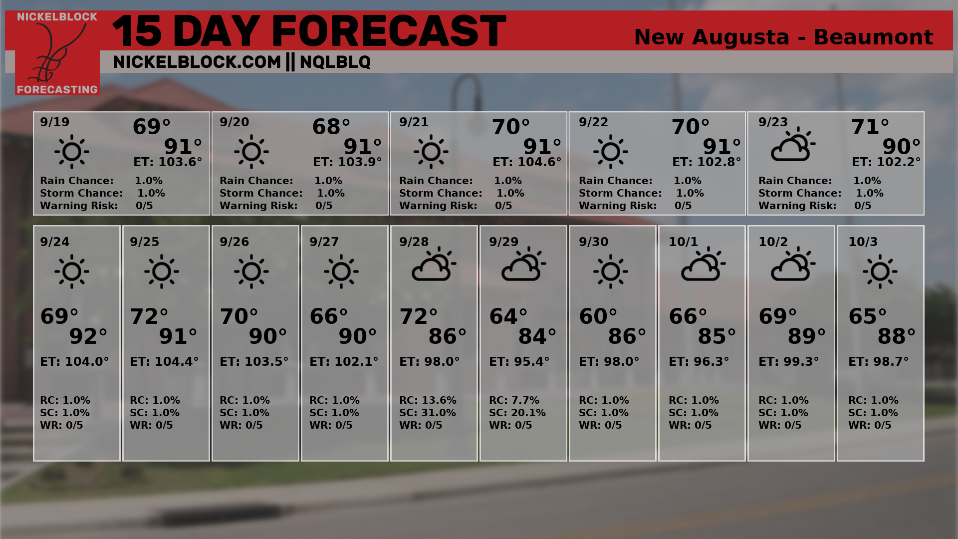
15-DAY GRAPHICAL OUTLOOK